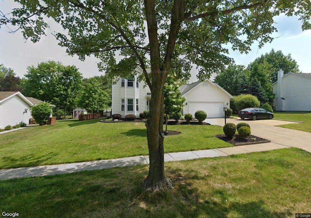
15534 Sassafras Dr Strongsville, OH 44136
Estimated Value: $321,000 - $383,000
3
Beds
3
Baths
1,991
Sq Ft
$176/Sq Ft
Est. Value
About This Home
This home is located at 15534 Sassafras Dr, Strongsville, OH 44136 and is currently estimated at $349,520, approximately $175 per square foot. 15534 Sassafras Dr is a home located in Cuyahoga County with nearby schools including Strongsville High School, Sts Joseph & John Interparochial School, and Bethel Christian Academy.
Ownership History
Date
Name
Owned For
Owner Type
Purchase Details
Closed on
Feb 14, 2013
Sold by
Turner Leanne C
Bought by
Turner David C and Turner Leanne C
Current Estimated Value
Home Financials for this Owner
Home Financials are based on the most recent Mortgage that was taken out on this home.
Original Mortgage
$78,750
Outstanding Balance
$15,492
Interest Rate
3.34%
Mortgage Type
New Conventional
Estimated Equity
$334,028
Purchase Details
Closed on
Apr 22, 2002
Sold by
Graves Polly A
Bought by
Turner Leanne C
Home Financials for this Owner
Home Financials are based on the most recent Mortgage that was taken out on this home.
Original Mortgage
$105,000
Interest Rate
7.13%
Purchase Details
Closed on
May 15, 2001
Sold by
Hill Tony
Bought by
Graves Polly A
Home Financials for this Owner
Home Financials are based on the most recent Mortgage that was taken out on this home.
Original Mortgage
$190,800
Interest Rate
6.99%
Purchase Details
Closed on
Apr 27, 2001
Sold by
Graves David A and Graves Alicia R
Bought by
Graves Polly A and Hill Tony
Home Financials for this Owner
Home Financials are based on the most recent Mortgage that was taken out on this home.
Original Mortgage
$190,800
Interest Rate
6.99%
Purchase Details
Closed on
Sep 25, 1996
Sold by
Cunnane Timothy W
Bought by
Graves David A
Home Financials for this Owner
Home Financials are based on the most recent Mortgage that was taken out on this home.
Original Mortgage
$140,000
Interest Rate
9.2%
Mortgage Type
New Conventional
Purchase Details
Closed on
May 17, 1991
Sold by
Associates Relocation
Bought by
Cunnane Timothy W
Purchase Details
Closed on
May 8, 1991
Sold by
Morrow Ray A
Bought by
Associates Relocation
Purchase Details
Closed on
Dec 4, 1989
Bought by
Morrow Ray A
Purchase Details
Closed on
Jan 1, 1989
Bought by
New Concord Homes
Create a Home Valuation Report for This Property
The Home Valuation Report is an in-depth analysis detailing your home's value as well as a comparison with similar homes in the area
Home Values in the Area
Average Home Value in this Area
Purchase History
| Date | Buyer | Sale Price | Title Company |
|---|---|---|---|
| Turner David C | -- | Liberty Title | |
| Turner Leanne C | $185,000 | Equity Title Agency Inc | |
| Graves Polly A | -- | -- | |
| Graves Polly A | -- | Rockport Title | |
| Graves David A | $151,500 | -- | |
| Cunnane Timothy W | $139,500 | -- | |
| Associates Relocation | $139,500 | -- | |
| Morrow Ray A | $129,900 | -- | |
| The W. Bishop Co An | $32,500 | -- | |
| New Concord Homes | -- | -- |
Source: Public Records
Mortgage History
| Date | Status | Borrower | Loan Amount |
|---|---|---|---|
| Open | Turner David C | $78,750 | |
| Closed | Turner Leanne C | $105,000 | |
| Previous Owner | Graves Polly A | $190,800 | |
| Previous Owner | Graves David A | $140,000 |
Source: Public Records
Tax History Compared to Growth
Tax History
| Year | Tax Paid | Tax Assessment Tax Assessment Total Assessment is a certain percentage of the fair market value that is determined by local assessors to be the total taxable value of land and additions on the property. | Land | Improvement |
|---|---|---|---|---|
| 2024 | $5,158 | $109,865 | $19,425 | $90,440 |
| 2023 | $5,389 | $86,070 | $21,530 | $64,540 |
| 2022 | $5,350 | $86,070 | $21,530 | $64,540 |
| 2021 | $5,308 | $86,070 | $21,530 | $64,540 |
| 2020 | $5,172 | $74,200 | $18,550 | $55,650 |
| 2019 | $5,021 | $212,000 | $53,000 | $159,000 |
| 2018 | $4,557 | $74,200 | $18,550 | $55,650 |
| 2017 | $4,365 | $65,800 | $16,520 | $49,280 |
| 2016 | $4,330 | $65,800 | $16,520 | $49,280 |
| 2015 | $4,263 | $65,800 | $16,520 | $49,280 |
| 2014 | $4,263 | $63,880 | $16,030 | $47,850 |
Source: Public Records
Map
Nearby Homes
- 9129 Tahoe Cir
- 9890 Webster Rd
- 10010 Chevy Chase
- 9531 Nicole Cir
- 9945 Twelve Oaks Cir
- 7685 Saratoga Rd
- 14015 Byron Blvd
- 13976 W Sprague Rd
- 10369 Council Bluff
- Buchanan Plan at The Enclave at Pine Lakes Crossing
- Belleville Plan at The Enclave at Pine Lakes Crossing
- 15485 Albion Rd
- 0 Webster Rd
- 18203 Broxton Dr
- 7664 Gerald Dr
- 7475 Lanier Dr
- 14280 Pawnee Trail
- 14069 Basswood Cir
- 14330 Pawnee Trail
- 16519 Albion Rd
- 15582 Sassafras Dr
- 15486 Sassafras Dr
- 15630 Sassafras Dr
- 15454 Sassafras Dr
- 15577 Sassafras Dr
- 8765 Chapman Cir
- 15655 Sassafras Dr
- 15422 Sassafras Dr
- 15678 Sassafras Dr
- 8770 Chapman Cir
- 15471 Sassafras Dr
- 15733 Sassafras Dr
- 15390 Sassafras Dr
- 15439 Sassafras Dr
- 15706 Sassafras Dr
- 8818 Chapman Cir
- 8853 Chapman Cir
- 8843 Groveside Dr
- 15407 Sassafras Dr
- 15358 Sassafras Dr