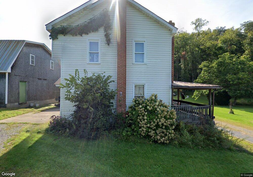
15541 Salt Rd Mount Union, PA 17066
Estimated Value: $88,000 - $177,000
Studio
--
Bath
1,022
Sq Ft
$119/Sq Ft
Est. Value
About This Home
This home is located at 15541 Salt Rd, Mount Union, PA 17066 and is currently estimated at $121,922, approximately $119 per square foot. 15541 Salt Rd is a home located in Huntingdon County with nearby schools including Mount Union Area Senior High School.
Ownership History
Date
Name
Owned For
Owner Type
Purchase Details
Closed on
Jun 20, 2011
Sold by
Wakefield Eugene A and Miller Linda S
Bought by
Hambleton John A and Hambleton Deborah J
Current Estimated Value
Purchase Details
Closed on
Apr 16, 2008
Sold by
Us Bank Na
Bought by
Fiore Joseph and Fiore Deborah L
Purchase Details
Closed on
May 26, 2006
Sold by
Derstine Randy W and Derstine Carolyn H
Bought by
Wakefield Joshua P
Home Financials for this Owner
Home Financials are based on the most recent Mortgage that was taken out on this home.
Original Mortgage
$89,551
Interest Rate
7.1%
Mortgage Type
Future Advance Clause Open End Mortgage
Purchase Details
Closed on
Aug 26, 2005
Sold by
Lightner William F
Bought by
Ross Bradley L and Ross Shannon M
Home Financials for this Owner
Home Financials are based on the most recent Mortgage that was taken out on this home.
Original Mortgage
$77,400
Interest Rate
9.14%
Mortgage Type
Adjustable Rate Mortgage/ARM
Create a Home Valuation Report for This Property
The Home Valuation Report is an in-depth analysis detailing your home's value as well as a comparison with similar homes in the area
Purchase History
| Date | Buyer | Sale Price | Title Company |
|---|---|---|---|
| Hambleton John A | $26,250 | None Available | |
| Fiore Joseph | $65,000 | None Available | |
| Wakefield Joshua P | $56,500 | None Available | |
| Ross Bradley L | $85,000 | None Available |
Source: Public Records
Mortgage History
| Date | Status | Borrower | Loan Amount |
|---|---|---|---|
| Previous Owner | Wakefield Joshua P | $89,551 | |
| Previous Owner | Ross Bradley L | $77,400 |
Source: Public Records
Tax History
| Year | Tax Paid | Tax Assessment Tax Assessment Total Assessment is a certain percentage of the fair market value that is determined by local assessors to be the total taxable value of land and additions on the property. | Land | Improvement |
|---|---|---|---|---|
| 2025 | $1,593 | $22,480 | $7,520 | $14,960 |
| 2024 | $1,460 | $22,480 | $7,520 | $14,960 |
| 2023 | $1,446 | $22,480 | $7,520 | $14,960 |
| 2022 | $1,438 | $22,480 | $7,520 | $14,960 |
| 2021 | $1,437 | $22,480 | $7,520 | $14,960 |
| 2020 | $1,470 | $22,480 | $7,520 | $14,960 |
| 2019 | $1,415 | $22,480 | $7,520 | $14,960 |
| 2018 | $1,416 | $22,480 | $7,520 | $14,960 |
| 2017 | $1,411 | $22,480 | $7,520 | $14,960 |
| 2016 | $1,349 | $22,480 | $7,520 | $14,960 |
| 2015 | $1,347 | $22,480 | $7,520 | $14,960 |
| 2014 | -- | $22,480 | $7,520 | $14,960 |
Source: Public Records
Map
Nearby Homes
- 15732 Walnut Hill Dr
- 80 Lower Country Club Rd
- 330 Dale Rd
- 56 Club Dr
- 90 Ferguson Valley Rd
- 14210 Croghan Pike
- 14074 2nd St
- 0 Wrangletown Rd
- 000 Sugar Ridge Rd
- 205 Shaversville Cir
- 48 E Market St
- 29 E Milford St
- 31 W Halley St
- 33 W Garber St
- 11664 Battistella Rd
- 319 N Lawrence St
- 95 Little Greenbriar Rd
- 0 Dark Hollow Rd
- Wp Unit 1 Vineyard Rd
- WP Lot 001 Vineyard Rd
- 15609 Walnut Hill Dr
- 15605 Walnut Hill Dr
- 15485 Salt Rd
- 15481 Pepper Ln
- 15167 Walnut Hill Dr
- 15489 Pepper Ln
- 15644 Acorn Ln
- 15661 Walnut Hill Dr
- Lot #46 Walnut Hill Subdivision
- Lot #48 Walnut Hill Subdivision
- Lot #47 Walnut Hill Subdivision
- Lot# 47 Walnut Hill Subdivision
- Lot#46 Walnut Hill Subdivision
- 6 W Walnut St
- 6 W Walnut St
- 15468 Pepper Ln
- 15454 Pepper Ln
- 15658 Acorn Ln
- 15740 Salt Rd
- 15701 Walnut Hill Dr
Your Personal Tour Guide
Ask me questions while you tour the home.