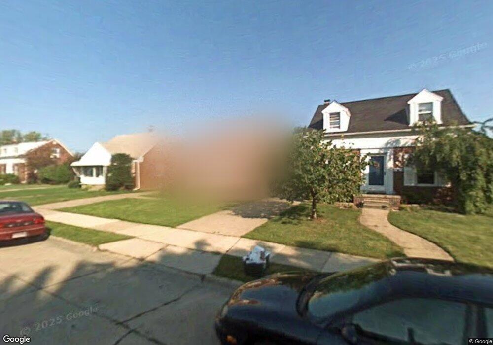
15545 Sprenger Ave Eastpointe, MI 48021
Estimated Value: $150,000 - $187,000
3
Beds
1
Bath
1,205
Sq Ft
$138/Sq Ft
Est. Value
About This Home
This home is located at 15545 Sprenger Ave, Eastpointe, MI 48021 and is currently estimated at $165,763, approximately $137 per square foot. 15545 Sprenger Ave is a home located in Macomb County with nearby schools including Pleasantview Elementary School, Eastpointe Middle School, and Eaton Academy.
Ownership History
Date
Name
Owned For
Owner Type
Purchase Details
Closed on
Aug 28, 2011
Sold by
Donovan Shaun and Secretary Of Housing & Urban D
Bought by
Powers Jasmine
Current Estimated Value
Purchase Details
Closed on
Jun 24, 2011
Sold by
Us Bank Na
Bought by
Us Department Of Housing & Urban Develop
Purchase Details
Closed on
Jul 10, 2009
Sold by
Mcdole Robert E and Houston Mcdole Peggy L
Bought by
Us Bank Na
Purchase Details
Closed on
Mar 4, 2004
Sold by
Cuellar Raymond C
Bought by
Mcdole Robert E
Purchase Details
Closed on
Feb 28, 2002
Sold by
Fuciarelli Victor
Bought by
Cuellar Raymond C
Create a Home Valuation Report for This Property
The Home Valuation Report is an in-depth analysis detailing your home's value as well as a comparison with similar homes in the area
Home Values in the Area
Average Home Value in this Area
Purchase History
| Date | Buyer | Sale Price | Title Company |
|---|---|---|---|
| Powers Jasmine | $21,500 | None Available | |
| Us Department Of Housing & Urban Develop | -- | None Available | |
| Us Bank Na | $126,048 | None Available | |
| Mcdole Robert E | $125,000 | Lawyers Title Insurance Co | |
| Cuellar Raymond C | $115,000 | -- |
Source: Public Records
Tax History Compared to Growth
Tax History
| Year | Tax Paid | Tax Assessment Tax Assessment Total Assessment is a certain percentage of the fair market value that is determined by local assessors to be the total taxable value of land and additions on the property. | Land | Improvement |
|---|---|---|---|---|
| 2025 | $3,384 | $72,100 | $0 | $0 |
| 2024 | $2,750 | $66,900 | $0 | $0 |
| 2023 | $2,367 | $54,900 | $0 | $0 |
| 2022 | $3,095 | $46,700 | $0 | $0 |
| 2021 | $3,014 | $41,100 | $0 | $0 |
| 2020 | $2,267 | $38,700 | $0 | $0 |
| 2019 | $2,530 | $34,700 | $0 | $0 |
| 2018 | $1,695 | $30,300 | $0 | $0 |
| 2017 | $1,695 | $29,320 | $2,820 | $26,500 |
| 2016 | $2,408 | $29,320 | $0 | $0 |
| 2015 | $2,163 | $26,540 | $0 | $0 |
| 2013 | -- | $25,320 | $0 | $0 |
Source: Public Records
Map
Nearby Homes
- 15400 Sprenger Ave
- 15510 Veronica Ave
- 15705 Juliana Ave
- 21241 Redmond Ave
- 15628 Lincoln Ave
- 15337 Veronica Ave
- 20921 Universal Ave
- 15329 Veronica Ave
- 15298 Veronica Ave
- 15162 Sprenger Ave
- 20845 Universal Ave
- 15145 Sprenger Ave
- 15640 Stricker Ave
- 21484 Redmond Ave
- 15701 Glander Ave
- 16114 Sprenger Ave
- 15605 Carlisle St
- 15598 Crescentwood Ave
- 16125 Lincoln Ave
- 14872 Collinson Ave
- 15553 Sprenger Ave
- 15544 Collinson Ave
- 15561 Sprenger Ave
- 15537 Sprenger Ave
- 15536 Collinson Ave
- 15609 Sprenger Ave
- 15552 Collinson Ave
- 15521 Sprenger Ave
- 15600 Collinson Ave
- 15528 Collinson Ave
- 15513 Sprenger Ave Unit Bldg-Unit
- 15513 Sprenger Ave
- 15615 Sprenger Ave
- 15544 Sprenger Ave
- 15608 Collinson Ave
- 15520 Collinson Ave
- 15538 Sprenger Ave
- 15554 Sprenger Ave
- 15600 Sprenger Ave
- 15616 Collinson Ave