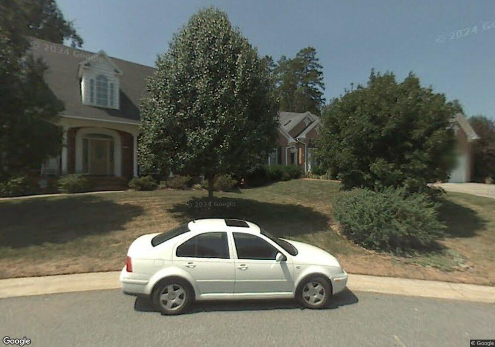
1555 Brockton Ln Winston Salem, NC 27106
Town And Country Estates NeighborhoodEstimated Value: $567,000 - $665,000
4
Beds
3
Baths
3,198
Sq Ft
$189/Sq Ft
Est. Value
About This Home
This home is located at 1555 Brockton Ln, Winston Salem, NC 27106 and is currently estimated at $604,825, approximately $189 per square foot. 1555 Brockton Ln is a home located in Forsyth County with nearby schools including Jefferson Elementary School, Thomas Jefferson Middle School, and Mount Tabor High School.
Ownership History
Date
Name
Owned For
Owner Type
Purchase Details
Closed on
Feb 13, 2018
Sold by
Balley Marian K
Bought by
Bailey Marian K and Marian K Bailey Revocable Trus
Current Estimated Value
Purchase Details
Closed on
Jul 17, 2000
Sold by
Gary Wayne Elliott Construction Co Inc
Bought by
Bailey Marian K
Home Financials for this Owner
Home Financials are based on the most recent Mortgage that was taken out on this home.
Original Mortgage
$125,000
Interest Rate
8.54%
Create a Home Valuation Report for This Property
The Home Valuation Report is an in-depth analysis detailing your home's value as well as a comparison with similar homes in the area
Home Values in the Area
Average Home Value in this Area
Purchase History
| Date | Buyer | Sale Price | Title Company |
|---|---|---|---|
| Bailey Marian K | -- | None Available | |
| Bailey Marian K | $289,000 | -- |
Source: Public Records
Mortgage History
| Date | Status | Borrower | Loan Amount |
|---|---|---|---|
| Previous Owner | Bailey Marian K | $125,000 | |
| Closed | Bailey Marian K | $15,000 |
Source: Public Records
Tax History Compared to Growth
Tax History
| Year | Tax Paid | Tax Assessment Tax Assessment Total Assessment is a certain percentage of the fair market value that is determined by local assessors to be the total taxable value of land and additions on the property. | Land | Improvement |
|---|---|---|---|---|
| 2025 | $5,203 | $532,800 | $63,300 | $469,500 |
| 2024 | $4,966 | $370,900 | $63,300 | $307,600 |
| 2023 | $4,966 | $370,900 | $63,300 | $307,600 |
| 2022 | $4,873 | $370,900 | $63,300 | $307,600 |
| 2021 | $4,785 | $370,900 | $63,300 | $307,600 |
| 2020 | $4,535 | $328,400 | $63,300 | $265,100 |
| 2019 | $4,568 | $328,400 | $63,300 | $265,100 |
| 2018 | $4,338 | $328,400 | $63,300 | $265,100 |
| 2016 | $4,286 | $325,656 | $60,320 | $265,336 |
| 2015 | $4,221 | $325,656 | $60,320 | $265,336 |
| 2014 | $4,093 | $325,656 | $60,320 | $265,336 |
Source: Public Records
Map
Nearby Homes
- 3933 Valley Ct Unit C
- 3969 Valley Ct Unit A
- 337 Petree Rd
- 727 Petree Rd
- 3985 Valley Ct Unit B
- 208 Forest Brook Dr
- 835 Petree Rd
- 801 Duckview Ct
- 1222 Shelter Cove
- 2575 Wood Valley Rd
- Hope Plan at River Rock
- Jasper Plan at River Rock
- Wagner Plan at River Rock
- Knox Plan at River Rock
- Lenox Plan at River Rock
- Huntley Plan at River Rock
- Reeves Plan at River Rock
- Calhoun Plan at River Rock
- Tate Plan at River Rock
- Whitney Plan at River Rock
- 1545 Brockton Ln
- 1532 Boxthorne Ln
- 1535 Brockton Ln
- 1540 Brockton Ln
- 1528 Boxthorne Ln
- 515 Petree Rd
- 1515 Brockton Ln
- 1560 Brockton Ln
- 1500 Boxthorne Ln
- 491 Petree Rd
- 6 Brockton Ln
- 9 Brockton Ln
- 1520 Brockton Ln
- 1524 Boxthorne Ln
- 1481 Brockton Ln
- 1580 Brockton Ln
- 1505 Brockton Ln
- 1497 Brockton Ln
- 487 Petree Rd
- 1489 Brockton Ln
