Estimated Value: $74,000 - $108,784
2
Beds
1
Bath
1,066
Sq Ft
$87/Sq Ft
Est. Value
About This Home
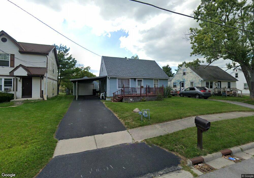
This home is located at 1555 N Union St, Lima, OH 45801 and is currently estimated at $93,196, approximately $87 per square foot. 1555 N Union St is a home located in Allen County with nearby schools including Independence Elementary School, Lima North Middle School, and Lima West Middle School.
Ownership History
Date
Name
Owned For
Owner Type
Purchase Details
Closed on
Apr 7, 2022
Bought by
Mark Shurelds
Current Estimated Value
Home Financials for this Owner
Home Financials are based on the most recent Mortgage that was taken out on this home.
Interest Rate
4.72%
Purchase Details
Closed on
Apr 5, 2022
Sold by
Turner Cynthia A
Bought by
Shurelds Mark
Home Financials for this Owner
Home Financials are based on the most recent Mortgage that was taken out on this home.
Interest Rate
4.72%
Purchase Details
Closed on
Aug 1, 1977
Bought by
Turner Matthew
Create a Home Valuation Report for This Property
The Home Valuation Report is an in-depth analysis detailing your home's value as well as a comparison with similar homes in the area
Home Values in the Area
Average Home Value in this Area
Purchase History
| Date | Buyer | Sale Price | Title Company |
|---|---|---|---|
| Mark Shurelds | $59,100 | -- | |
| Shurelds Mark | $59,100 | None Listed On Document | |
| Turner Matthew | $21,000 | -- |
Source: Public Records
Mortgage History
| Date | Status | Borrower | Loan Amount |
|---|---|---|---|
| Closed | Mark Shurelds | -- |
Source: Public Records
Tax History Compared to Growth
Tax History
| Year | Tax Paid | Tax Assessment Tax Assessment Total Assessment is a certain percentage of the fair market value that is determined by local assessors to be the total taxable value of land and additions on the property. | Land | Improvement |
|---|---|---|---|---|
| 2024 | $1,059 | $28,140 | $4,480 | $23,660 |
| 2023 | $911 | $20,690 | $3,290 | $17,400 |
| 2022 | $886 | $20,690 | $3,290 | $17,400 |
| 2021 | $939 | $20,690 | $3,290 | $17,400 |
| 2020 | $880 | $17,120 | $3,190 | $13,930 |
| 2019 | $880 | $17,120 | $3,190 | $13,930 |
| 2018 | $876 | $17,120 | $3,190 | $13,930 |
| 2017 | $883 | $17,120 | $3,190 | $13,930 |
| 2016 | $893 | $17,120 | $3,190 | $13,930 |
| 2015 | $814 | $17,120 | $3,190 | $13,930 |
| 2014 | $814 | $15,370 | $3,050 | $12,320 |
| 2013 | $793 | $15,370 | $3,050 | $12,320 |
Source: Public Records
Map
Nearby Homes
- 128 E Lane Ave
- 1200 N Main St
- 105 Watt Ave
- 400 W Northern Ave
- 340 W Robb Ave
- 410 W Northern Ave
- 711 Taylor Ave
- 610 W Robb Ave
- 1776 Virginia Ave
- 939 N West St
- 608 W O'Connor Ave
- 2104 Virginia Ave
- 700 Lewis Blvd
- 123 Flanders Ave
- 222 W Grand Ave
- 765 W O'Connor Ave
- 168 Lyre Bird Ln
- 2370 N McDonel St
- 1116 Belvidere Ave
- 735 N Main St
- 1567 N Union St
- 152 E Lane Ave
- 1591 N Union St
- 140 E Lane Ave
- 1550 Main N
- 1521 N Union St
- 1566 N Union St
- 1534 N Union St
- 116 E Lane Ave
- 1590 N Union St
- 1528 N Union St
- 165 E Lane Ave
- 177 E Lane Ave
- 189 E Lane Ave
- 1518 N Main St
- 141 E Lane Ave
- 1580 N Main St
- 1515 N Union St
- 129 E Lane Ave
- 1524 N Union St