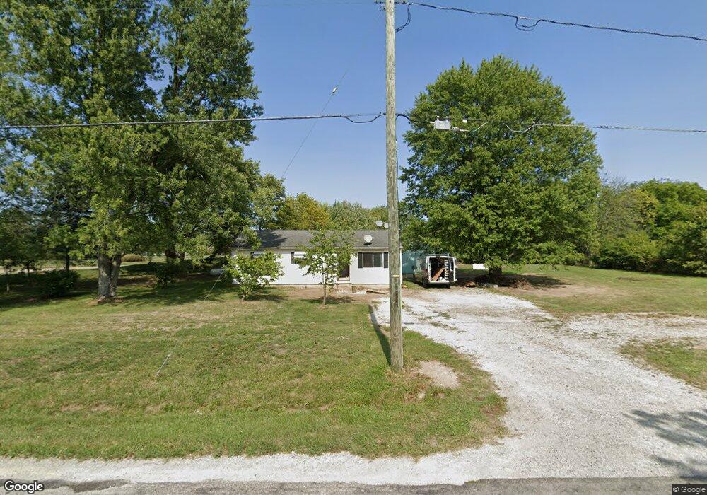
1555 Olmstead Rd West Jefferson, OH 43162
Estimated Value: $181,000 - $223,000
3
Beds
1
Bath
960
Sq Ft
$209/Sq Ft
Est. Value
About This Home
This home is located at 1555 Olmstead Rd, West Jefferson, OH 43162 and is currently estimated at $200,894, approximately $209 per square foot. 1555 Olmstead Rd is a home located in Madison County with nearby schools including Norwood Elementary School, West Jefferson Middle School, and West Jefferson High School.
Ownership History
Date
Name
Owned For
Owner Type
Purchase Details
Closed on
Feb 28, 2025
Sold by
Myers Andrew and Myers Danielle
Bought by
Myers Madeline Anne and Miller Colton Ray
Current Estimated Value
Home Financials for this Owner
Home Financials are based on the most recent Mortgage that was taken out on this home.
Original Mortgage
$270,000
Outstanding Balance
$268,623
Interest Rate
6.89%
Mortgage Type
New Conventional
Estimated Equity
-$67,729
Purchase Details
Closed on
Jul 16, 2024
Sold by
Stewart Jodie A
Bought by
Myers Andrew and Myers Danielle
Purchase Details
Closed on
Nov 20, 2009
Sold by
Lillie Debbie Jean
Bought by
Stewart Jodie A
Home Financials for this Owner
Home Financials are based on the most recent Mortgage that was taken out on this home.
Original Mortgage
$108,007
Interest Rate
4.95%
Mortgage Type
FHA
Create a Home Valuation Report for This Property
The Home Valuation Report is an in-depth analysis detailing your home's value as well as a comparison with similar homes in the area
Home Values in the Area
Average Home Value in this Area
Purchase History
| Date | Buyer | Sale Price | Title Company |
|---|---|---|---|
| Myers Madeline Anne | $360,000 | None Listed On Document | |
| Myers Madeline Anne | $360,000 | None Listed On Document | |
| Myers Andrew | $195,000 | Community Title Network | |
| Stewart Jodie A | $110,000 | Midland Title |
Source: Public Records
Mortgage History
| Date | Status | Borrower | Loan Amount |
|---|---|---|---|
| Open | Myers Madeline Anne | $270,000 | |
| Closed | Myers Madeline Anne | $270,000 | |
| Previous Owner | Stewart Jodie A | $108,007 |
Source: Public Records
Tax History Compared to Growth
Tax History
| Year | Tax Paid | Tax Assessment Tax Assessment Total Assessment is a certain percentage of the fair market value that is determined by local assessors to be the total taxable value of land and additions on the property. | Land | Improvement |
|---|---|---|---|---|
| 2024 | $2,172 | $49,020 | $19,390 | $29,630 |
| 2023 | $2,172 | $49,020 | $19,390 | $29,630 |
| 2022 | $1,744 | $36,630 | $14,280 | $22,350 |
| 2021 | $1,751 | $36,630 | $14,280 | $22,350 |
| 2020 | $1,782 | $36,630 | $14,280 | $22,350 |
| 2019 | $1,608 | $32,550 | $16,710 | $15,840 |
| 2018 | $1,495 | $32,550 | $16,710 | $15,840 |
| 2017 | $1,497 | $32,550 | $16,710 | $15,840 |
| 2016 | $1,405 | $29,930 | $16,710 | $13,220 |
| 2015 | $1,465 | $29,930 | $16,710 | $13,220 |
| 2014 | $1,465 | $29,930 | $16,710 | $13,220 |
| 2013 | -- | $30,800 | $13,920 | $16,880 |
Source: Public Records
Map
Nearby Homes
- 1615 Olmstead Rd
- 125 Dogwood Ct
- 9665 Roberts Rd SE
- 106 Kings Way Unit 4
- 312 Larkspur Dr
- 430 Trillium Dr
- 0 W Jeff Kiousville Rd Unit 225000725
- 545 Trillium Dr
- 304 Middle Dr
- 283 Madison Dr N
- 200 Smith St
- 622 Brookdale Dr
- 63 Jones St
- 74 S Chester St
- 248 London Rd
- 555 Kirkwood Dr
- 22 N Franklin St
- 1890 Wilson Rd SE
- 283 Blendon Rd
- 1000 W Main St Unit Lot 13