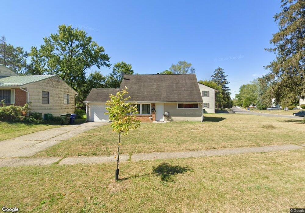
1555 Simpson Dr Columbus, OH 43227
Leawood NeighborhoodEstimated Value: $170,000 - $226,000
4
Beds
2
Baths
1,541
Sq Ft
$131/Sq Ft
Est. Value
About This Home
This home is located at 1555 Simpson Dr, Columbus, OH 43227 and is currently estimated at $201,142, approximately $130 per square foot. 1555 Simpson Dr is a home located in Franklin County with nearby schools including Leawood Elementary School, Sherwood Middle School, and Walnut Ridge High School.
Ownership History
Date
Name
Owned For
Owner Type
Purchase Details
Closed on
Sep 23, 2004
Sold by
Hud
Bought by
Mekonen Ethiopia T
Current Estimated Value
Home Financials for this Owner
Home Financials are based on the most recent Mortgage that was taken out on this home.
Original Mortgage
$74,000
Outstanding Balance
$36,004
Interest Rate
5.93%
Mortgage Type
Purchase Money Mortgage
Estimated Equity
$165,138
Purchase Details
Closed on
Jun 25, 2004
Sold by
Poston Ken L and Principal Residential Mortgage
Bought by
Hud
Purchase Details
Closed on
Apr 5, 1999
Sold by
Liberty Svgs Bank Fsb
Bought by
Poston Kenneth L
Home Financials for this Owner
Home Financials are based on the most recent Mortgage that was taken out on this home.
Original Mortgage
$68,405
Interest Rate
6.94%
Mortgage Type
FHA
Purchase Details
Closed on
Oct 22, 1998
Sold by
Coe Robert L and Coe Sarah J
Bought by
Liberty Svgs Bank Fsb
Purchase Details
Closed on
Nov 20, 1991
Bought by
Coe Robert L and Coe Sarah J
Purchase Details
Closed on
Mar 24, 1989
Create a Home Valuation Report for This Property
The Home Valuation Report is an in-depth analysis detailing your home's value as well as a comparison with similar homes in the area
Home Values in the Area
Average Home Value in this Area
Purchase History
| Date | Buyer | Sale Price | Title Company |
|---|---|---|---|
| Mekonen Ethiopia T | $74,000 | Contract Pr | |
| Hud | $70,000 | -- | |
| Poston Kenneth L | $69,000 | Celtic Title Agency Inc | |
| Liberty Svgs Bank Fsb | -- | -- | |
| Coe Robert L | $59,500 | -- | |
| -- | -- | -- |
Source: Public Records
Mortgage History
| Date | Status | Borrower | Loan Amount |
|---|---|---|---|
| Open | Mekonen Ethiopia T | $74,000 | |
| Previous Owner | Poston Kenneth L | $68,405 |
Source: Public Records
Tax History
| Year | Tax Paid | Tax Assessment Tax Assessment Total Assessment is a certain percentage of the fair market value that is determined by local assessors to be the total taxable value of land and additions on the property. | Land | Improvement |
|---|---|---|---|---|
| 2025 | $2,609 | $58,140 | $14,950 | $43,190 |
| 2024 | $2,609 | $58,140 | $14,950 | $43,190 |
| 2023 | $2,576 | $58,135 | $14,945 | $43,190 |
| 2022 | $1,420 | $27,370 | $5,600 | $21,770 |
| 2021 | $1,422 | $27,370 | $5,600 | $21,770 |
| 2020 | $1,424 | $27,370 | $5,600 | $21,770 |
| 2019 | $1,285 | $21,180 | $4,480 | $16,700 |
| 2018 | $1,212 | $21,180 | $4,480 | $16,700 |
| 2017 | $1,284 | $21,180 | $4,480 | $16,700 |
| 2016 | $1,326 | $18,980 | $4,100 | $14,880 |
| 2015 | $1,141 | $18,980 | $4,100 | $14,880 |
| 2014 | $1,144 | $18,980 | $4,100 | $14,880 |
| 2013 | $664 | $22,330 | $4,830 | $17,500 |
Source: Public Records
Map
Nearby Homes
- 1612 Simpson Dr
- 1639 Shady Lane Rd
- 4677 E Livingston Ave
- 4472 Aragon Ave
- 1691 Shady Lane Rd
- 1607 Baxter Dr
- 4701 Janis Dr
- 4649 Dundee Ave
- 4467 Grimsby Rd
- 4589 Belfast Dr
- 1284 Thurston Dr
- 4475 Ellery Dr
- 1356 Harlow Rd
- 1752 S Hamilton Rd
- 1654 Wilton Dr
- 4859 Folger Dr
- 1281 Maetzel Dr
- 1243 Simpson Dr
- 1229 Simpson Dr
- 1646 Clyde Place
- 1565 Simpson Dr
- 1570 Genoa Place
- 1575 Simpson Dr
- 1560 Genoa Place
- 4568 Aragon Ave
- 1544 Simpson Dr
- 1550 Simpson Dr
- 1534 Simpson Dr
- 1578 Genoa Place
- 1558 Simpson Dr
- 1583 Simpson Dr
- 1566 Simpson Dr
- 1527 Simpson Dr
- 4558 Aragon Ave
- 1586 Genoa Place
- 1526 Simpson Dr
- 1572 Simpson Dr
- 4607 E Livingston Ave
- 1591 Simpson Dr
- 4573 E Livingston Ave
Your Personal Tour Guide
Ask me questions while you tour the home.