Estimated Value: $144,655 - $280,000
2
Beds
1
Bath
1,064
Sq Ft
$186/Sq Ft
Est. Value
About This Home
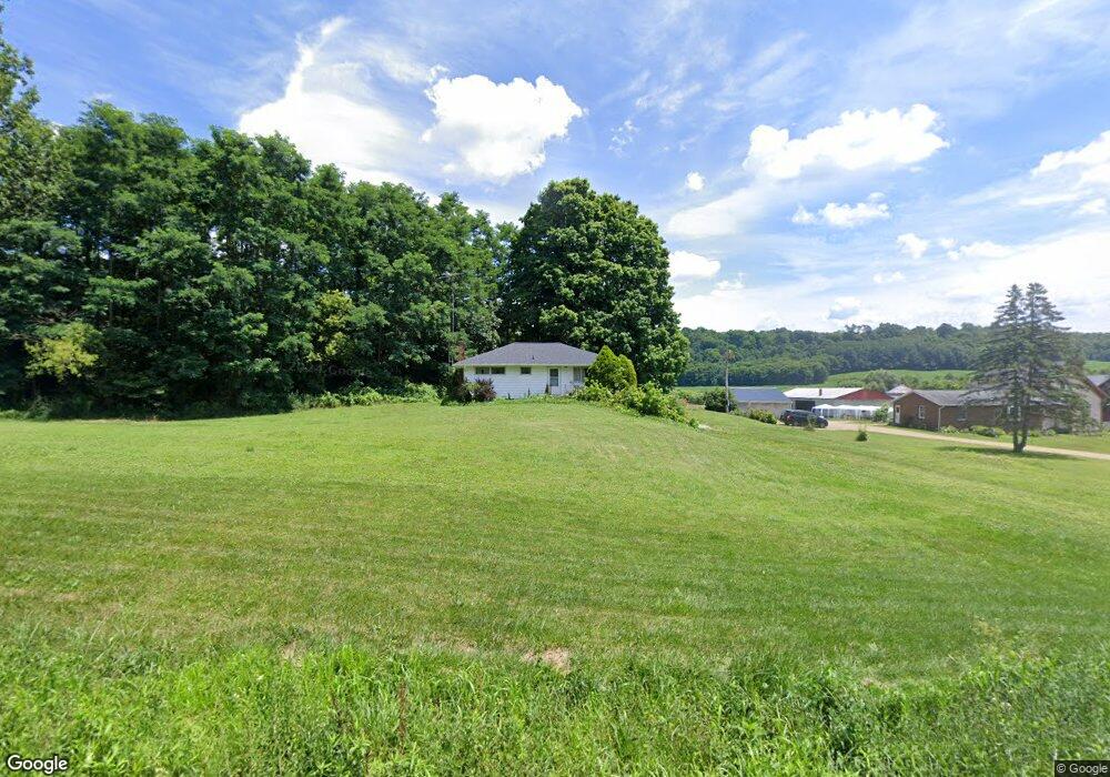
This home is located at 1555 Smart Rd, Lucas, OH 44843 and is currently estimated at $197,914, approximately $186 per square foot. 1555 Smart Rd is a home located in Richland County with nearby schools including Lucas Elementary School, Lucas Heritage Middle School, and Lucas High School.
Ownership History
Date
Name
Owned For
Owner Type
Purchase Details
Closed on
Jan 7, 2015
Sold by
Estate Of Anna Mae Stotts
Bought by
Stotts Daniel
Current Estimated Value
Create a Home Valuation Report for This Property
The Home Valuation Report is an in-depth analysis detailing your home's value as well as a comparison with similar homes in the area
Purchase History
| Date | Buyer | Sale Price | Title Company |
|---|---|---|---|
| Stotts Daniel | -- | None Available |
Source: Public Records
Tax History
| Year | Tax Paid | Tax Assessment Tax Assessment Total Assessment is a certain percentage of the fair market value that is determined by local assessors to be the total taxable value of land and additions on the property. | Land | Improvement |
|---|---|---|---|---|
| 2025 | $868 | $31,680 | $8,040 | $23,640 |
| 2024 | $868 | $31,680 | $8,040 | $23,640 |
| 2023 | $917 | $31,680 | $8,040 | $23,640 |
| 2022 | $587 | $21,260 | $7,190 | $14,070 |
| 2021 | $588 | $21,260 | $7,190 | $14,070 |
| 2020 | $598 | $21,260 | $7,190 | $14,070 |
| 2019 | $471 | $18,010 | $6,090 | $11,920 |
| 2018 | $484 | $18,010 | $6,090 | $11,920 |
| 2017 | $564 | $22,200 | $7,000 | $15,200 |
| 2016 | $420 | $16,810 | $6,300 | $10,510 |
| 2015 | $420 | $16,810 | $6,300 | $10,510 |
| 2014 | $880 | $16,810 | $6,300 | $10,510 |
| 2012 | -- | $22,270 | $6,300 | $15,970 |
Source: Public Records
Map
Nearby Homes
- 28 N Union St
- 1 E Main St
- 2778 Lucas Perrysville Rd
- 0 Mount Zion Rd Unit 226009674
- 0 Mount Zion Rd Unit 9072801
- 2130 State Route 39
- 2804 Rd
- 0 State Route 39 & I-71 Northeast Quadrant
- 2011 Ohio 39
- 0 State Route 39 & I-71 Southeast Quadrant
- 4281 Lucas Perrysville Rd
- 0 McBride Road Parcel # 1 Unit 9066028
- St Rt 603
- 1715 Mansfield Lucas Rd
- 474 Biscayne Dr
- 0 Mcelroy Rd
- 754 Touby Ln
- 620 Running Brook Way
- 59 Ridge Rd S
- 1117 County Road 2075
Your Personal Tour Guide
Ask me questions while you tour the home.