Estimated Value: $424,000
4
Beds
1
Bath
2,432
Sq Ft
$174/Sq Ft
Est. Value
About This Home
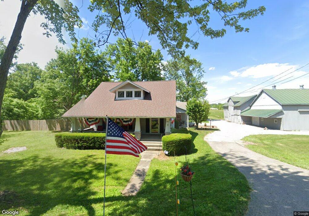
This home is located at 1555 Swailes Rd, Troy, OH 45373 and is currently estimated at $424,000, approximately $174 per square foot. 1555 Swailes Rd is a home located in Miami County with nearby schools including Concord Elementary School, Van Cleve Elementary School, and Troy Junior High School.
Ownership History
Date
Name
Owned For
Owner Type
Purchase Details
Closed on
Mar 1, 2022
Sold by
Andrew Wellington Properties Swailes Llc
Bought by
Sturm Andrew J and Sturm Sarah A
Current Estimated Value
Home Financials for this Owner
Home Financials are based on the most recent Mortgage that was taken out on this home.
Original Mortgage
$161,100
Outstanding Balance
$149,878
Interest Rate
3.55%
Mortgage Type
New Conventional
Estimated Equity
$274,122
Purchase Details
Closed on
Feb 3, 2018
Sold by
Sturm Andrew J
Bought by
Andrew Wellington Properties Swailes Llc
Purchase Details
Closed on
Dec 14, 1990
Bought by
Sheafer Perry J
Create a Home Valuation Report for This Property
The Home Valuation Report is an in-depth analysis detailing your home's value as well as a comparison with similar homes in the area
Home Values in the Area
Average Home Value in this Area
Purchase History
| Date | Buyer | Sale Price | Title Company |
|---|---|---|---|
| Sturm Andrew J | -- | Hallmark Title | |
| Andrew Wellington Properties Swailes Llc | -- | None Available | |
| Sheafer Perry J | -- | -- |
Source: Public Records
Mortgage History
| Date | Status | Borrower | Loan Amount |
|---|---|---|---|
| Open | Sturm Andrew J | $161,100 |
Source: Public Records
Tax History Compared to Growth
Tax History
| Year | Tax Paid | Tax Assessment Tax Assessment Total Assessment is a certain percentage of the fair market value that is determined by local assessors to be the total taxable value of land and additions on the property. | Land | Improvement |
|---|---|---|---|---|
| 2024 | $2,512 | $64,110 | $29,040 | $35,070 |
| 2023 | $2,512 | $64,110 | $29,040 | $35,070 |
| 2022 | $2,144 | $64,110 | $29,040 | $35,070 |
| 2021 | $2,292 | $62,420 | $27,350 | $35,070 |
| 2020 | $2,225 | $62,420 | $27,350 | $35,070 |
| 2019 | $2,245 | $62,420 | $27,350 | $35,070 |
| 2018 | $2,416 | $64,930 | $36,790 | $28,140 |
| 2017 | $2,438 | $64,930 | $36,790 | $28,140 |
| 2016 | $6,906 | $100,100 | $71,960 | $28,140 |
| 2015 | $2,365 | $61,440 | $33,300 | $28,140 |
| 2014 | $2,365 | $61,440 | $33,300 | $28,140 |
| 2013 | $2,045 | $61,440 | $33,300 | $28,140 |
Source: Public Records
Map
Nearby Homes
- 1965 Quail Nest Ct
- 2295 Shenandoah Dr
- 2206 Northbridge Trail
- 1985 Fox Run
- 1550 Creekwood Dr
- 650 Swailes Rd
- 2015 Merrimont Dr
- 00 W
- 1209 Spruce St
- 2215 Merrimont Dr
- 2537 Huntington Dr
- 0 Lincolnshire Unit 939331
- 1350 Winchester Dr
- 1118 Winchester Dr
- 609 Old Newton Pike
- Spruce Plan at Summit Landing
- Norway Plan at Summit Landing
- Chestnut Plan at Summit Landing
- Juniper Plan at Summit Landing
- Palmetto Plan at Summit Landing
- 2095 Woodstock Ct
- 2111 Woodstock Ct
- 2125 Woodstock Ct
- 2075 Woodstock Ct
- 2145 Woodstock Ct
- 2025 Shenandoah Dr
- 2120 Woodstock Ct
- 2165 Woodstock Ct
- 1770 Shenandoah Dr
- 2070 Woodstock Ct
- 2150 Woodstock Ct
- 2020 Shenandoah Dr
- 2055 Woodstock Ct
- 2175 Woodstock Ct
- 2050 Shenandoah Dr
- 2160 Woodstock Ct
- 2095 Shenandoah Dr
- 2195 Woodstock Ct
- 2180 Woodstock Ct
- 2070 Shenandoah Dr