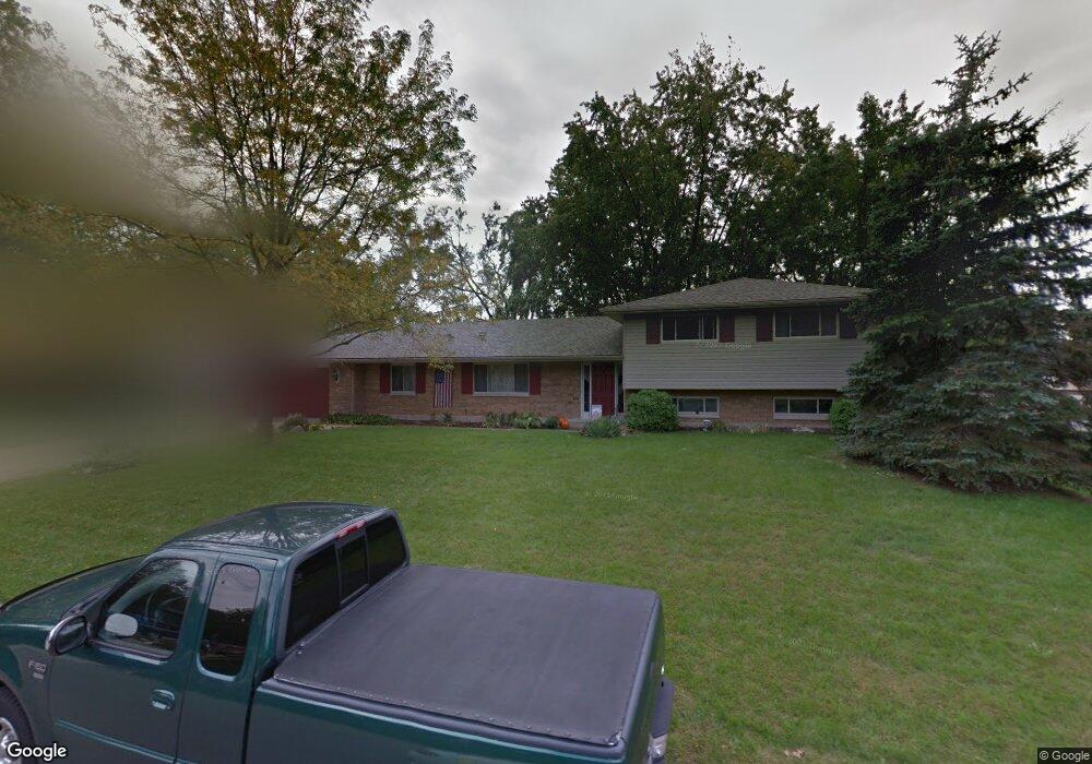
1556 Langdon Dr Dayton, OH 45459
Estimated Value: $356,000 - $437,000
3
Beds
3
Baths
2,149
Sq Ft
$181/Sq Ft
Est. Value
About This Home
This home is located at 1556 Langdon Dr, Dayton, OH 45459 and is currently estimated at $388,356, approximately $180 per square foot. 1556 Langdon Dr is a home located in Montgomery County with nearby schools including Primary Village North, Stingley Elementary School, and Tower Heights Middle School.
Ownership History
Date
Name
Owned For
Owner Type
Purchase Details
Closed on
Aug 5, 2002
Sold by
Proudfoot Robert C
Bought by
Feverston Steven A and Feverston Diane Kay
Current Estimated Value
Home Financials for this Owner
Home Financials are based on the most recent Mortgage that was taken out on this home.
Original Mortgage
$172,000
Outstanding Balance
$73,198
Interest Rate
6.63%
Estimated Equity
$315,158
Purchase Details
Closed on
Feb 23, 1999
Sold by
Estate Of Marian L Proudfoot
Bought by
Proudfoot Robert C
Create a Home Valuation Report for This Property
The Home Valuation Report is an in-depth analysis detailing your home's value as well as a comparison with similar homes in the area
Home Values in the Area
Average Home Value in this Area
Purchase History
| Date | Buyer | Sale Price | Title Company |
|---|---|---|---|
| Feverston Steven A | $185,000 | -- | |
| Proudfoot Robert C | -- | -- |
Source: Public Records
Mortgage History
| Date | Status | Borrower | Loan Amount |
|---|---|---|---|
| Open | Feverston Steven A | $172,000 |
Source: Public Records
Tax History Compared to Growth
Tax History
| Year | Tax Paid | Tax Assessment Tax Assessment Total Assessment is a certain percentage of the fair market value that is determined by local assessors to be the total taxable value of land and additions on the property. | Land | Improvement |
|---|---|---|---|---|
| 2024 | $6,682 | $115,160 | $21,740 | $93,420 |
| 2023 | $6,682 | $115,160 | $21,740 | $93,420 |
| 2022 | $6,102 | $83,390 | $15,750 | $67,640 |
| 2021 | $6,119 | $83,390 | $15,750 | $67,640 |
| 2020 | $6,110 | $83,390 | $15,750 | $67,640 |
| 2019 | $6,004 | $73,130 | $15,750 | $57,380 |
| 2018 | $5,321 | $73,130 | $15,750 | $57,380 |
| 2017 | $5,260 | $73,130 | $15,750 | $57,380 |
| 2016 | $5,067 | $66,480 | $15,750 | $50,730 |
| 2015 | $5,015 | $66,480 | $15,750 | $50,730 |
| 2014 | $5,015 | $66,480 | $15,750 | $50,730 |
| 2012 | -- | $64,350 | $17,500 | $46,850 |
Source: Public Records
Map
Nearby Homes
- 1563 Langdon Dr
- 1620 Ambridge Rd
- 7640 Cloverbrook Park Dr
- 7201 Brookmeadow Dr Unit 11A
- 2349 Donamere Cir Unit 5C
- 7308 Tamarind Trail
- 2540 Early Spring Ct
- 6765 Montpellier Blvd
- 2580 Hingham Ln
- 7395 Cades Cove Unit 174174
- 2193 Tampico Trail
- 5018 Alpine Rose Ct
- 2565 Briggs Rd
- 1501 Lake Pointe Way Unit 8
- 1235 Chevington Ct Unit 1515
- 7124 Fallen Oak Trace Unit 420
- 1511 Lake Pointe Way
- 1511 Lake Pointe Way Unit 2
- 7215 Whitetail Trail Unit 108108
- 7129 Fallen Oak Trace Unit 839
- 1550 Langdon Dr
- 1562 Langdon Dr
- 1577 Ambridge Rd
- 1571 Ambridge Rd
- 1545 Langdon Dr
- 1568 Langdon Dr
- 1583 Ambridge Rd
- 1539 Langdon Dr
- 1551 Langdon Dr
- 1565 Ambridge Rd
- 1538 Langdon Dr
- 1533 Langdon Dr
- 1557 Langdon Dr
- 1589 Ambridge Rd
- 1574 Langdon Dr
- 1559 Ambridge Rd
- 7670 E von Dette Cir
- 7650 W von Dette Cir
- 1527 Langdon Dr
- 1532 Langdon Dr