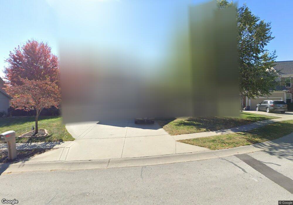
1556 Parkside Dr Liberty, MO 64068
Estimated Value: $374,000 - $488,000
4
Beds
3
Baths
1,651
Sq Ft
$253/Sq Ft
Est. Value
About This Home
This home is located at 1556 Parkside Dr, Liberty, MO 64068 and is currently estimated at $417,454, approximately $252 per square foot. 1556 Parkside Dr is a home located in Clay County with nearby schools including Alexander Doniphan Elementary School, Liberty Middle School, and Liberty High School.
Ownership History
Date
Name
Owned For
Owner Type
Purchase Details
Closed on
May 30, 2000
Sold by
Smith Steven R
Bought by
Hisle Gary S and Hisle Julie A
Current Estimated Value
Home Financials for this Owner
Home Financials are based on the most recent Mortgage that was taken out on this home.
Original Mortgage
$132,900
Interest Rate
8.17%
Mortgage Type
Balloon
Purchase Details
Closed on
Mar 15, 1999
Sold by
South Liberty Development Llc
Bought by
Smith Steven R and Smith Diane E
Create a Home Valuation Report for This Property
The Home Valuation Report is an in-depth analysis detailing your home's value as well as a comparison with similar homes in the area
Home Values in the Area
Average Home Value in this Area
Purchase History
| Date | Buyer | Sale Price | Title Company |
|---|---|---|---|
| Hisle Gary S | -- | United Title Company | |
| Smith Steven R | -- | United Title Company |
Source: Public Records
Mortgage History
| Date | Status | Borrower | Loan Amount |
|---|---|---|---|
| Closed | Hisle Gary S | $132,900 |
Source: Public Records
Tax History Compared to Growth
Tax History
| Year | Tax Paid | Tax Assessment Tax Assessment Total Assessment is a certain percentage of the fair market value that is determined by local assessors to be the total taxable value of land and additions on the property. | Land | Improvement |
|---|---|---|---|---|
| 2025 | $4,248 | $63,970 | -- | -- |
| 2024 | $4,248 | $55,230 | -- | -- |
| 2023 | $4,320 | $55,230 | $0 | $0 |
| 2022 | $3,749 | $47,330 | $0 | $0 |
| 2021 | $3,720 | $47,329 | $7,980 | $39,349 |
| 2020 | $3,932 | $46,970 | $0 | $0 |
| 2019 | $3,931 | $46,968 | $7,980 | $38,988 |
| 2018 | $3,901 | $45,770 | $0 | $0 |
| 2017 | $3,623 | $45,770 | $6,650 | $39,120 |
| 2016 | $3,623 | $42,900 | $6,650 | $36,250 |
| 2015 | $3,623 | $42,900 | $6,650 | $36,250 |
| 2014 | $3,528 | $41,440 | $7,220 | $34,220 |
Source: Public Records
Map
Nearby Homes
- 1537 Canterbury Ln
- 1205 Blackberry Dr
- 1733 Welleslay Ln
- 1836 Green Meadow Dr
- 1856 Arbor Trail
- 2188 Heritage Ct
- 1327 Easton Ct
- 1845 Arbor Trail
- McKinley Plan at Homestead of Liberty - Homestead
- Monroe Plan at Homestead of Liberty - Homestead
- Chestnut Plan at Homestead of Liberty - Homestead
- The Brooklyn Plan at Homestead of Liberty - Homestead
- Cypress Plan at Homestead of Liberty - Homestead
- The Linden Plan at Homestead of Liberty - Homestead
- Spruce Plan at Homestead of Liberty - Homestead
- Ashton Plan at Homestead of Liberty - Homestead
- Meg Plan at Homestead of Liberty - Homestead
- The Hillsdale Plan at Homestead of Liberty - Homestead
- The Maple Plan at Homestead of Liberty - Homestead
- Redbud Plan at Homestead of Liberty - Homestead
- 1560 Parkside Dr
- 1552 Parkside Dr
- 1572 Smiley St
- 1576 Smiley St
- 1568 Smiley St
- 1564 Parkside Dr
- 1553 Parkside Dr
- 1580 Smiley St
- 1557 Parkside Dr
- 1561 Parkside Dr
- 1585 Merit Ln
- 1684 Parkside Dr
- 1584 Smiley St
- 1581 Merit Ln
- 1664 Buckingham Dr
- 1723 Buckingham Dr
- 1575 Smiley St
- 1577 Merit Ln
- 1579 Smiley St
- 1560 Smiley St