Estimated Value: $492,165 - $518,000
3
Beds
2
Baths
1,542
Sq Ft
$324/Sq Ft
Est. Value
About This Home
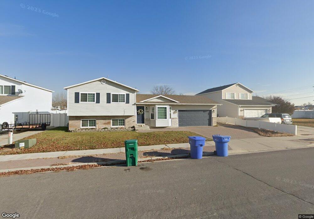
This home is located at 1558 N 2260 W, Lehi, UT 84043 and is currently estimated at $500,291, approximately $324 per square foot. 1558 N 2260 W is a home located in Utah County with nearby schools including North Point Elementary School, Willowcreek Middle School, and Lehi High School.
Ownership History
Date
Name
Owned For
Owner Type
Purchase Details
Closed on
Oct 4, 2018
Sold by
Cannon Gordon V
Bought by
Jessee Paul and Jessee Romina
Current Estimated Value
Home Financials for this Owner
Home Financials are based on the most recent Mortgage that was taken out on this home.
Original Mortgage
$254,000
Outstanding Balance
$221,503
Interest Rate
4.5%
Mortgage Type
New Conventional
Estimated Equity
$278,788
Purchase Details
Closed on
Oct 10, 2005
Sold by
Cannon Gordon V
Bought by
Cannon Gordon and Cannon Christy W
Home Financials for this Owner
Home Financials are based on the most recent Mortgage that was taken out on this home.
Original Mortgage
$134,400
Interest Rate
5.67%
Mortgage Type
Fannie Mae Freddie Mac
Purchase Details
Closed on
Jul 8, 2004
Sold by
Cannon Gordon
Bought by
Cannon Gordon and Cannon Christy W
Home Financials for this Owner
Home Financials are based on the most recent Mortgage that was taken out on this home.
Original Mortgage
$123,188
Interest Rate
6.31%
Mortgage Type
Purchase Money Mortgage
Purchase Details
Closed on
Sep 30, 1999
Sold by
Salisbury Development Lc
Bought by
Robinson Timothy D
Home Financials for this Owner
Home Financials are based on the most recent Mortgage that was taken out on this home.
Original Mortgage
$120,700
Interest Rate
7.97%
Purchase Details
Closed on
Sep 29, 1999
Sold by
Robinson Timothy D
Bought by
Robinson Timothy D and Robinson Katie M
Home Financials for this Owner
Home Financials are based on the most recent Mortgage that was taken out on this home.
Original Mortgage
$120,700
Interest Rate
7.97%
Create a Home Valuation Report for This Property
The Home Valuation Report is an in-depth analysis detailing your home's value as well as a comparison with similar homes in the area
Home Values in the Area
Average Home Value in this Area
Purchase History
| Date | Buyer | Sale Price | Title Company |
|---|---|---|---|
| Jessee Paul | -- | Cottonwood Title Ins Agency | |
| Cannon Gordon | -- | Affiliated First Title Comp | |
| Cannon Gordon | -- | Affiliated First Title Comp | |
| Cannon Gordon | -- | Old Republic Title Company | |
| Cannon Gordon | -- | Old Republic Title Company | |
| Robinson Timothy D | -- | Provo Land Title Company | |
| Robinson Timothy D | -- | Provo Land Title Company |
Source: Public Records
Mortgage History
| Date | Status | Borrower | Loan Amount |
|---|---|---|---|
| Open | Jessee Paul | $254,000 | |
| Previous Owner | Cannon Gordon | $134,400 | |
| Previous Owner | Cannon Gordon | $123,188 | |
| Previous Owner | Robinson Timothy D | $120,700 | |
| Closed | Cannon Gordon | $30,797 |
Source: Public Records
Tax History Compared to Growth
Tax History
| Year | Tax Paid | Tax Assessment Tax Assessment Total Assessment is a certain percentage of the fair market value that is determined by local assessors to be the total taxable value of land and additions on the property. | Land | Improvement |
|---|---|---|---|---|
| 2025 | $1,887 | $245,300 | $187,500 | $258,500 |
| 2024 | $1,887 | $220,825 | $0 | $0 |
| 2023 | $1,736 | $220,550 | $0 | $0 |
| 2022 | $1,965 | $242,055 | $0 | $0 |
| 2021 | $1,749 | $325,700 | $108,500 | $217,200 |
| 2020 | $1,649 | $303,500 | $100,500 | $203,000 |
| 2019 | $1,456 | $278,600 | $100,500 | $178,100 |
| 2018 | $1,370 | $247,800 | $89,600 | $158,200 |
| 2017 | $1,332 | $128,095 | $0 | $0 |
| 2016 | $1,309 | $116,820 | $0 | $0 |
| 2015 | $1,326 | $112,365 | $0 | $0 |
| 2014 | $1,212 | $102,080 | $0 | $0 |
Source: Public Records
Map
Nearby Homes
- 1870 N 2230 W
- 1896 N 2230 W
- 1908 N 2230 W
- 1542 N 1900 W
- Huntington Plan at Pioneer Meadows
- Silver Lake Plan at Pioneer Meadows
- Summit Plan at Pioneer Meadows
- Palisade Plan at Pioneer Meadows
- 1648 N 1900 W
- 1302 N 2450 W
- 1696 N 2640 W
- 1970 N 2090 St W
- Accord Plan at Riverwalk
- Interlude Plan at Riverwalk
- Trio Plan at Riverwalk
- Fortissimo Plan at Riverwalk
- Ballad Plan at Riverwalk
- Tenor Plan at Riverwalk
- Madrigal Plan at Riverwalk
- Timpani Plan at Riverwalk