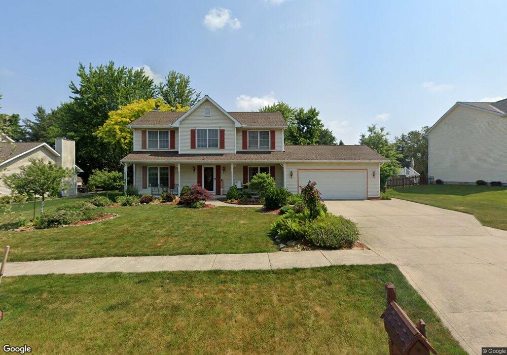
15582 Sassafras Dr Strongsville, OH 44136
Estimated Value: $384,000 - $467,000
5
Beds
4
Baths
2,657
Sq Ft
$155/Sq Ft
Est. Value
About This Home
This home is located at 15582 Sassafras Dr, Strongsville, OH 44136 and is currently estimated at $413,000, approximately $155 per square foot. 15582 Sassafras Dr is a home located in Cuyahoga County with nearby schools including Strongsville High School, Sts Joseph & John Interparochial School, and Bethel Christian Academy.
Ownership History
Date
Name
Owned For
Owner Type
Purchase Details
Closed on
Mar 19, 2004
Sold by
Cooney James M
Bought by
Cooney James M and Cooney Nancy S
Current Estimated Value
Home Financials for this Owner
Home Financials are based on the most recent Mortgage that was taken out on this home.
Original Mortgage
$110,000
Interest Rate
5%
Mortgage Type
Purchase Money Mortgage
Purchase Details
Closed on
Apr 9, 1998
Sold by
Leo Victor and Leo Ann E
Bought by
Cooney James M
Home Financials for this Owner
Home Financials are based on the most recent Mortgage that was taken out on this home.
Original Mortgage
$134,000
Interest Rate
7.18%
Purchase Details
Closed on
Jan 25, 1989
Bought by
Leo Victor
Purchase Details
Closed on
Jan 1, 1989
Bought by
The W Bishop Co
Create a Home Valuation Report for This Property
The Home Valuation Report is an in-depth analysis detailing your home's value as well as a comparison with similar homes in the area
Home Values in the Area
Average Home Value in this Area
Purchase History
| Date | Buyer | Sale Price | Title Company |
|---|---|---|---|
| Cooney James M | -- | Haverfield Title Agency Inc | |
| Cooney James M | $194,000 | Commonwealth Land Title Insu | |
| Leo Victor | $152,200 | -- | |
| The W Bishop Co | -- | -- |
Source: Public Records
Mortgage History
| Date | Status | Borrower | Loan Amount |
|---|---|---|---|
| Closed | Cooney James M | $110,000 | |
| Closed | Cooney James M | $134,000 |
Source: Public Records
Tax History Compared to Growth
Tax History
| Year | Tax Paid | Tax Assessment Tax Assessment Total Assessment is a certain percentage of the fair market value that is determined by local assessors to be the total taxable value of land and additions on the property. | Land | Improvement |
|---|---|---|---|---|
| 2024 | $5,834 | $124,250 | $19,425 | $104,825 |
| 2023 | $6,336 | $101,190 | $21,530 | $79,660 |
| 2022 | $6,290 | $101,190 | $21,530 | $79,660 |
| 2021 | $6,240 | $101,190 | $21,530 | $79,660 |
| 2020 | $6,080 | $87,220 | $18,550 | $68,670 |
| 2019 | $5,902 | $249,200 | $53,000 | $196,200 |
| 2018 | $2,678 | $87,220 | $18,550 | $68,670 |
| 2017 | $5,252 | $79,170 | $16,520 | $62,650 |
| 2016 | $5,209 | $79,170 | $16,520 | $62,650 |
| 2015 | $5,129 | $79,170 | $16,520 | $62,650 |
| 2014 | $5,129 | $76,860 | $16,030 | $60,830 |
Source: Public Records
Map
Nearby Homes
- 9129 Tahoe Cir
- 9890 Webster Rd
- 10010 Chevy Chase
- 9531 Nicole Cir
- 9945 Twelve Oaks Cir
- 7685 Saratoga Rd
- 14015 Byron Blvd
- 13976 W Sprague Rd
- 10369 Council Bluff
- Buchanan Plan at The Enclave at Pine Lakes Crossing
- Belleville Plan at The Enclave at Pine Lakes Crossing
- 15485 Albion Rd
- 0 Webster Rd
- 18203 Broxton Dr
- 7475 Lanier Dr
- 7664 Gerald Dr
- 14280 Pawnee Trail
- 14330 Pawnee Trail
- 14069 Basswood Cir
- 16519 Albion Rd
- 15630 Sassafras Dr
- 15534 Sassafras Dr
- 15678 Sassafras Dr
- 15577 Sassafras Dr
- 15655 Sassafras Dr
- 15486 Sassafras Dr
- 15733 Sassafras Dr
- 15706 Sassafras Dr
- 8765 Chapman Cir
- 15454 Sassafras Dr
- 8770 Chapman Cir
- 15724 Sassafras Dr
- 8843 Groveside Dr
- 15751 Sassafras Dr
- 15422 Sassafras Dr
- 8818 Chapman Cir
- 15471 Sassafras Dr
- 15742 Sassafras Dr
- 8861 Groveside Dr
- 8853 Chapman Cir