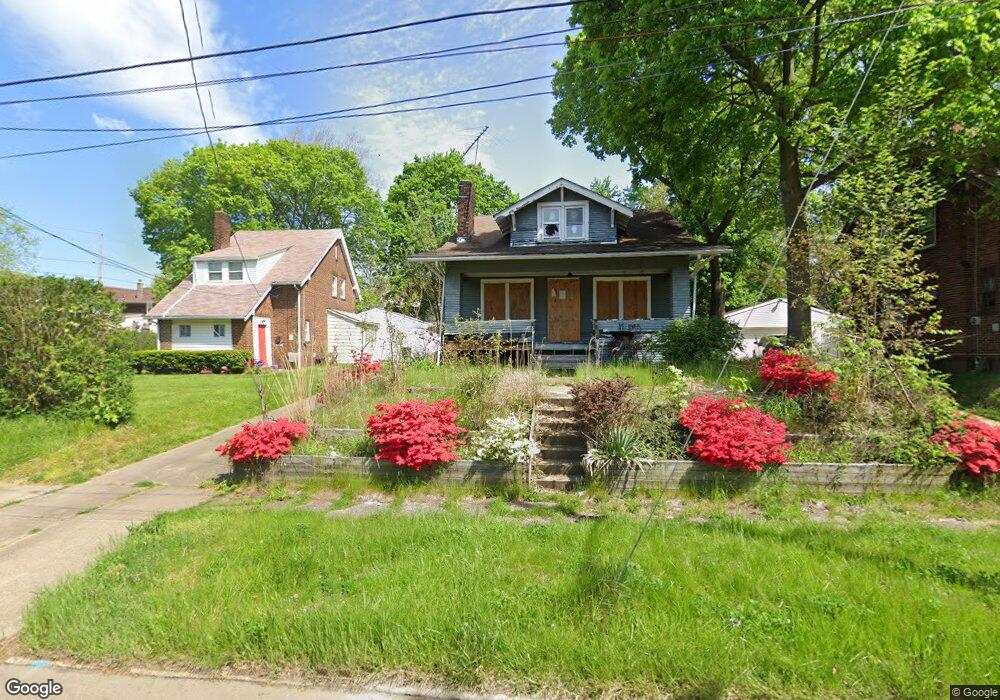
1559 Hampton Rd Akron, OH 44305
Goodyear Heights NeighborhoodEstimated Value: $57,469 - $158,000
3
Beds
1
Bath
1,039
Sq Ft
$116/Sq Ft
Est. Value
About This Home
This home is located at 1559 Hampton Rd, Akron, OH 44305 and is currently estimated at $120,867, approximately $116 per square foot. 1559 Hampton Rd is a home located in Summit County with nearby schools including Seiberling Community Learning Center, Akron Preparatory school, and Middlebury Academy.
Ownership History
Date
Name
Owned For
Owner Type
Purchase Details
Closed on
May 11, 2021
Sold by
Mustard Seed Development Center
Bought by
Property Junkie Llc
Current Estimated Value
Purchase Details
Closed on
Feb 10, 2017
Sold by
Fannie Mae
Bought by
Mustard Seed Development Center
Purchase Details
Closed on
Nov 23, 2016
Sold by
Dasen Kevin
Bought by
Federal National Mortgage Association
Purchase Details
Closed on
Dec 21, 2004
Sold by
Regallis Joseph D
Bought by
Dasen Kevin and Dasen Jill
Home Financials for this Owner
Home Financials are based on the most recent Mortgage that was taken out on this home.
Original Mortgage
$89,400
Interest Rate
5.9%
Mortgage Type
Purchase Money Mortgage
Create a Home Valuation Report for This Property
The Home Valuation Report is an in-depth analysis detailing your home's value as well as a comparison with similar homes in the area
Home Values in the Area
Average Home Value in this Area
Purchase History
| Date | Buyer | Sale Price | Title Company |
|---|---|---|---|
| Property Junkie Llc | $15,000 | None Available | |
| Mustard Seed Development Center | -- | Nova Title Agency Inc | |
| Federal National Mortgage Association | -- | None Available | |
| Dasen Kevin | $89,400 | Cresent Title Agency Llc |
Source: Public Records
Mortgage History
| Date | Status | Borrower | Loan Amount |
|---|---|---|---|
| Previous Owner | Dasen Kevin | $89,400 |
Source: Public Records
Tax History
| Year | Tax Paid | Tax Assessment Tax Assessment Total Assessment is a certain percentage of the fair market value that is determined by local assessors to be the total taxable value of land and additions on the property. | Land | Improvement |
|---|---|---|---|---|
| 2025 | $10,913 | $27,461 | $7,378 | $20,083 |
| 2024 | $4,204 | $27,461 | $7,378 | $20,083 |
| 2023 | $10,913 | $27,461 | $7,378 | $20,083 |
| 2022 | $2,177 | $20,164 | $5,233 | $14,931 |
| 2021 | $1,516 | $20,164 | $5,233 | $14,931 |
| 2020 | $1,699 | $20,160 | $5,230 | $14,930 |
| 2019 | $1,898 | $22,490 | $5,280 | $17,210 |
| 2018 | $2,757 | $22,490 | $5,280 | $17,210 |
| 2017 | $1,960 | $22,490 | $5,280 | $17,210 |
| 2016 | $1,732 | $22,490 | $5,280 | $17,210 |
| 2015 | $1,960 | $22,490 | $5,280 | $17,210 |
| 2014 | $2,763 | $22,490 | $5,280 | $17,210 |
| 2013 | $2,023 | $22,670 | $5,280 | $17,390 |
Source: Public Records
Map
Nearby Homes
- 1551 Preston Ave
- 153 Cutler Pkwy
- 1581 Hillside Terrace
- 1578 Pilgrim St
- 1591 Pilgrim St
- 204 Morningview Ave
- 250 Morningview Ave
- 191 Colony Crescent
- 1874 Adelaide Blvd
- 310 Vaniman St
- 1438 Newton St
- 320 Para Ave
- 1820 Malasia Rd
- 1268 Pondview Ave
- 1239 Pondview Ave
- 248 Malacca St
- 282 Sobul Ave
- 303 Barder Ave
- 82 Detroit St
- 291 Malacca St
- 1565 Hampton Rd
- 1555 Hampton Rd
- 1567 Hampton Rd
- 1560 Preston Ave
- 1566 Preston Ave
- 1552 Preston Ave
- 1575 Hampton Rd
- 1570 Preston Ave
- 1558 Hampton Rd
- 1562 Hampton Rd
- 1541 Hampton Rd
- 1568 Hampton Rd
- 1576 Preston Ave
- 1579 Hampton Rd
- 1574 Hampton Rd
- 1540 Preston Ave
- 1544 Hampton Rd
- 1535 Hampton Rd
- 1580 Hampton Rd
- 1540 Hampton Rd
Your Personal Tour Guide
Ask me questions while you tour the home.