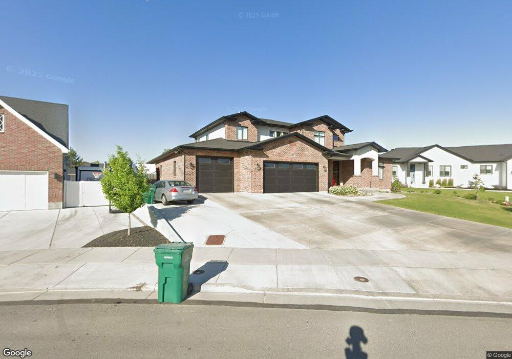
1559 W Norm B Cir Riverton, UT 84065
Estimated Value: $1,014,000 - $1,455,784
5
Beds
3
Baths
3,474
Sq Ft
$358/Sq Ft
Est. Value
About This Home
This home is located at 1559 W Norm B Cir, Riverton, UT 84065 and is currently estimated at $1,243,196, approximately $357 per square foot. 1559 W Norm B Cir is a home with nearby schools including Rosamond Elementary School, Oquirrh Hills Middle School, and Riverton High School.
Ownership History
Date
Name
Owned For
Owner Type
Purchase Details
Closed on
Feb 19, 2019
Sold by
Viewport Construction Inc
Bought by
Alder Mindy and The Mindy Alder Revocable Trust
Current Estimated Value
Home Financials for this Owner
Home Financials are based on the most recent Mortgage that was taken out on this home.
Original Mortgage
$200,285
Outstanding Balance
$175,727
Interest Rate
4.4%
Mortgage Type
Unknown
Estimated Equity
$1,067,469
Purchase Details
Closed on
Jul 3, 2018
Sold by
Treasure Valey Real Estate And Construct
Bought by
Viewpoint Construction Inc
Create a Home Valuation Report for This Property
The Home Valuation Report is an in-depth analysis detailing your home's value as well as a comparison with similar homes in the area
Home Values in the Area
Average Home Value in this Area
Purchase History
| Date | Buyer | Sale Price | Title Company |
|---|---|---|---|
| Alder Mindy | -- | None Available | |
| Viewpoint Construction Inc | -- | None Available |
Source: Public Records
Mortgage History
| Date | Status | Borrower | Loan Amount |
|---|---|---|---|
| Open | Alder Mindy | $200,285 |
Source: Public Records
Tax History Compared to Growth
Tax History
| Year | Tax Paid | Tax Assessment Tax Assessment Total Assessment is a certain percentage of the fair market value that is determined by local assessors to be the total taxable value of land and additions on the property. | Land | Improvement |
|---|---|---|---|---|
| 2025 | $7,230 | $1,298,400 | $323,900 | $974,500 |
| 2024 | $7,230 | $1,251,400 | $314,700 | $936,700 |
| 2023 | $7,411 | $1,209,300 | $308,500 | $900,800 |
| 2022 | $7,684 | $1,230,000 | $302,500 | $927,500 |
| 2021 | $5,607 | $799,100 | $256,400 | $542,700 |
| 2020 | $5,364 | $712,700 | $255,100 | $457,600 |
| 2019 | $2,951 | $385,500 | $251,200 | $134,300 |
Source: Public Records
Map
Nearby Homes
- 1611 W Laurel Chase Dr
- 1721 W Hollow Cedar Ln Unit 1
- 11784 Stone Ridge Ct
- 1337 Natasha Cir
- 1410 W 12115 S
- 11711 Stone Crest Cir
- 11860 S Alysum Cir
- 11694 Stone Crest Cir
- 1661 W Madison View Dr
- 1767 W Lunford Ln
- 12034 S 1900 W
- 12294 S 1490 W
- 12216 S 1300 W
- 1592 W Andover Rd
- 1182 River Hills Dr
- 1184 W Margaret Rose Dr
- 12317 S Redwood Rd
- 12325 S Redwood Rd
- 11513 S Andover Rd
- 12345 S Redwood Rd
- 1563 W Norm B Cir
- 1547 W Norm B Cir
- 1544 W Norm B Cir Unit 15
- 1567 W Norm B Cir
- 11973 S Broadhead Cove
- 1536 Lindsay Marie Cir
- 1536 W Lindsay Marie Cir
- 1552 W Norm B Cir
- 1533 W Norm B Cir
- 11961 S Broadhead Cove Unit 11
- 1528 W Lindsay Marie Cir
- 1528 Lindsay Marie Cir
- 11962 S Laurel Chase Dr
- 1544 W Lindsay Marie Cir
- 11987 S Broadhead Cove
- 11938 S Laurel Chase Dr
- 1522 Lindsay Marie Cir
- 1522 W Lindsay Marie Cir
- 11995 S Redwood Rd
- 12397 S Laurel Chase Dr