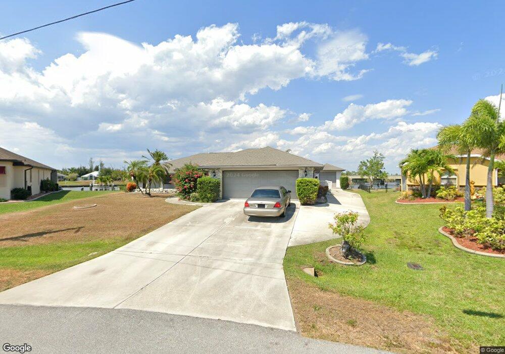
15596 Ruston Cir Port Charlotte, FL 33981
Gulf Cove NeighborhoodEstimated Value: $538,186 - $696,000
3
Beds
2
Baths
2,347
Sq Ft
$278/Sq Ft
Est. Value
About This Home
This home is located at 15596 Ruston Cir, Port Charlotte, FL 33981 and is currently estimated at $653,547, approximately $278 per square foot. 15596 Ruston Cir is a home located in Charlotte County with nearby schools including Myakka River Elementary School, L.A. Ainger Middle School, and Lemon Bay High School.
Ownership History
Date
Name
Owned For
Owner Type
Purchase Details
Closed on
Jun 19, 2018
Sold by
Webber Kim and Johnson Kim
Bought by
Webber Gregg
Current Estimated Value
Purchase Details
Closed on
Feb 17, 2015
Sold by
Tonz Anthony S and Tonz Katherine A
Bought by
Ursin Bjarne and Ursin Denise
Home Financials for this Owner
Home Financials are based on the most recent Mortgage that was taken out on this home.
Original Mortgage
$167,000
Outstanding Balance
$128,145
Interest Rate
3.81%
Mortgage Type
New Conventional
Estimated Equity
$525,402
Create a Home Valuation Report for This Property
The Home Valuation Report is an in-depth analysis detailing your home's value as well as a comparison with similar homes in the area
Home Values in the Area
Average Home Value in this Area
Purchase History
| Date | Buyer | Sale Price | Title Company |
|---|---|---|---|
| Webber Gregg | -- | Attorney | |
| Ursin Bjarne | $334,000 | Sunbelt Title Agency |
Source: Public Records
Mortgage History
| Date | Status | Borrower | Loan Amount |
|---|---|---|---|
| Open | Ursin Bjarne | $167,000 |
Source: Public Records
Tax History Compared to Growth
Tax History
| Year | Tax Paid | Tax Assessment Tax Assessment Total Assessment is a certain percentage of the fair market value that is determined by local assessors to be the total taxable value of land and additions on the property. | Land | Improvement |
|---|---|---|---|---|
| 2023 | $5,119 | $301,745 | $0 | $0 |
| 2022 | $5,437 | $312,527 | $0 | $0 |
| 2021 | $5,452 | $303,424 | $0 | $0 |
| 2020 | $5,344 | $299,235 | $0 | $0 |
| 2019 | $5,214 | $292,507 | $0 | $0 |
| 2018 | $4,885 | $287,053 | $0 | $0 |
| 2017 | $4,843 | $281,149 | $119,000 | $162,149 |
| 2016 | $5,273 | $262,310 | $0 | $0 |
| 2015 | $2,609 | $157,438 | $0 | $0 |
| 2014 | -- | $156,188 | $0 | $0 |
Source: Public Records
Map
Nearby Homes
- 15588 Ruston Cir
- 15571 Ruston Cir
- 15563 Ruston Cir
- 15659 Ruston Cir
- 10096 Saint Paul Dr
- 9365 Saint Paul Dr
- 10528 Saint Paul Dr
- 10072 Saint Paul Dr
- 15660 Ruston Cir
- 9325 Saint Paul Dr
- 9149 Lane Ct
- 15555 Ruston Cir
- 15401 Aqua Cir
- 9349 Saint Paul Dr
- 9346 St Paul Dr
- 15475 Aqua Cir
- 16031 Eastern Blvd
- 15483 Mccomb Cir
- 15503 Mccomb Cir
- 15873 Aqua Cir
- 15604 Ruston Cir
- 15612 Ruston Cir
- 15580 Ruston Cir
- 9285 Saint Paul Dr
- 15572 Ruston Cir
- 15620 Ruston Cir
- 15635 Ruston Cir
- 9301 Saint Paul Dr
- 15564 Ruston Cir
- 15628 Ruston Cir
- 15962 Aqua Cir
- 15970 Aqua Cir
- 9309 St Paul Dr
- 15946 Aqua Cir
- 15978 Aqua Cir
- 15556 Ruston Cir
- 15988 Aqua Cir
- 15636 Ruston Cir
- 15644 Ruston Cir
- 15930 Aqua Cir