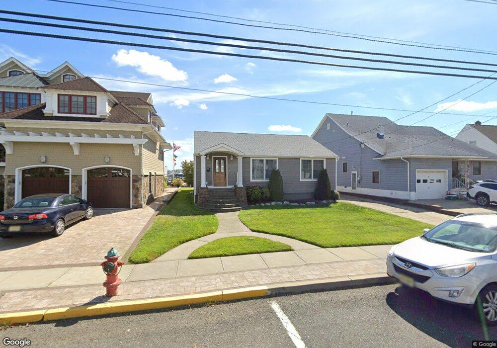
156 Baltimore Ave Point Pleasant Beach, NJ 08742
Point Pleasant Beach NeighborhoodEstimated Value: $1,299,000 - $1,664,000
3
Beds
1
Bath
1,421
Sq Ft
$1,029/Sq Ft
Est. Value
About This Home
This home is located at 156 Baltimore Ave, Point Pleasant Beach, NJ 08742 and is currently estimated at $1,461,948, approximately $1,028 per square foot. 156 Baltimore Ave is a home located in Ocean County with nearby schools including G Harold Antrim Elementary School, Point Pleasant Beach High School, and St. Peter School.
Ownership History
Date
Name
Owned For
Owner Type
Purchase Details
Closed on
Apr 15, 2008
Sold by
Curren Dolores
Bought by
Campione Vincent and Campione Florence
Current Estimated Value
Home Financials for this Owner
Home Financials are based on the most recent Mortgage that was taken out on this home.
Original Mortgage
$350,000
Outstanding Balance
$221,942
Interest Rate
5.99%
Mortgage Type
Purchase Money Mortgage
Estimated Equity
$1,240,006
Create a Home Valuation Report for This Property
The Home Valuation Report is an in-depth analysis detailing your home's value as well as a comparison with similar homes in the area
Home Values in the Area
Average Home Value in this Area
Purchase History
| Date | Buyer | Sale Price | Title Company |
|---|---|---|---|
| Campione Vincent | $800,000 | Lawyers Title Insurance Corp |
Source: Public Records
Mortgage History
| Date | Status | Borrower | Loan Amount |
|---|---|---|---|
| Open | Campione Vincent | $350,000 |
Source: Public Records
Tax History Compared to Growth
Tax History
| Year | Tax Paid | Tax Assessment Tax Assessment Total Assessment is a certain percentage of the fair market value that is determined by local assessors to be the total taxable value of land and additions on the property. | Land | Improvement |
|---|---|---|---|---|
| 2025 | $13,335 | $776,200 | $654,000 | $122,200 |
| 2024 | $12,931 | $776,200 | $654,000 | $122,200 |
| 2023 | $12,567 | $776,200 | $654,000 | $122,200 |
| 2022 | $12,567 | $776,200 | $654,000 | $122,200 |
| 2021 | $12,287 | $776,200 | $654,000 | $122,200 |
| 2020 | $12,272 | $776,200 | $654,000 | $122,200 |
| 2019 | $12,101 | $776,200 | $654,000 | $122,200 |
| 2018 | $11,915 | $776,200 | $654,000 | $122,200 |
| 2017 | $11,728 | $776,200 | $654,000 | $122,200 |
| 2016 | $11,783 | $776,200 | $654,000 | $122,200 |
| 2015 | $11,690 | $776,200 | $654,000 | $122,200 |
| 2014 | $11,635 | $776,200 | $654,000 | $122,200 |
Source: Public Records
Map
Nearby Homes
- 202 Yale Ave
- 2 Beachcomber Ln Unit 7-2
- 6 Beachcomber Ln Unit 6
- 140 Ocean Ave
- 7 Brunswick Place
- 10 Brunswick Place
- 5 Water St
- 143 Boardwalk
- 109 Griffiths Ave
- 23 Ocean Ave N
- 303 Cooks Ln
- 109 Boardwalk
- 45 Inlet Dr
- 325 Hawthorne Ave Unit 327
- 204 Curtis Ave
- 328 Curtis Ave Unit Lot 28
- 326 Curtis Ave Unit Lot 27
- 573 Perch Ave
- 201 Forman Ave
- 607 Richmond Ave Unit 4
- 158 Baltimore Ave
- 154 Baltimore Ave
- 160 Baltimore Ave
- 152 Baltimore Ave
- 150 Baltimore Ave
- 162 Baltimore Ave
- 159 Baltimore Ave
- 116 Harvard Ave
- 161 Baltimore Ave
- 163 Baltimore Ave
- 164 Baltimore Ave
- 114 Harvard Ave
- 157 Baltimore Ave
- 165 Baltimore Ave
- 112 Harvard Ave
- 155 Baltimore Ave
- 110 Harvard Ave
- 166 Baltimore Ave
- 200 Yale Ave
- 153 Baltimore Ave