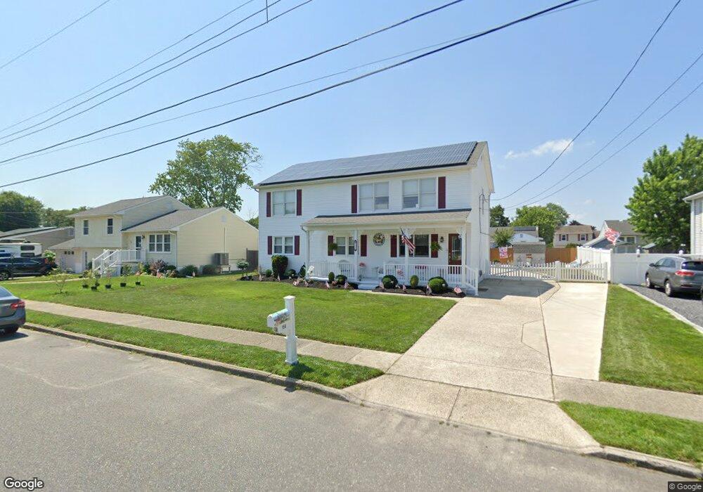
156 Exton Rd Somers Point, NJ 08244
Estimated Value: $532,000 - $605,000
5
Beds
3
Baths
2,506
Sq Ft
$224/Sq Ft
Est. Value
About This Home
This home is located at 156 Exton Rd, Somers Point, NJ 08244 and is currently estimated at $561,613, approximately $224 per square foot. 156 Exton Rd is a home located in Atlantic County with nearby schools including Mainland Regional High School, ChARTer TECH High School for the Performing Arts, and Gospel of Grace Christian School.
Ownership History
Date
Name
Owned For
Owner Type
Purchase Details
Closed on
Sep 29, 2017
Sold by
Tower Dbw Reo Llc
Bought by
Mcmanus Charles and Mcmanus Donna
Current Estimated Value
Purchase Details
Closed on
Jul 10, 2006
Sold by
Hart Dorothy
Bought by
Dorothy Hart
Purchase Details
Closed on
Mar 4, 1993
Sold by
Hart George L
Bought by
Hart George L and Hart Dorothy
Purchase Details
Closed on
Jun 4, 1992
Sold by
Ditko Stephen
Bought by
Hart George and Hart Dorothy
Create a Home Valuation Report for This Property
The Home Valuation Report is an in-depth analysis detailing your home's value as well as a comparison with similar homes in the area
Home Values in the Area
Average Home Value in this Area
Purchase History
| Date | Buyer | Sale Price | Title Company |
|---|---|---|---|
| Mcmanus Charles | $200,000 | Surety Title Co | |
| Dorothy Hart | -- | -- | |
| Hart George L | -- | -- | |
| Hart George | $100,000 | -- |
Source: Public Records
Tax History
| Year | Tax Paid | Tax Assessment Tax Assessment Total Assessment is a certain percentage of the fair market value that is determined by local assessors to be the total taxable value of land and additions on the property. | Land | Improvement |
|---|---|---|---|---|
| 2025 | $10,353 | $289,500 | $67,500 | $222,000 |
| 2024 | $10,046 | $289,500 | $67,500 | $222,000 |
Source: Public Records
Map
Nearby Homes
Your Personal Tour Guide
Ask me questions while you tour the home.