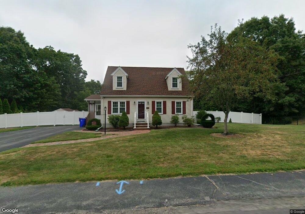
156 Hummingbird Ln East Taunton, MA 02718
East Taunton NeighborhoodEstimated Value: $514,000 - $591,000
3
Beds
2
Baths
1,414
Sq Ft
$386/Sq Ft
Est. Value
About This Home
This home is located at 156 Hummingbird Ln, East Taunton, MA 02718 and is currently estimated at $546,183, approximately $386 per square foot. 156 Hummingbird Ln is a home located in Bristol County with nearby schools including East Taunton Elementary School, Joseph H. Martin, and Taunton High School.
Ownership History
Date
Name
Owned For
Owner Type
Purchase Details
Closed on
Nov 2, 2009
Sold by
Ryan Shawn and Ryan June A
Bought by
Araujo Eldo C and Araujo Amanda M
Current Estimated Value
Home Financials for this Owner
Home Financials are based on the most recent Mortgage that was taken out on this home.
Original Mortgage
$255,290
Outstanding Balance
$167,205
Interest Rate
5.06%
Mortgage Type
Purchase Money Mortgage
Estimated Equity
$378,978
Create a Home Valuation Report for This Property
The Home Valuation Report is an in-depth analysis detailing your home's value as well as a comparison with similar homes in the area
Home Values in the Area
Average Home Value in this Area
Purchase History
| Date | Buyer | Sale Price | Title Company |
|---|---|---|---|
| Araujo Eldo C | $260,000 | -- |
Source: Public Records
Mortgage History
| Date | Status | Borrower | Loan Amount |
|---|---|---|---|
| Open | Araujo Eldo C | $255,290 |
Source: Public Records
Tax History Compared to Growth
Tax History
| Year | Tax Paid | Tax Assessment Tax Assessment Total Assessment is a certain percentage of the fair market value that is determined by local assessors to be the total taxable value of land and additions on the property. | Land | Improvement |
|---|---|---|---|---|
| 2025 | $4,946 | $452,100 | $140,300 | $311,800 |
| 2024 | $4,771 | $426,400 | $140,300 | $286,100 |
| 2023 | $4,590 | $380,900 | $133,900 | $247,000 |
| 2022 | $4,448 | $337,500 | $122,200 | $215,300 |
| 2021 | $4,396 | $309,600 | $111,100 | $198,500 |
| 2020 | $4,213 | $283,500 | $111,100 | $172,400 |
| 2019 | $4,321 | $274,200 | $111,100 | $163,100 |
| 2018 | $4,015 | $259,900 | $112,200 | $147,700 |
| 2017 | $3,876 | $246,700 | $106,400 | $140,300 |
| 2016 | $3,737 | $238,300 | $103,300 | $135,000 |
| 2015 | $3,697 | $246,300 | $105,300 | $141,000 |
| 2014 | $3,506 | $240,000 | $105,300 | $134,700 |
Source: Public Records
Map
Nearby Homes
- 203 Bluejay Ln
- 79 Liberty St
- 51 Swan Dr
- 526 Caswell St
- 8 Powhattan Dr
- 649 Middleboro Ave
- 125R Middleboro Ave
- 95 Meeshawn Ave
- 96 Old Colony Ave Unit 264
- 96 Old Colony Ave Unit 319
- 96 Old Colony Ave Unit 227
- 96 Old Colony Ave Unit 153
- 96 Old Colony Ave Unit 313
- 6 Bear Paw Trail
- 482 Staples St
- 53 Cheshire Dr
- 218R Hart St Unit B
- 218R Hart St Unit A
- 15 Carlton St
- 147 Colonial Dr
- 170 Hummingbird Ln
- 146 Hummingbird Ln
- 99 Wren St
- 111 Wren St
- 151 Hummingbird Ln
- 85 Wren St
- 165 Hummingbird Ln
- 180 Hummingbird Ln
- 130 Hummingbird Ln
- 135 Hummingbird Ln
- 125 Wren St
- 175 Hummingbird Ln
- 71 Wren St
- 196 Hummingbird Ln
- 116 Hummingbird Ln
- 121 Hummingbird Ln
- 135 Wren St
- 96 Bluejay Ln
- 80 Bluejay Ln
- 110 Bluejay Ln