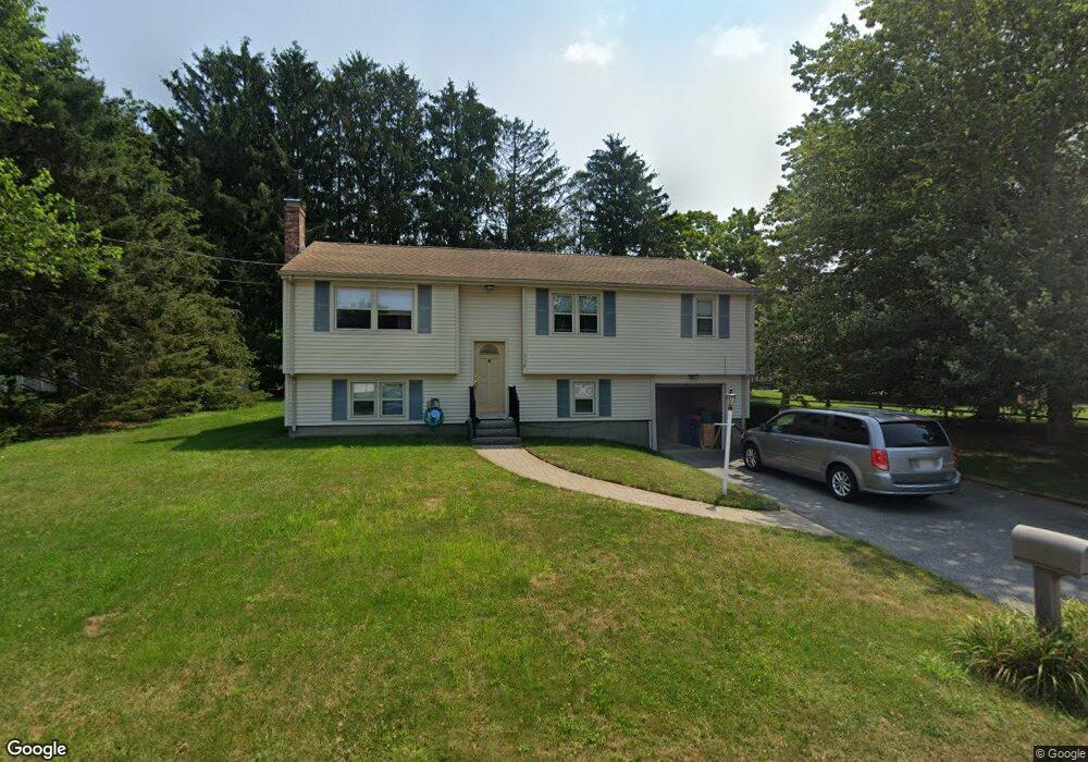
156 King Philip Rd Seekonk, MA 02771
Estimated Value: $484,000 - $565,000
3
Beds
2
Baths
1,137
Sq Ft
$447/Sq Ft
Est. Value
About This Home
This home is located at 156 King Philip Rd, Seekonk, MA 02771 and is currently estimated at $508,510, approximately $447 per square foot. 156 King Philip Rd is a home located in Bristol County with nearby schools including Seekonk High School, Ocean State Montessori School, and Providence Country Day School.
Ownership History
Date
Name
Owned For
Owner Type
Purchase Details
Closed on
Oct 2, 1991
Sold by
Botelho Stephen M and Botelho Annette
Bought by
Durant Raymond W and Durant Diane M
Current Estimated Value
Purchase Details
Closed on
Jul 21, 1989
Sold by
Seaward Hilip W
Bought by
Botelho Stephen
Create a Home Valuation Report for This Property
The Home Valuation Report is an in-depth analysis detailing your home's value as well as a comparison with similar homes in the area
Home Values in the Area
Average Home Value in this Area
Purchase History
| Date | Buyer | Sale Price | Title Company |
|---|---|---|---|
| Durant Raymond W | $129,000 | -- | |
| Botelho Stephen | $139,000 | -- |
Source: Public Records
Mortgage History
| Date | Status | Borrower | Loan Amount |
|---|---|---|---|
| Open | Botelho Stephen | $212,000 | |
| Closed | Botelho Stephen | $26,500 | |
| Closed | Botelho Stephen | $33,500 |
Source: Public Records
Tax History Compared to Growth
Tax History
| Year | Tax Paid | Tax Assessment Tax Assessment Total Assessment is a certain percentage of the fair market value that is determined by local assessors to be the total taxable value of land and additions on the property. | Land | Improvement |
|---|---|---|---|---|
| 2025 | $4,946 | $400,500 | $161,400 | $239,100 |
| 2024 | $4,757 | $385,200 | $161,400 | $223,800 |
| 2023 | $4,590 | $350,100 | $144,900 | $205,200 |
| 2022 | $4,271 | $320,200 | $144,900 | $175,300 |
| 2021 | $4,006 | $295,200 | $123,500 | $171,700 |
| 2020 | $3,749 | $284,700 | $123,800 | $160,900 |
| 2019 | $3,639 | $278,600 | $123,800 | $154,800 |
| 2018 | $3,611 | $270,500 | $123,800 | $146,700 |
| 2017 | $3,462 | $257,200 | $125,200 | $132,000 |
| 2016 | $3,432 | $255,900 | $125,200 | $130,700 |
| 2015 | $3,298 | $249,300 | $113,700 | $135,600 |
Source: Public Records
Map
Nearby Homes
- 358 Olney St
- 57 Mohawk Dr
- 147 Olney St
- 454 Fall River Ave
- 30 Rosemarie Dr
- 25 Pimental Dr
- 759 Fall River Ave
- 349 County St
- 42 Tee Jay Dr
- 524 County St
- 698 Fall River Ave
- 679 County St
- 420 Chestnut St
- 296 Fall River Ave
- 39 John Alden Rd
- 206 Wheeler St
- 0 Milton St Unit 72633661
- 62 Chestnut St
- 7 Jill Ct
- 442 Taunton Ave
- 419 Olney St
- 146 King Philip Rd
- 429 Olney St
- 157 King Philip Rd
- 409 Olney St
- 147 King Philip Rd
- 167 King Philip Rd
- 136 King Philip Rd
- 426 Olney St
- 166 Mohawk Dr
- 143 King Philip Rd
- 176 King Philip Rd
- 441 Olney St
- 156 Mohawk Dr
- 395 Olney St
- 176 Mohawk Dr
- 406 Olney St
- 186 King Philip Rd
- 436 Olney St
- 146 Mohawk Dr