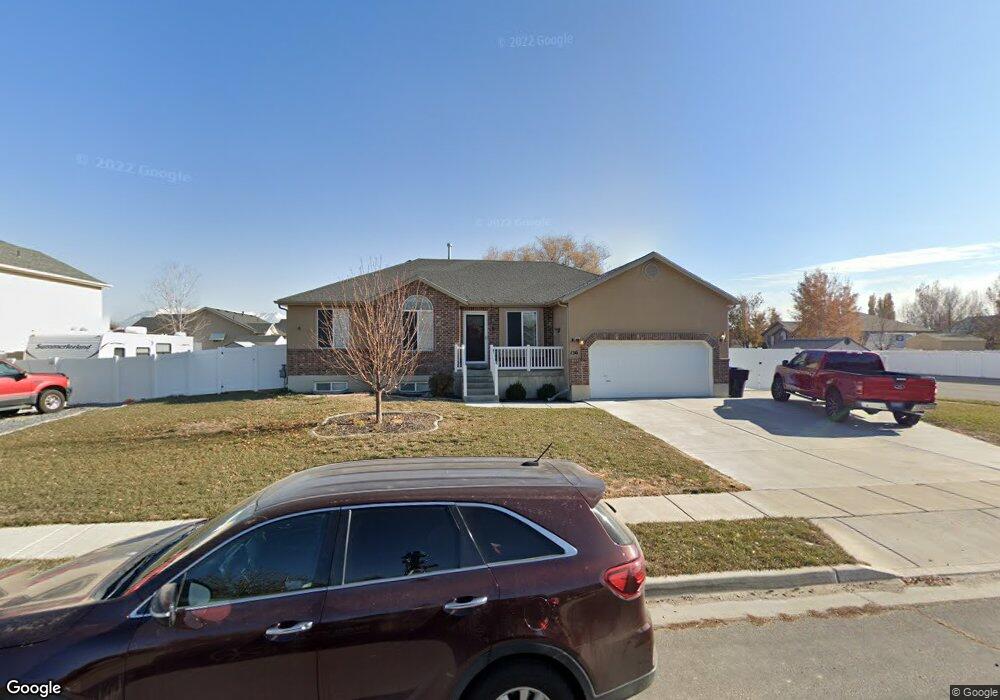
156 N 4950 W West Point, UT 84015
Estimated Value: $574,000 - $608,017
3
Beds
2
Baths
3,030
Sq Ft
$193/Sq Ft
Est. Value
About This Home
This home is located at 156 N 4950 W, West Point, UT 84015 and is currently estimated at $584,754, approximately $192 per square foot. 156 N 4950 W is a home located in Davis County with nearby schools including West Point School, West Point Junior High School, and Syracuse High School.
Ownership History
Date
Name
Owned For
Owner Type
Purchase Details
Closed on
Aug 20, 2020
Sold by
Wilson Jonathan
Bought by
Wilson Jonathan and Wilson Kayleen Hall
Current Estimated Value
Home Financials for this Owner
Home Financials are based on the most recent Mortgage that was taken out on this home.
Original Mortgage
$198,000
Outstanding Balance
$140,279
Interest Rate
2.9%
Mortgage Type
New Conventional
Estimated Equity
$444,475
Purchase Details
Closed on
Jan 6, 2009
Sold by
Lasalle Bank National Association
Bought by
Wilson Jonathan
Home Financials for this Owner
Home Financials are based on the most recent Mortgage that was taken out on this home.
Original Mortgage
$175,500
Interest Rate
5.14%
Mortgage Type
Purchase Money Mortgage
Purchase Details
Closed on
Oct 7, 2008
Sold by
Dabb Justin
Bought by
Lasalle Bank National Association
Purchase Details
Closed on
Apr 9, 2007
Sold by
Dabb Justin
Bought by
Dabb Justin and Dabb Kristilyn
Home Financials for this Owner
Home Financials are based on the most recent Mortgage that was taken out on this home.
Original Mortgage
$204,000
Interest Rate
7.65%
Mortgage Type
New Conventional
Purchase Details
Closed on
Mar 13, 2006
Sold by
Carter Rick A
Bought by
Dabb Justin
Home Financials for this Owner
Home Financials are based on the most recent Mortgage that was taken out on this home.
Original Mortgage
$193,000
Interest Rate
5.75%
Mortgage Type
New Conventional
Purchase Details
Closed on
Mar 10, 2006
Sold by
Dabb Justin
Bought by
Dabb Justin and Dabb Kristilyn
Home Financials for this Owner
Home Financials are based on the most recent Mortgage that was taken out on this home.
Original Mortgage
$193,000
Interest Rate
5.75%
Mortgage Type
New Conventional
Purchase Details
Closed on
Apr 29, 2005
Sold by
Mark Higley Construction Lc
Bought by
Carter Rick A
Home Financials for this Owner
Home Financials are based on the most recent Mortgage that was taken out on this home.
Original Mortgage
$19,000
Interest Rate
5.56%
Mortgage Type
Stand Alone Second
Purchase Details
Closed on
Sep 13, 2004
Sold by
S M Carter Co
Bought by
Mark Highley Construction Lc
Purchase Details
Closed on
Oct 29, 2003
Sold by
Paice Farms Llc
Bought by
S M Carter Co
Home Financials for this Owner
Home Financials are based on the most recent Mortgage that was taken out on this home.
Original Mortgage
$202,500
Interest Rate
5.98%
Mortgage Type
Construction
Purchase Details
Closed on
Apr 16, 2003
Sold by
Mark Higley Construction Lc and Boothe Gordon
Bought by
Paice Farms Llc
Home Financials for this Owner
Home Financials are based on the most recent Mortgage that was taken out on this home.
Original Mortgage
$850,000
Interest Rate
6.22%
Mortgage Type
Seller Take Back
Create a Home Valuation Report for This Property
The Home Valuation Report is an in-depth analysis detailing your home's value as well as a comparison with similar homes in the area
Home Values in the Area
Average Home Value in this Area
Purchase History
| Date | Buyer | Sale Price | Title Company |
|---|---|---|---|
| Wilson Jonathan | -- | First American Title | |
| Wilson Jonathan | -- | Premier Title Insurance Agen | |
| Lasalle Bank National Association | $188,682 | Etitle Insurance Agency | |
| Dabb Justin | -- | First American Title | |
| Dabb Justin | -- | First American Title | |
| Dabb Justin | -- | Lincoln Title Ins Agency | |
| Dabb Justin | -- | First American Title | |
| Carter Rick A | -- | Heritage West Title Ins Agen | |
| Mark Highley Construction Lc | -- | Security Title Company | |
| S M Carter Co | -- | Security Title Company | |
| Paice Farms Llc | -- | Heritage West Title Insuranc |
Source: Public Records
Mortgage History
| Date | Status | Borrower | Loan Amount |
|---|---|---|---|
| Open | Wilson Jonathan | $198,000 | |
| Closed | Wilson Jonathan | $175,500 | |
| Previous Owner | Dabb Justin | $204,000 | |
| Previous Owner | Dabb Justin | $38,250 | |
| Previous Owner | Dabb Justin | $193,000 | |
| Previous Owner | Carter Rick A | $19,000 | |
| Previous Owner | Carter Rick A | $152,000 | |
| Previous Owner | S M Carter Co | $202,500 | |
| Previous Owner | Paice Farms Llc | $850,000 |
Source: Public Records
Tax History Compared to Growth
Tax History
| Year | Tax Paid | Tax Assessment Tax Assessment Total Assessment is a certain percentage of the fair market value that is determined by local assessors to be the total taxable value of land and additions on the property. | Land | Improvement |
|---|---|---|---|---|
| 2025 | $3,358 | $309,100 | $109,684 | $199,416 |
| 2024 | $3,219 | $297,550 | $98,735 | $198,815 |
| 2023 | $2,990 | $508,000 | $123,821 | $384,179 |
| 2022 | $3,233 | $300,850 | $64,617 | $236,233 |
| 2021 | $2,969 | $413,000 | $100,151 | $312,849 |
| 2020 | $2,380 | $326,000 | $84,283 | $241,717 |
| 2019 | $2,290 | $309,000 | $81,727 | $227,273 |
| 2018 | $2,115 | $281,000 | $81,405 | $199,595 |
| 2016 | $1,827 | $127,380 | $31,512 | $95,868 |
| 2015 | $1,831 | $121,000 | $31,512 | $89,488 |
| 2014 | $1,713 | $114,515 | $31,512 | $83,003 |
| 2013 | -- | $108,618 | $30,787 | $77,831 |
Source: Public Records
Map
Nearby Homes
- 4669 W 75 N
- 4594 W 75 N Unit 405
- 128 N 4500 W
- 4719 W 650 N
- 477 N 4500 W
- 4366 W 200 N
- 4352 W 300 N
- 4325 W 75 N
- 4362 West St Unit 106
- 4358 West St Unit 105
- 120 N 4325 W
- 356 S 4300 W Unit 611
- 364 S 4300 W Unit 610
- 696 S 4500 W
- 357 N 4000 W
- 3949 W 250 N
- 3851 W 50 S Unit 425
- 3849 W 50 S Unit 426
- Charleston Plan at Bluff View
- 3847 W 50 S Unit 428
- 168 N 4950 W
- 4922 W 150 N
- 138 N 4950 W
- 4921 Morning Dove Dr Unit 45
- 4921 Morning Dove Dr
- 4921 W 175 N
- 153 N 4950 W
- 161 N 4950 W
- 4927 W 150 N
- 135 N 4950 W
- 173 N 4950 W
- 4910 Canvasback Ln Unit 48
- 4910 W 150 N
- 190 N 4950 W
- 118 N 4950 W
- 4909 W 175 N
- 4915 W 150 N
- 4928 W Eagles Landing
- 4928 W 100 N
- 4924 W 175 N