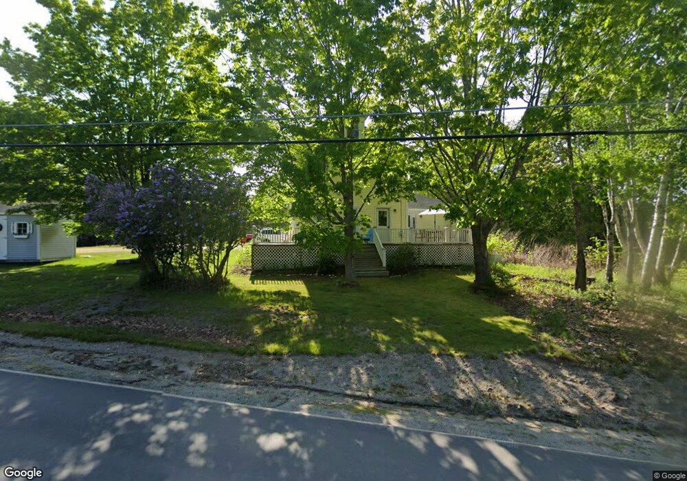
156 N Main St Stonington, ME 04681
Estimated Value: $308,000 - $392,000
--
Bed
--
Bath
--
Sq Ft
2
Acres
About This Home
This home is located at 156 N Main St, Stonington, ME 04681 and is currently estimated at $350,097. 156 N Main St is a home with nearby schools including Deer Isle-Stonington Elementary School, Deer Isle-Stonington High School, and The Heritage School.
Ownership History
Date
Name
Owned For
Owner Type
Purchase Details
Closed on
Jun 8, 2012
Sold by
Lawson Todd B and Lawson Sarah L
Bought by
Boyce Justin D and Brennan Rachel A
Current Estimated Value
Home Financials for this Owner
Home Financials are based on the most recent Mortgage that was taken out on this home.
Original Mortgage
$242,500
Outstanding Balance
$168,612
Interest Rate
3.9%
Mortgage Type
Commercial
Estimated Equity
$181,485
Create a Home Valuation Report for This Property
The Home Valuation Report is an in-depth analysis detailing your home's value as well as a comparison with similar homes in the area
Home Values in the Area
Average Home Value in this Area
Purchase History
| Date | Buyer | Sale Price | Title Company |
|---|---|---|---|
| Boyce Justin D | -- | -- |
Source: Public Records
Mortgage History
| Date | Status | Borrower | Loan Amount |
|---|---|---|---|
| Open | Boyce Justin D | $242,500 |
Source: Public Records
Tax History Compared to Growth
Tax History
| Year | Tax Paid | Tax Assessment Tax Assessment Total Assessment is a certain percentage of the fair market value that is determined by local assessors to be the total taxable value of land and additions on the property. | Land | Improvement |
|---|---|---|---|---|
| 2024 | $2,579 | $254,100 | $39,500 | $214,600 |
| 2023 | $1,814 | $116,600 | $26,500 | $90,100 |
| 2022 | $1,814 | $116,600 | $26,500 | $90,100 |
| 2021 | $1,831 | $116,600 | $26,500 | $90,100 |
| 2020 | $1,831 | $116,600 | $26,500 | $90,100 |
| 2019 | $1,827 | $114,900 | $26,500 | $88,400 |
| 2018 | $2,078 | $114,900 | $26,500 | $88,400 |
| 2017 | $1,851 | $114,900 | $26,500 | $88,400 |
| 2016 | $1,942 | $114,900 | $26,500 | $88,400 |
| 2015 | $1,928 | $112,400 | $26,500 | $85,900 |
| 2014 | $1,685 | $111,600 | $26,500 | $85,100 |
| 2013 | $1,582 | $111,600 | $26,500 | $85,100 |
Source: Public Records
Map
Nearby Homes
- 176 N Main St
- 68 Main St Unit 3
- 51 Main St Unit A
- 18 Davids Way
- 36 Green Head Rd
- 12-3 S Burnt Cove Rd
- 12-4 S Burnt Cove Rd
- 12-2 S Burnt Cove Rd
- 12-1 S Burnt Cove Rd
- 102 S Burnt Cove Rd
- 145 Stanley Field Rd
- 32 Burnt Cove Rd
- 17 Barbour Farm Rd
- 3-11-G Cat Cove Rd
- M3L66&66-2 Sunset Cross Rd
- 27 Spofford Dr
- 191 Sunset Cross Rd
- 643 Sunset Rd
- 10 Moss Ledge Lndg Ln
- 36 Treasure Ln
- 157 N Main St
- 0 N Main St
- 3 Ice House Rd
- 18 Ice House Rd
- 145 N Main St
- 167 N Main St
- 10 Tea Hill Rd
- 146 N Main St
- 170 N Main St
- 17 Ice House Rd
- 175 N Main St
- 1 Tea Hill Rd
- 0 Tea Hill Rd Unit 750150
- 0 Tea Hill Rd Unit 780076
- 0 Tea Hill Rd Unit 914605
- 178 N Main St
- 27 Tea Hill Rd
- 129 N Main St
- 183 N Main St
- 24 Ice House Rd