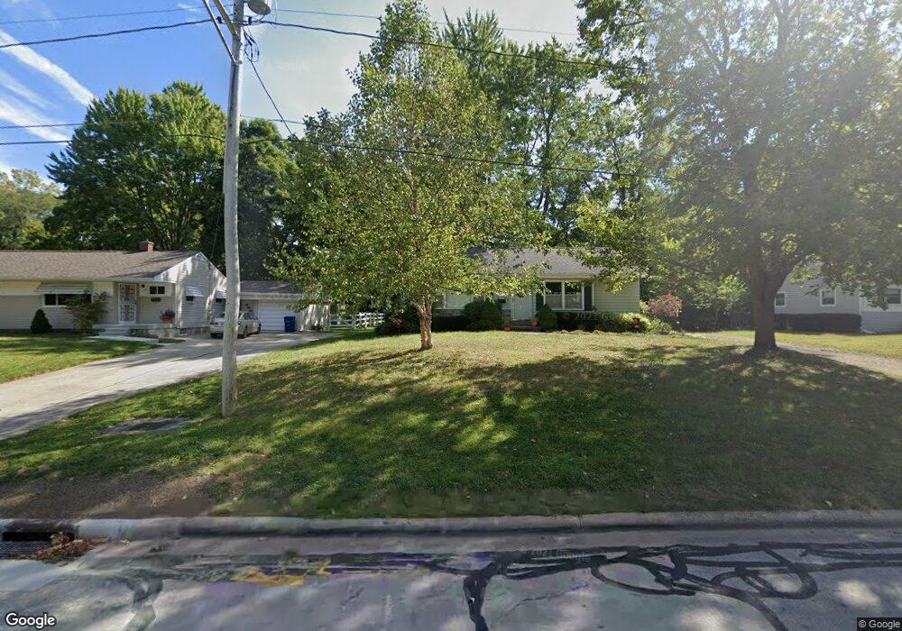
156 Orchard Ln Columbus, OH 43081
Estimated Value: $247,333 - $267,000
2
Beds
2
Baths
1,316
Sq Ft
$198/Sq Ft
Est. Value
About This Home
This home is located at 156 Orchard Ln, Columbus, OH 43081 and is currently estimated at $260,333, approximately $197 per square foot. 156 Orchard Ln is a home located in Franklin County with nearby schools including Whittier Elementary School, Blendon Middle School, and Westerville South High School.
Ownership History
Date
Name
Owned For
Owner Type
Purchase Details
Closed on
Jun 20, 2018
Sold by
Campbell Mary Lou
Bought by
Campbell Darin G and Campbell Vanessa L
Current Estimated Value
Purchase Details
Closed on
Sep 30, 2002
Sold by
Mayfair Homes Willow Oaks Inc
Bought by
Campbell Mary Lou
Home Financials for this Owner
Home Financials are based on the most recent Mortgage that was taken out on this home.
Original Mortgage
$91,900
Outstanding Balance
$39,035
Interest Rate
6.34%
Mortgage Type
Purchase Money Mortgage
Estimated Equity
$221,298
Create a Home Valuation Report for This Property
The Home Valuation Report is an in-depth analysis detailing your home's value as well as a comparison with similar homes in the area
Home Values in the Area
Average Home Value in this Area
Purchase History
| Date | Buyer | Sale Price | Title Company |
|---|---|---|---|
| Campbell Darin G | -- | None Available | |
| Campbell Mary Lou | $138,400 | Service Title Agency |
Source: Public Records
Mortgage History
| Date | Status | Borrower | Loan Amount |
|---|---|---|---|
| Open | Campbell Mary Lou | $91,900 |
Source: Public Records
Tax History Compared to Growth
Tax History
| Year | Tax Paid | Tax Assessment Tax Assessment Total Assessment is a certain percentage of the fair market value that is determined by local assessors to be the total taxable value of land and additions on the property. | Land | Improvement |
|---|---|---|---|---|
| 2024 | $2,903 | $74,490 | $13,130 | $61,360 |
| 2023 | $2,894 | $74,480 | $13,125 | $61,355 |
| 2022 | $2,179 | $50,760 | $7,110 | $43,650 |
| 2021 | $2,183 | $50,760 | $7,110 | $43,650 |
| 2020 | $2,186 | $50,760 | $7,110 | $43,650 |
| 2019 | $1,750 | $37,590 | $5,250 | $32,340 |
| 2018 | $1,665 | $37,590 | $5,250 | $32,340 |
| 2017 | $1,746 | $37,590 | $5,250 | $32,340 |
| 2016 | $1,744 | $35,080 | $5,220 | $29,860 |
| 2015 | $1,583 | $35,080 | $5,220 | $29,860 |
| 2014 | $1,587 | $35,080 | $5,220 | $29,860 |
| 2013 | $966 | $41,230 | $6,125 | $35,105 |
Source: Public Records
Map
Nearby Homes
- 417 E Park St
- 360 Potawatomi Dr
- 182 Hillcrest Dr
- 368 E College Ave
- 589 E College Ave
- 364 E College Ave
- 150 Matthew Ave
- 200 Matthew Ave
- 371 Delaware Dr
- 0 Cherrington Rd Unit 225023909
- 192 Buckeye Ct
- 199 E College Ave
- 768 Collingwood Dr
- 539 Cherrington Rd
- 466 S State St
- 559 Allview Ct
- 470 S State St
- 92 N Vine St
- 53 W College Ave
- 969 Farrington Dr