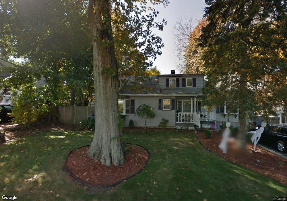
156 Parker Rd Wakefield, MA 01880
West Side NeighborhoodEstimated Value: $836,148 - $1,099,000
3
Beds
2
Baths
2,614
Sq Ft
$360/Sq Ft
Est. Value
About This Home
This home is located at 156 Parker Rd, Wakefield, MA 01880 and is currently estimated at $942,037, approximately $360 per square foot. 156 Parker Rd is a home located in Middlesex County with nearby schools including Wakefield Memorial High School and St Joseph School.
Ownership History
Date
Name
Owned For
Owner Type
Purchase Details
Closed on
Apr 30, 2024
Sold by
Dale Carla L
Bought by
Carla L Dale Lt and Dale
Current Estimated Value
Create a Home Valuation Report for This Property
The Home Valuation Report is an in-depth analysis detailing your home's value as well as a comparison with similar homes in the area
Home Values in the Area
Average Home Value in this Area
Purchase History
| Date | Buyer | Sale Price | Title Company |
|---|---|---|---|
| Carla L Dale Lt | -- | None Available | |
| Carla L Dale Lt | -- | None Available |
Source: Public Records
Tax History Compared to Growth
Tax History
| Year | Tax Paid | Tax Assessment Tax Assessment Total Assessment is a certain percentage of the fair market value that is determined by local assessors to be the total taxable value of land and additions on the property. | Land | Improvement |
|---|---|---|---|---|
| 2025 | $9,064 | $798,600 | $425,500 | $373,100 |
| 2024 | $8,360 | $743,100 | $395,800 | $347,300 |
| 2023 | $8,138 | $693,800 | $369,400 | $324,400 |
| 2022 | $7,636 | $619,800 | $329,900 | $289,900 |
| 2021 | $7,382 | $579,900 | $301,600 | $278,300 |
| 2020 | $6,943 | $543,700 | $282,700 | $261,000 |
| 2019 | $7,091 | $552,700 | $263,900 | $288,800 |
| 2018 | $6,838 | $528,000 | $252,100 | $275,900 |
| 2017 | $6,430 | $493,500 | $235,600 | $257,900 |
| 2016 | $6,393 | $473,900 | $232,600 | $241,300 |
| 2015 | $5,972 | $443,000 | $217,300 | $225,700 |
| 2014 | $5,524 | $432,200 | $212,000 | $220,200 |
Source: Public Records
Map
Nearby Homes
- 347 Ash St
- 114 Parker Rd
- 4 Mcdonald Farm Rd
- 2 Summit Dr Unit 18
- 40 Friend St
- 7 Leaning Elm Dr Unit 7
- 95 Prospect St
- 50 Quannapowitt Pkwy
- 35 Park Ave
- 90 Prospect St
- 169 Green St
- 62 Abigail Way Unit 3004
- 26 Curve St
- 4 Adams St
- 48 Village St Unit 1001
- 7 Carnation Cir Unit C
- 73 Track Rd
- 40 Main St Unit 505
- 47 Emerson St
- 34 Cedar St