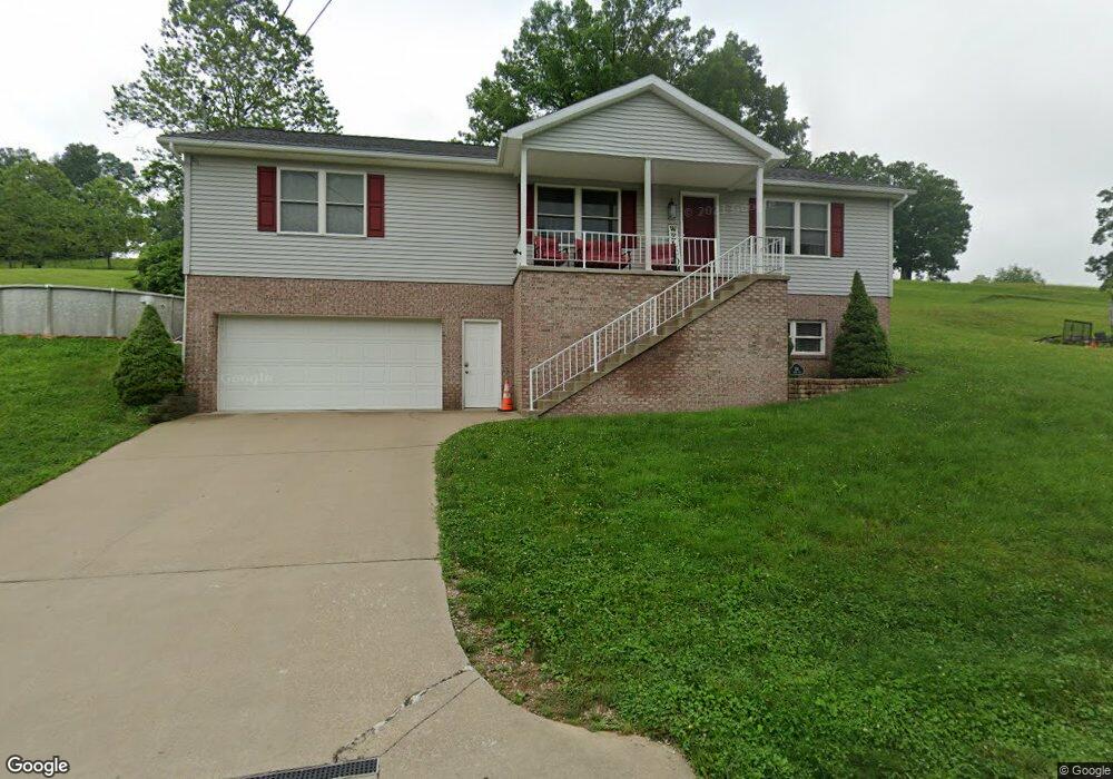
156 Robin Ln Mount Clare, WV 26408
Estimated Value: $222,000 - $333,000
3
Beds
2
Baths
1,540
Sq Ft
$188/Sq Ft
Est. Value
About This Home
This home is located at 156 Robin Ln, Mount Clare, WV 26408 and is currently estimated at $289,498, approximately $187 per square foot. 156 Robin Ln is a home.
Ownership History
Date
Name
Owned For
Owner Type
Purchase Details
Closed on
Dec 4, 2017
Sold by
L & J Developers Llc
Bought by
Perris Julie A
Current Estimated Value
Purchase Details
Closed on
Jun 20, 2013
Sold by
Glass Justin A and Glass Ashley N
Bought by
Perris Samuel J and Perris Julie A
Home Financials for this Owner
Home Financials are based on the most recent Mortgage that was taken out on this home.
Original Mortgage
$158,000
Interest Rate
4.45%
Mortgage Type
New Conventional
Purchase Details
Closed on
Feb 8, 2010
Sold by
Mackenzie Michele M and Mackenzie Philip J
Bought by
Glass Justin A and Glass Ashley N
Home Financials for this Owner
Home Financials are based on the most recent Mortgage that was taken out on this home.
Original Mortgage
$185,490
Interest Rate
5.25%
Mortgage Type
FHA
Create a Home Valuation Report for This Property
The Home Valuation Report is an in-depth analysis detailing your home's value as well as a comparison with similar homes in the area
Purchase History
| Date | Buyer | Sale Price | Title Company |
|---|---|---|---|
| Perris Julie A | $1,000 | -- | |
| Perris Samuel J | $208,000 | None Available | |
| Glass Justin A | $189,000 | None Available |
Source: Public Records
Mortgage History
| Date | Status | Borrower | Loan Amount |
|---|---|---|---|
| Previous Owner | Perris Samuel J | $158,000 | |
| Previous Owner | Glass Justin A | $185,490 |
Source: Public Records
Tax History
| Year | Tax Paid | Tax Assessment Tax Assessment Total Assessment is a certain percentage of the fair market value that is determined by local assessors to be the total taxable value of land and additions on the property. | Land | Improvement |
|---|---|---|---|---|
| 2025 | $1,677 | $143,940 | $36,900 | $107,040 |
| 2024 | $1,491 | $130,020 | $36,900 | $93,120 |
| 2023 | $1,491 | $122,340 | $36,900 | $85,440 |
| 2022 | $1,442 | $122,400 | $36,900 | $85,500 |
| 2021 | $1,412 | $121,260 | $36,900 | $84,360 |
| 2020 | $1,385 | $120,120 | $36,900 | $83,220 |
| 2019 | $1,381 | $119,700 | $36,900 | $82,800 |
| 2018 | $1,361 | $118,560 | $36,900 | $81,660 |
| 2017 | $1,338 | $117,000 | $36,900 | $80,100 |
| 2016 | $1,288 | $114,120 | $35,580 | $78,540 |
| 2015 | $1,224 | $107,820 | $31,980 | $75,840 |
| 2014 | $1,132 | $99,840 | $25,200 | $74,640 |
Source: Public Records
Map
Nearby Homes
Your Personal Tour Guide
Ask me questions while you tour the home.