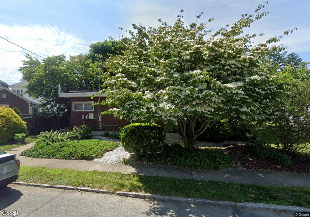
156 Ryan St New Bedford, MA 02740
Buttonwood Park NeighborhoodEstimated Value: $454,000 - $538,000
3
Beds
2
Baths
1,710
Sq Ft
$290/Sq Ft
Est. Value
About This Home
This home is located at 156 Ryan St, New Bedford, MA 02740 and is currently estimated at $495,181, approximately $289 per square foot. 156 Ryan St is a home located in Bristol County with nearby schools including Betsey B. Winslow Elementary School, Keith Middle School, and New Bedford High School.
Ownership History
Date
Name
Owned For
Owner Type
Purchase Details
Closed on
Aug 18, 2016
Sold by
237 Tremont Street Rt and Gilbarg
Bought by
Pollock Marlene
Current Estimated Value
Purchase Details
Closed on
Sep 14, 2007
Sold by
Gilbarg Daniel and Pollock Marlene
Bought by
237 Tremont St Rt and Gilbarg Daniel
Purchase Details
Closed on
May 28, 2003
Sold by
Gardner James E and Gardner Joanne
Bought by
Gilbarg Daniel and Pollock Marlene
Create a Home Valuation Report for This Property
The Home Valuation Report is an in-depth analysis detailing your home's value as well as a comparison with similar homes in the area
Home Values in the Area
Average Home Value in this Area
Purchase History
| Date | Buyer | Sale Price | Title Company |
|---|---|---|---|
| Pollock Marlene | -- | -- | |
| Pollock Marlene | -- | -- | |
| 237 Tremont St Rt | -- | -- | |
| 237 Tremont St Rt | -- | -- | |
| Gilbarg Daniel | $250,500 | -- | |
| Gilbarg Daniel | $250,500 | -- |
Source: Public Records
Mortgage History
| Date | Status | Borrower | Loan Amount |
|---|---|---|---|
| Previous Owner | Gilbarg Daniel | $80,000 | |
| Previous Owner | Gilbarg Daniel | $105,000 |
Source: Public Records
Tax History Compared to Growth
Tax History
| Year | Tax Paid | Tax Assessment Tax Assessment Total Assessment is a certain percentage of the fair market value that is determined by local assessors to be the total taxable value of land and additions on the property. | Land | Improvement |
|---|---|---|---|---|
| 2025 | $5,465 | $483,200 | $113,700 | $369,500 |
| 2024 | $5,342 | $445,200 | $108,400 | $336,800 |
| 2023 | $5,719 | $400,200 | $97,000 | $303,200 |
| 2022 | $5,333 | $343,200 | $92,400 | $250,800 |
| 2021 | $5,204 | $333,800 | $92,400 | $241,400 |
| 2020 | $5,056 | $312,900 | $95,900 | $217,000 |
| 2019 | $4,873 | $295,900 | $97,700 | $198,200 |
| 2018 | $7,564 | $265,700 | $97,700 | $168,000 |
| 2017 | $4,181 | $250,500 | $97,700 | $152,800 |
| 2016 | $3,751 | $227,500 | $92,400 | $135,100 |
| 2015 | $3,599 | $228,800 | $95,900 | $132,900 |
| 2014 | $3,513 | $231,700 | $97,700 | $134,000 |
Source: Public Records
Map
Nearby Homes
- 166 Ryan St
- 150 Ryan St
- 509 Bedford St
- 537 Rockdale Ave Unit 539
- 531 Rockdale Ave Unit 533
- 170 Ryan St
- 159 Ryan St
- 161 Ryan St
- 151 Ryan St
- 165 Ryan St
- 558 John St
- 527 Bedford St
- 171 Ryan St
- 523-525 Rockdale Ave
- 523 Rockdale Ave Unit 525
- 204 Carroll St
- 204 Carroll St Unit house
- 559 Rockdale Ave Unit 561
- 508 Bedford St Unit 510
- 512 Bedford St