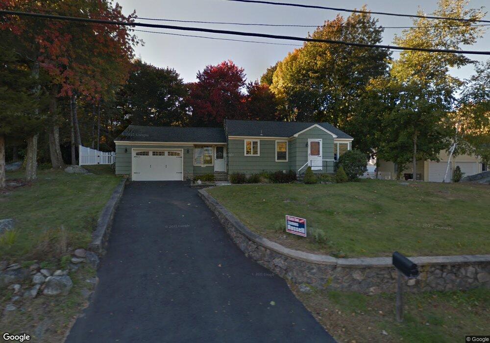
156 Union City Rd Naugatuck, CT 06770
Estimated Value: $307,768 - $348,000
2
Beds
1
Bath
1,043
Sq Ft
$312/Sq Ft
Est. Value
About This Home
This home is located at 156 Union City Rd, Naugatuck, CT 06770 and is currently estimated at $325,442, approximately $312 per square foot. 156 Union City Rd is a home located in New Haven County with nearby schools including City Hill Middle School and Naugatuck High School.
Ownership History
Date
Name
Owned For
Owner Type
Purchase Details
Closed on
Sep 8, 2023
Sold by
Sumner Holly E and Maglaris Monica A
Bought by
Maglaris Monica A
Current Estimated Value
Home Financials for this Owner
Home Financials are based on the most recent Mortgage that was taken out on this home.
Original Mortgage
$200,000
Outstanding Balance
$195,968
Interest Rate
7.23%
Mortgage Type
Stand Alone Refi Refinance Of Original Loan
Estimated Equity
$129,474
Purchase Details
Closed on
Nov 23, 2004
Sold by
Walters John F Est and Kiernan
Bought by
Sumner Holly E and Maglaris Monica A
Home Financials for this Owner
Home Financials are based on the most recent Mortgage that was taken out on this home.
Original Mortgage
$140,000
Interest Rate
5.8%
Mortgage Type
Purchase Money Mortgage
Create a Home Valuation Report for This Property
The Home Valuation Report is an in-depth analysis detailing your home's value as well as a comparison with similar homes in the area
Home Values in the Area
Average Home Value in this Area
Purchase History
| Date | Buyer | Sale Price | Title Company |
|---|---|---|---|
| Maglaris Monica A | -- | None Available | |
| Maglaris Monica A | -- | None Available | |
| Sumner Holly E | $175,000 | -- | |
| Sumner Holly E | $175,000 | -- |
Source: Public Records
Mortgage History
| Date | Status | Borrower | Loan Amount |
|---|---|---|---|
| Open | Maglaris Monica A | $200,000 | |
| Closed | Maglaris Monica A | $200,000 | |
| Previous Owner | Sumner Holly E | $153,100 | |
| Previous Owner | Sumner Holly E | $184,000 | |
| Previous Owner | Sumner Holly E | $140,000 |
Source: Public Records
Tax History Compared to Growth
Tax History
| Year | Tax Paid | Tax Assessment Tax Assessment Total Assessment is a certain percentage of the fair market value that is determined by local assessors to be the total taxable value of land and additions on the property. | Land | Improvement |
|---|---|---|---|---|
| 2025 | $5,624 | $141,330 | $37,380 | $103,950 |
| 2024 | $5,906 | $141,330 | $37,380 | $103,950 |
| 2023 | $6,325 | $141,330 | $37,380 | $103,950 |
| 2022 | $4,701 | $98,440 | $39,840 | $58,600 |
| 2021 | $4,701 | $98,440 | $39,840 | $58,600 |
| 2020 | $4,701 | $98,440 | $39,840 | $58,600 |
| 2019 | $4,651 | $98,440 | $39,840 | $58,600 |
| 2018 | $4,800 | $99,280 | $50,940 | $48,340 |
| 2017 | $4,820 | $99,280 | $50,940 | $48,340 |
| 2016 | $4,733 | $99,280 | $50,940 | $48,340 |
Source: Public Records
Map
Nearby Homes
- 29 Ramsey Ave
- 223 E Waterbury Rd
- 219 Union City Rd
- 333 Wooster St
- 92 Quentin St
- 20 Charlene Dr
- 38 Tyler Hill Rd
- 101 Adella St
- 142 Applewood Ln
- 21 Acushnet St
- 11 Shadee Ln
- 17 Meadowbrook Dr
- 465 N Main St
- 51 Brook St Unit 7A
- 51 Brook St Unit 6A
- 4 Florence Dr
- 317 City Hill St
- 212 Pearl Lake Rd
- 42 Clark Hill Rd
- 39 Alma St
- 146 Union City Rd
- 20 Gail Dr
- 164 Union City Rd
- 26 Ramsey Ave
- 20 Ramsey Ave
- 136 Union City Rd
- 32 Gail Dr
- 157 Union City Rd
- 149 Union City Rd
- 5 Tidmouth Ct
- 171 Union City Rd
- 36 Ramsey Ave
- 115 Union City Rd
- 3 Tidmouth Ct
- Lot 3 Tidmouth Ct
- 3 Tidmouth Ct
- 184 Union City Rd
- 4 Tidmouth Ct
- 1 Gail Dr
- 0 Tidmouth Ct Unit W10044965