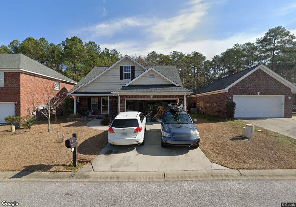
156 War Admiral Dr West Columbia, SC 29170
Estimated Value: $268,000 - $286,000
3
Beds
3
Baths
1,956
Sq Ft
$142/Sq Ft
Est. Value
About This Home
This home is located at 156 War Admiral Dr, West Columbia, SC 29170 and is currently estimated at $277,643, approximately $141 per square foot. 156 War Admiral Dr is a home located in Lexington County with nearby schools including Riverbank Elementary, Northside Middle, and Brookland-Cayce High School.
Ownership History
Date
Name
Owned For
Owner Type
Purchase Details
Closed on
Nov 1, 2022
Sold by
Davis Mary J
Bought by
Humphries Amy S and Humphries David G
Current Estimated Value
Purchase Details
Closed on
Mar 25, 2016
Sold by
Ward Kari T and Taylor Kari E
Bought by
Ward Kari T and Ward Dale C
Home Financials for this Owner
Home Financials are based on the most recent Mortgage that was taken out on this home.
Original Mortgage
$150,100
Interest Rate
3.68%
Mortgage Type
New Conventional
Purchase Details
Closed on
Jan 26, 2007
Sold by
Hurricane Construction Inc
Bought by
Taylor Kari E and Ward Dale C
Home Financials for this Owner
Home Financials are based on the most recent Mortgage that was taken out on this home.
Original Mortgage
$174,900
Interest Rate
6.08%
Mortgage Type
Purchase Money Mortgage
Create a Home Valuation Report for This Property
The Home Valuation Report is an in-depth analysis detailing your home's value as well as a comparison with similar homes in the area
Home Values in the Area
Average Home Value in this Area
Purchase History
| Date | Buyer | Sale Price | Title Company |
|---|---|---|---|
| Humphries Amy S | -- | -- | |
| Humphries Amy S | -- | None Listed On Document | |
| Ward Kari T | -- | None Available | |
| Taylor Kari E | $174,900 | None Available |
Source: Public Records
Mortgage History
| Date | Status | Borrower | Loan Amount |
|---|---|---|---|
| Previous Owner | Ward Kari T | $150,100 | |
| Previous Owner | Taylor Kari E | $174,900 |
Source: Public Records
Tax History Compared to Growth
Tax History
| Year | Tax Paid | Tax Assessment Tax Assessment Total Assessment is a certain percentage of the fair market value that is determined by local assessors to be the total taxable value of land and additions on the property. | Land | Improvement |
|---|---|---|---|---|
| 2024 | $638 | $7,338 | $1,600 | $5,738 |
| 2023 | $638 | $7,338 | $1,600 | $5,738 |
| 2022 | $649 | $7,338 | $1,600 | $5,738 |
| 2020 | $643 | $7,338 | $1,600 | $5,738 |
| 2019 | $656 | $7,320 | $1,200 | $6,120 |
| 2018 | $671 | $7,320 | $1,200 | $6,120 |
| 2017 | $3,357 | $10,980 | $1,800 | $9,180 |
| 2016 | $1,057 | $7,320 | $1,200 | $6,120 |
| 2014 | $726 | $7,358 | $1,280 | $6,078 |
| 2013 | -- | $7,360 | $1,280 | $6,080 |
Source: Public Records
Map
Nearby Homes
- 179 War Admiral Dr
- 713 Winged Seed Rd
- 438 Pinaster Path
- 437 Pinaster Path
- 420 Pinaster Path
- 405 Pinaster Path
- 401 Pinaster Path
- 353 Pinaster Path
- 382 Pinaster Path
- 364 Pinaster Path
- 348 Pinaster Path
- Lot 83 337 Pinaster Path
- 913 Harper Rose Ct
- Monroe Plan at Pinecrest
- Monroe II Plan at Pinecrest
- Anderson Plan at Pinecrest
- Magnolia Plan at Pinecrest
- Taylor II Plan at Pinecrest
- Camelia Plan at Pinecrest
- Cypress Plan at Pinecrest
- 152 War Admiral Dr
- 148 War Admiral Dr
- 151 War Admiral Dr
- 164 War Admiral Dr
- 147 War Admiral Dr
- 168 War Admiral Dr
- 144 War Admiral Dr
- 201 Derby Dr
- 140 War Admiral Dr
- 172 War Admiral Dr
- 143 War Admiral Dr
- 136 War Admiral Dr
- 181 War Admiral Dr
- 181 War Admiral Dr Unit 2
- 199 Derby Dr
- 139 War Admiral Dr
- 178 War Admiral Dr
- 200 Derby Dr
- 183 War Admiral Dr
- 180 War Admiral Dr