Estimated Value: $309,000 - $352,000
3
Beds
2
Baths
1,499
Sq Ft
$215/Sq Ft
Est. Value
About This Home
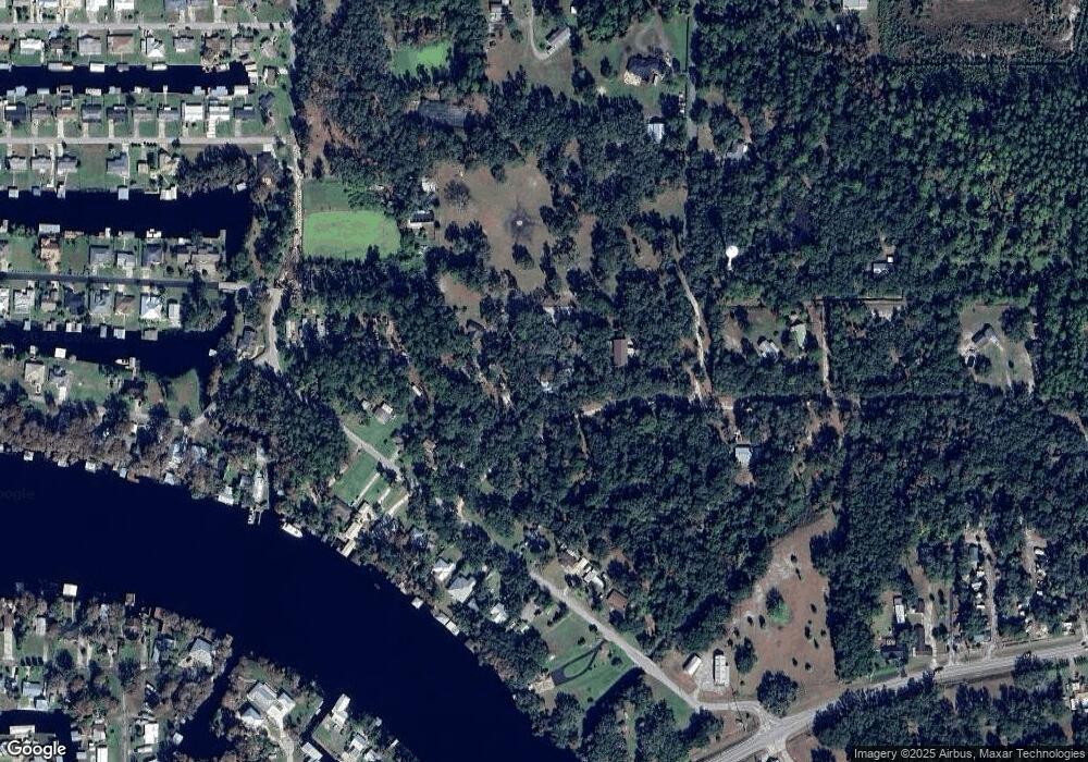
This home is located at 1560 Dillard Rd, Astor, FL 32102 and is currently estimated at $322,941, approximately $215 per square foot. 1560 Dillard Rd is a home located in Volusia County with nearby schools including Pierson Elementary School and T. Dewitt Taylor Middle/High School.
Ownership History
Date
Name
Owned For
Owner Type
Purchase Details
Closed on
Mar 29, 2011
Sold by
Chandler Terrie E and Mehlin Terrie E
Bought by
Mehlin Donald E and Mehlin Sarah I
Current Estimated Value
Home Financials for this Owner
Home Financials are based on the most recent Mortgage that was taken out on this home.
Original Mortgage
$85,000
Outstanding Balance
$57,930
Interest Rate
4.85%
Mortgage Type
Seller Take Back
Estimated Equity
$265,011
Purchase Details
Closed on
Nov 15, 1987
Bought by
Mehlin Donald E and Mehlin Sarah I
Purchase Details
Closed on
Mar 15, 1983
Bought by
Mehlin Donald E and Mehlin Sarah I
Purchase Details
Closed on
May 15, 1981
Bought by
Mehlin Donald E and Mehlin Sarah I
Purchase Details
Closed on
Sep 15, 1978
Bought by
Mehlin Donald E and Mehlin Sarah I
Purchase Details
Closed on
Nov 15, 1977
Bought by
Mehlin Donald E and Mehlin Sarah I
Create a Home Valuation Report for This Property
The Home Valuation Report is an in-depth analysis detailing your home's value as well as a comparison with similar homes in the area
Home Values in the Area
Average Home Value in this Area
Purchase History
| Date | Buyer | Sale Price | Title Company |
|---|---|---|---|
| Mehlin Donald E | $85,000 | Attorney | |
| Mehlin Donald E | $20,500 | -- | |
| Mehlin Donald E | $12,000 | -- | |
| Mehlin Donald E | $10,000 | -- | |
| Mehlin Donald E | $7,500 | -- | |
| Mehlin Donald E | $5,500 | -- |
Source: Public Records
Mortgage History
| Date | Status | Borrower | Loan Amount |
|---|---|---|---|
| Open | Mehlin Donald E | $85,000 |
Source: Public Records
Tax History
| Year | Tax Paid | Tax Assessment Tax Assessment Total Assessment is a certain percentage of the fair market value that is determined by local assessors to be the total taxable value of land and additions on the property. | Land | Improvement |
|---|---|---|---|---|
| 2026 | $1,886 | $128,868 | -- | -- |
| 2025 | $1,886 | $128,868 | -- | -- |
| 2024 | $1,767 | $125,237 | -- | -- |
| 2023 | $1,767 | $121,590 | $0 | $0 |
| 2022 | $1,711 | $118,049 | $0 | $0 |
| 2021 | $1,752 | $114,611 | $0 | $0 |
| 2020 | $1,721 | $113,029 | $0 | $0 |
| 2019 | $1,757 | $110,488 | $0 | $0 |
| 2018 | $1,736 | $108,428 | $0 | $0 |
| 2017 | $1,713 | $106,198 | $0 | $0 |
| 2016 | $1,629 | $104,014 | $0 | $0 |
| 2015 | $1,657 | $103,291 | $0 | $0 |
| 2014 | $1,639 | $102,471 | $0 | $0 |
Source: Public Records
Map
Nearby Homes
- 1905 Alice Dr Unit 4
- 1620 River Rd
- 1610 Juno Trail
- 1501 Dillard Rd
- 1617 Paradise Ln
- 55744 Holiday Cir
- 1621 Spring Garden Dr
- 55730 Holiday Cir
- 1628 Paradise Ln
- 1511 Riveredge Ct
- 1636 Juno Trail
- 1640 Juno Trail Unit 204C
- 1640 Juno Trail Unit 101
- 1640 Juno Trail Unit 103
- 1640 Juno Trail Unit 202
- 1640 Juno Trail Unit 102A
- 1640 Juno Trail Unit 205
- 55746 Carroll St
- 55512 Front St
- 55805 Carrol St
Your Personal Tour Guide
Ask me questions while you tour the home.
