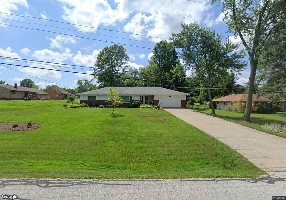
15602 Sunset Dr Strongsville, OH 44136
Estimated Value: $324,000 - $439,000
4
Beds
3
Baths
2,856
Sq Ft
$136/Sq Ft
Est. Value
About This Home
This home is located at 15602 Sunset Dr, Strongsville, OH 44136 and is currently estimated at $388,915, approximately $136 per square foot. 15602 Sunset Dr is a home located in Cuyahoga County with nearby schools including Strongsville High School and Sts Joseph & John Interparochial School.
Ownership History
Date
Name
Owned For
Owner Type
Purchase Details
Closed on
Oct 31, 1995
Sold by
Miketo Joseph E
Bought by
Juguilon Alejandro and Juguilon Eleanore J
Current Estimated Value
Home Financials for this Owner
Home Financials are based on the most recent Mortgage that was taken out on this home.
Original Mortgage
$208,565
Outstanding Balance
$2,615
Interest Rate
6.5%
Mortgage Type
New Conventional
Estimated Equity
$386,300
Purchase Details
Closed on
Apr 24, 1987
Sold by
Cochran Roy L and Cochran Davine Y
Bought by
Miketo Joseph E
Purchase Details
Closed on
Aug 3, 1982
Sold by
Cochran Roy T
Bought by
Cochran Roy L and Cochran Davine Y
Purchase Details
Closed on
Jun 15, 1982
Sold by
Marcis T Richard
Bought by
Cochran Roy T
Purchase Details
Closed on
Feb 17, 1977
Sold by
Marcis Marcis T T and Marcis E
Bought by
Marcis T Richard
Purchase Details
Closed on
Jan 1, 1975
Bought by
Marcis Marcis T and Marcis E
Create a Home Valuation Report for This Property
The Home Valuation Report is an in-depth analysis detailing your home's value as well as a comparison with similar homes in the area
Home Values in the Area
Average Home Value in this Area
Purchase History
| Date | Buyer | Sale Price | Title Company |
|---|---|---|---|
| Juguilon Alejandro | $158,900 | -- | |
| Miketo Joseph E | $92,000 | -- | |
| Cochran Roy L | -- | -- | |
| Cochran Roy T | $78,000 | -- | |
| Marcis T Richard | -- | -- | |
| Marcis Marcis T | -- | -- |
Source: Public Records
Mortgage History
| Date | Status | Borrower | Loan Amount |
|---|---|---|---|
| Open | Juguilon Alejandro | $208,565 |
Source: Public Records
Tax History Compared to Growth
Tax History
| Year | Tax Paid | Tax Assessment Tax Assessment Total Assessment is a certain percentage of the fair market value that is determined by local assessors to be the total taxable value of land and additions on the property. | Land | Improvement |
|---|---|---|---|---|
| 2024 | $4,680 | $109,480 | $26,110 | $83,370 |
| 2023 | $4,125 | $75,050 | $15,090 | $59,960 |
| 2022 | $4,121 | $75,040 | $15,090 | $59,960 |
| 2021 | $4,089 | $75,040 | $15,090 | $59,960 |
| 2020 | $3,980 | $65,840 | $13,230 | $52,610 |
| 2019 | $3,863 | $188,100 | $37,800 | $150,300 |
| 2018 | $3,500 | $65,840 | $13,230 | $52,610 |
| 2017 | $3,560 | $62,410 | $10,850 | $51,560 |
| 2016 | $3,531 | $62,410 | $10,850 | $51,560 |
| 2015 | $3,581 | $62,410 | $10,850 | $51,560 |
| 2014 | $3,581 | $62,410 | $10,850 | $51,560 |
Source: Public Records
Map
Nearby Homes
- 15639 Indianhead Ln
- 17069 Partridge Dr
- 14826 Lenox Dr
- 14703 Lenox Dr Unit 103
- 16650 Lanier Ave
- 16450 Howe Rd
- 18162 Fawn Cir
- 18630 Shurmer Rd
- 17159 Turkey Meadow Ln
- 17024 Bear Creek Ln
- 13513 Suncrest Ct
- 17682 Drake Rd
- 17289 Akita Ct Unit 4508
- 0 Mill Hollow Ln Unit 5069608
- 18294 Drake Rd
- 16486 S Red Rock Dr
- 19311 Bradford Ct
- 19160 Wheelers Ln
- 17130 Golden Star Dr
- 19513 Lunn Rd
- 15556 Sunset Dr
- 17094 Shurmer Rd
- 17140 Shurmer Rd
- 17052 Shurmer Rd
- 15510 Sunset Dr
- 15561 Sunset Dr
- 15607 Sunset Dr
- 17220 Shurmer Rd
- 17000 Shurmer Rd
- 15519 Sunset Dr
- 15466 Sunset Dr
- 17228 Shurmer Rd
- 15471 Sunset Dr
- 16954 Shurmer Rd
- 17141 Shurmer Rd
- 17310 Shurmer Rd
- 17091 Shurmer Rd
- 15420 Sunset Dr
- 17053 Shurmer Rd
- 17221 Shurmer Rd