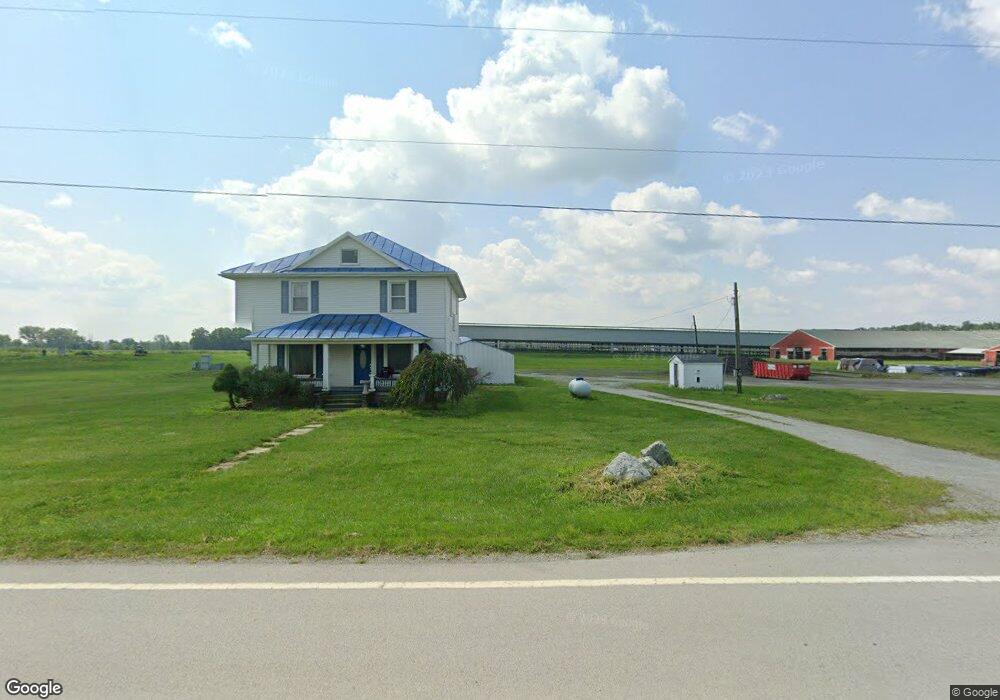
15603 State Route 67 Forest, OH 45843
Estimated Value: $168,000 - $1,370,000
4
Beds
2
Baths
2,048
Sq Ft
$460/Sq Ft
Est. Value
About This Home
This home is located at 15603 State Route 67, Forest, OH 45843 and is currently estimated at $942,856, approximately $460 per square foot. 15603 State Route 67 is a home located in Wyandot County with nearby schools including Upper Sandusky High School.
Ownership History
Date
Name
Owned For
Owner Type
Purchase Details
Closed on
Mar 10, 2017
Sold by
Silver Creek Dairy Llc
Bought by
Leif Dairy 1 Llc
Current Estimated Value
Purchase Details
Closed on
Sep 19, 2011
Sold by
Hoover Raymond S and Hoover Wilma D
Bought by
Silver Creek Dairy Llc
Purchase Details
Closed on
Dec 23, 2010
Sold by
Skutch Steve
Bought by
Hoover Raymond S and Hoover Wilma D
Create a Home Valuation Report for This Property
The Home Valuation Report is an in-depth analysis detailing your home's value as well as a comparison with similar homes in the area
Home Values in the Area
Average Home Value in this Area
Purchase History
| Date | Buyer | Sale Price | Title Company |
|---|---|---|---|
| Leif Dairy 1 Llc | $650,000 | None Available | |
| Silver Creek Dairy Llc | $799,000 | None Available | |
| Hoover Raymond S | $847,500 | None Available |
Source: Public Records
Tax History Compared to Growth
Tax History
| Year | Tax Paid | Tax Assessment Tax Assessment Total Assessment is a certain percentage of the fair market value that is determined by local assessors to be the total taxable value of land and additions on the property. | Land | Improvement |
|---|---|---|---|---|
| 2025 | $16,073 | $186,860 | $119,680 | $67,180 |
| 2024 | $16,073 | $550,340 | $97,900 | $452,440 |
| 2023 | $16,070 | $489,940 | $37,500 | $452,440 |
| 2022 | $16,066 | $170,340 | $33,440 | $136,900 |
| 2021 | $5,860 | $170,340 | $33,440 | $136,900 |
| 2020 | $5,858 | $170,340 | $33,440 | $136,900 |
| 2019 | $5,845 | $170,340 | $33,440 | $136,900 |
| 2018 | $5,900 | $175,490 | $47,110 | $128,380 |
| 2017 | $5,905 | $174,220 | $47,110 | $127,110 |
| 2016 | -- | $174,220 | $47,110 | $127,110 |
| 2015 | -- | $168,760 | $41,650 | $127,110 |
| 2014 | -- | $168,760 | $41,650 | $127,110 |
| 2013 | -- | $168,760 | $41,650 | $127,110 |
Source: Public Records
Map
Nearby Homes
- 18205 County Highway 96
- 23385 Township Road 126
- 0 Ohio 309
- 16190 Township Highway 97
- 3132 Decliff Rd N
- 3096 Decliff Rd N
- 0 Osbun Rd Unit Lot 27 225032274
- 00 Osbun Rd Unit Lot 6
- 15418 Ohio 37
- 21485 Elevator St
- 18322 State Route 67
- 0 Cr 215 Unit 11594771
- 0 Cr 215 Unit 11594600
- 0 Cr 215 Unit 25370311
- 0 Cr 215 Unit 11598074
- 3065 County Road 205
- 265 River St
- 8147 Ohio 294
- 61 N Marsh St
- 0 Dry Lane Rd N Unit 225022570
- 15603 S H 67
- 15603 Ohio 67
- 15886 State Route 67
- 20710 County Highway 142
- 20748 County Highway 142
- 20826 County Highway 142
- 15315 State Route 67
- 15315 S H 67
- 20567 Co Hwy
- 20918 County Highway 142
- 15231 State Route 67
- 20567 County Highway 142
- 10510 County Highway 22
- 16262 State Route 67
- 24070 County Road 100
- 20438 State Highway 67
- 19998 State Highway 37
- 20282 State Hwy
- 20100 State Highway 37
- 19925 Ohio 67