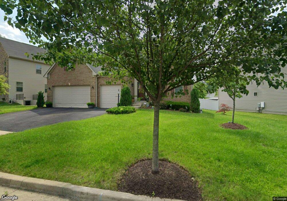
15604 Norus St Upper Marlboro, MD 20772
Estimated Value: $748,032 - $915,000
--
Bed
3
Baths
3,088
Sq Ft
$262/Sq Ft
Est. Value
About This Home
This home is located at 15604 Norus St, Upper Marlboro, MD 20772 and is currently estimated at $810,508, approximately $262 per square foot. 15604 Norus St is a home located in Prince George's County with nearby schools including Patuxent Elementary School, James Madison Middle School, and Dr. Henry A. Wise Jr. High School.
Ownership History
Date
Name
Owned For
Owner Type
Purchase Details
Closed on
Dec 28, 2017
Sold by
Nvr Inc
Bought by
Mcphatter Lee P and Mcphatter Annie R
Current Estimated Value
Home Financials for this Owner
Home Financials are based on the most recent Mortgage that was taken out on this home.
Original Mortgage
$504,455
Outstanding Balance
$424,487
Interest Rate
3.92%
Mortgage Type
VA
Estimated Equity
$386,021
Purchase Details
Closed on
Sep 7, 2017
Sold by
M I Homes Of Dc
Bought by
Nvr Inc
Create a Home Valuation Report for This Property
The Home Valuation Report is an in-depth analysis detailing your home's value as well as a comparison with similar homes in the area
Home Values in the Area
Average Home Value in this Area
Purchase History
| Date | Buyer | Sale Price | Title Company |
|---|---|---|---|
| Mcphatter Lee P | $523,300 | None Available | |
| Nvr Inc | $145,000 | None Available |
Source: Public Records
Mortgage History
| Date | Status | Borrower | Loan Amount |
|---|---|---|---|
| Open | Mcphatter Lee P | $504,455 |
Source: Public Records
Tax History Compared to Growth
Tax History
| Year | Tax Paid | Tax Assessment Tax Assessment Total Assessment is a certain percentage of the fair market value that is determined by local assessors to be the total taxable value of land and additions on the property. | Land | Improvement |
|---|---|---|---|---|
| 2025 | $8,488 | $606,400 | $185,800 | $420,600 |
| 2024 | $8,488 | $574,900 | $0 | $0 |
| 2023 | $8,185 | $543,400 | $0 | $0 |
| 2022 | $7,790 | $511,900 | $155,800 | $356,100 |
| 2021 | $7,697 | $506,067 | $0 | $0 |
| 2020 | $7,621 | $500,233 | $0 | $0 |
| 2019 | $7,537 | $494,400 | $100,400 | $394,000 |
| 2018 | $7,480 | $490,433 | $0 | $0 |
| 2017 | $420 | $26,200 | $0 | $0 |
| 2016 | -- | $26,200 | $0 | $0 |
| 2015 | $365 | $26,200 | $0 | $0 |
| 2014 | $365 | $26,200 | $0 | $0 |
Source: Public Records
Map
Nearby Homes
- 15701 Norus St
- 15700 Grand St
- 15318 Governors Park Ln
- 3807 Pentland Hills Dr
- 15407 Governors Park Ln
- 3823 Effie Fox Way
- 15411 Governors Park Ln
- 3902 Presidential Golf Dr
- 16115 Brookmead Ct
- 16201 Brookmead Ct
- 15308 Littleton Place
- 15606 Beech Tree Pkwy
- 15312 Sir Edwards Dr
- 15608 Bibury Alley
- 3604 Halloway N
- 3002 Presidential Golf Dr
- 15503 Humberside Way
- 16504 Village Dr W
- 2704 Beech Orchard Ln
- 15200 Peerless Ave
- 15604 Norus St
- 15608 Norus St
- 3609 Chancelsors Dr
- 3611 Chancelsors Dr
- 15612 Norus St
- 15600 Norus St Unit H-001
- 15600 Norus St
- 15603 Norus St
- 15605 Norus St
- 3613 Chancelsors Dr
- 15601 Norus St
- 15607 Norus St
- 15609 Norus St
- 3608 Chancelsors Dr
- 15704 Norus St
- 15706 Norus St
- 3610 Chancelsors Dr
- 15611 Norus St
- 3606 Chancelsors Dr
- 3615 Chancelsors Dr