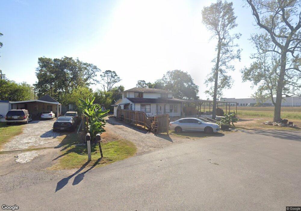
15606 Losa Dr Houston, TX 77032
Greenspoint NeighborhoodEstimated Value: $157,000 - $199,000
4
Beds
1
Bath
1,672
Sq Ft
$104/Sq Ft
Est. Value
About This Home
This home is located at 15606 Losa Dr, Houston, TX 77032 and is currently estimated at $173,067, approximately $103 per square foot. 15606 Losa Dr is a home located in Harris County with nearby schools including Calvert Elementary School, Nimitz Ninth Grade School, and Teague Middle School.
Ownership History
Date
Name
Owned For
Owner Type
Purchase Details
Closed on
Aug 30, 2005
Sold by
First Capital Interests Llc
Bought by
Rodriguez Benito and Bautista Janine
Current Estimated Value
Home Financials for this Owner
Home Financials are based on the most recent Mortgage that was taken out on this home.
Original Mortgage
$62,500
Interest Rate
5.73%
Mortgage Type
Fannie Mae Freddie Mac
Create a Home Valuation Report for This Property
The Home Valuation Report is an in-depth analysis detailing your home's value as well as a comparison with similar homes in the area
Home Values in the Area
Average Home Value in this Area
Purchase History
| Date | Buyer | Sale Price | Title Company |
|---|---|---|---|
| Rodriguez Benito | -- | -- |
Source: Public Records
Mortgage History
| Date | Status | Borrower | Loan Amount |
|---|---|---|---|
| Closed | Rodriguez Benito | $62,500 |
Source: Public Records
Tax History Compared to Growth
Tax History
| Year | Tax Paid | Tax Assessment Tax Assessment Total Assessment is a certain percentage of the fair market value that is determined by local assessors to be the total taxable value of land and additions on the property. | Land | Improvement |
|---|---|---|---|---|
| 2025 | $2,433 | $137,364 | $45,839 | $91,525 |
| 2024 | $2,433 | $125,921 | $38,520 | $87,401 |
| 2023 | $2,433 | $107,188 | $38,520 | $68,668 |
| 2022 | $1,700 | $82,930 | $38,520 | $44,410 |
| 2021 | $1,502 | $69,738 | $23,112 | $46,626 |
| 2020 | $1,584 | $69,738 | $23,112 | $46,626 |
| 2019 | $1,659 | $69,738 | $23,112 | $46,626 |
| 2018 | $1,001 | $69,738 | $23,112 | $46,626 |
| 2017 | $1,581 | $69,738 | $23,112 | $46,626 |
| 2016 | $1,425 | $62,871 | $11,556 | $51,315 |
| 2015 | $1,400 | $62,871 | $11,556 | $51,315 |
| 2014 | $1,400 | $62,871 | $11,556 | $51,315 |
Source: Public Records
Map
Nearby Homes
- 15607 Dowlwood Dr
- 1042 Tunell Ln
- 810 Benmar Dr
- 1403 Old Greens Rd
- 1114 Blackwood Ave
- 0 W Hardy Rd Unit 90623815
- 1159 Aldine Meadows Rd
- 14811 W Hardy Rd
- 15607 Weldon Dr
- 2112 Greenbriar Colony Dr
- 15611 Martineau St
- 2115 Whittier Dr
- 2120 Greenbriar Colony Dr
- 2106 Shiveley Cir
- 2129 Whittier Dr
- 2142 Greenbriar Colony Dr
- 15522 Blake Way St
- 17202 Imperial Valley Dr Unit 34
- 17202 Imperial Valley Dr Unit 28
- 17202 Imperial Valley Dr Unit 3
- 15611 Dowlwood Dr
- 15615 Losa Dr
- 15610 Dowlwood Dr
- 951 Salter Dr
- 959 Salter Dr
- 15614 Ledla Ln
- 15602 Dowlwood Dr
- 935 Salter Dr
- 1003 Salter Dr
- 1011 Salter Dr
- 950 Benmar Dr
- 942 Benmar Dr
- 15607 Alenzo Dr
- 938 Benmar Dr
- 1002 Benmar Dr
- 923 Salter Dr
- 1010 Benmar Dr
- 924 Benmar Dr
- 1016 Benmar Dr
- 1018 Benmar Dr