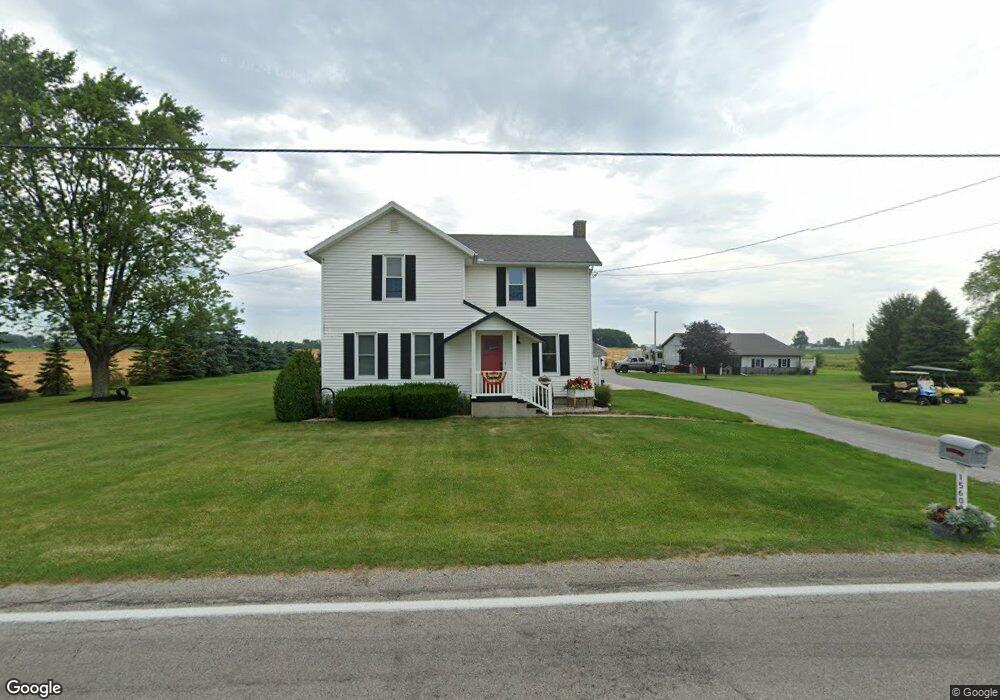
15608 State Route 2 Wauseon, OH 43567
Estimated Value: $320,000 - $380,000
4
Beds
1
Bath
2,113
Sq Ft
$165/Sq Ft
Est. Value
About This Home
This home is located at 15608 State Route 2, Wauseon, OH 43567 and is currently estimated at $348,689, approximately $165 per square foot. 15608 State Route 2 is a home located in Fulton County with nearby schools including Wauseon Primary School, Wauseon Elementary School, and Wauseon Middle School.
Ownership History
Date
Name
Owned For
Owner Type
Purchase Details
Closed on
Sep 19, 1995
Sold by
Tedrow Hal F
Bought by
Shehorn Ronald and Shehorn Julie
Current Estimated Value
Home Financials for this Owner
Home Financials are based on the most recent Mortgage that was taken out on this home.
Original Mortgage
$30,000
Interest Rate
7.81%
Mortgage Type
New Conventional
Create a Home Valuation Report for This Property
The Home Valuation Report is an in-depth analysis detailing your home's value as well as a comparison with similar homes in the area
Home Values in the Area
Average Home Value in this Area
Purchase History
| Date | Buyer | Sale Price | Title Company |
|---|---|---|---|
| Shehorn Ronald | $92,000 | -- |
Source: Public Records
Mortgage History
| Date | Status | Borrower | Loan Amount |
|---|---|---|---|
| Closed | Shehorn Ronald | $30,000 |
Source: Public Records
Tax History Compared to Growth
Tax History
| Year | Tax Paid | Tax Assessment Tax Assessment Total Assessment is a certain percentage of the fair market value that is determined by local assessors to be the total taxable value of land and additions on the property. | Land | Improvement |
|---|---|---|---|---|
| 2024 | $5,309 | $109,590 | $19,670 | $89,920 |
| 2023 | $5,310 | $109,590 | $19,670 | $89,920 |
| 2022 | $4,905 | $86,310 | $16,380 | $69,930 |
| 2021 | $5,158 | $86,310 | $16,380 | $69,930 |
| 2020 | $4,810 | $86,310 | $16,380 | $69,930 |
| 2019 | $4,363 | $78,020 | $13,860 | $64,160 |
| 2018 | $3,824 | $78,020 | $13,860 | $64,160 |
| 2017 | $3,767 | $78,020 | $13,860 | $64,160 |
| 2016 | $3,676 | $68,150 | $13,860 | $54,290 |
| 2015 | $3,444 | $68,150 | $13,860 | $54,290 |
| 2014 | $3,434 | $68,150 | $13,860 | $54,290 |
| 2013 | $3,276 | $59,930 | $11,380 | $48,550 |
Source: Public Records
Map
Nearby Homes
- 744 Fairway Dr
- 604 W Leggett St
- 448 Dwight Ave
- 749 Parkside Dr
- 420 Clover Ln
- 208 N Brunell St
- 263 W Chestnut St
- 234 W Chestnut St
- 227 Wabash St
- 115 W Leggett St
- 115 W Superior St
- 16020 County Road D
- 125 Cherry St
- 15819 County Road D
- 236 Birch St
- 218 Cherry St
- 17020 State Route 2
- 351 E Walnut St
- 1235 N Ottokee St
- 1270 S Park Ln
- 15639 State Route 2
- 15554 State Route 2
- 15601 State Route 2
- 15551 State Route 2
- 15521 State Route 2
- 15508 State Route 2
- 15508 State Highway 2
- 15508 State Route 2
- 15724 State Route 2
- 15457 State Route 2
- 15723 State Route 2
- 0 Co Rd E Lot 5 Unit 4639830
- 0 Co Rd B Unit 4642070
- 0 Co Rd B Unit 4650986
- 0 Us20a Unit 4657014
- 0 Co Rd H - Dover Glenn Unit 4659489
- 0 Co Rd H - Dover Glenn Unit 4663033
- Airpor Airport Hwy
- 0 Us20a Unit 5030172
- 0 Co Rd 18 North Parcel Unit 4635749