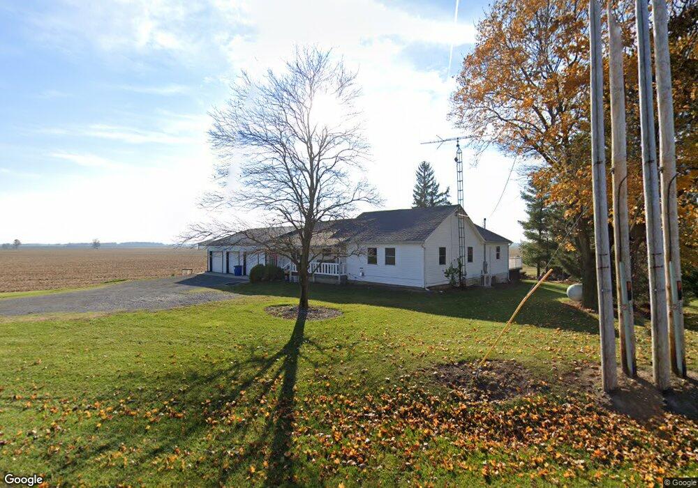
15609 State Route 117 Waynesfield, OH 45896
Estimated Value: $238,690 - $321,000
2
Beds
1
Bath
1,456
Sq Ft
$198/Sq Ft
Est. Value
About This Home
This home is located at 15609 State Route 117, Waynesfield, OH 45896 and is currently estimated at $287,673, approximately $197 per square foot. 15609 State Route 117 is a home located in Hardin County with nearby schools including Upper Scioto Valley Elementary School, Upper Scioto Valley Middle School, and Upper Scioto Valley High School.
Ownership History
Date
Name
Owned For
Owner Type
Purchase Details
Closed on
Feb 1, 2024
Sold by
Harless Brenda Jo and Harless Brad
Bought by
Satterly Tylor
Current Estimated Value
Home Financials for this Owner
Home Financials are based on the most recent Mortgage that was taken out on this home.
Original Mortgage
$304,900
Outstanding Balance
$299,512
Interest Rate
6.61%
Mortgage Type
VA
Estimated Equity
-$11,839
Purchase Details
Closed on
Jul 9, 2021
Sold by
Crossmon Melinda Sue and Gallimore Charlotte Kay
Bought by
Harless Brenda Jo and Harless Bradley A
Home Financials for this Owner
Home Financials are based on the most recent Mortgage that was taken out on this home.
Original Mortgage
$42,169
Interest Rate
4.8%
Mortgage Type
Land Contract Argmt. Of Sale
Purchase Details
Closed on
Jul 1, 2021
Sold by
Crossmon Melinda Sue and Crossman Melinda Sue
Bought by
Gallimore Charlotte Kay
Home Financials for this Owner
Home Financials are based on the most recent Mortgage that was taken out on this home.
Original Mortgage
$42,169
Interest Rate
4.8%
Mortgage Type
Land Contract Argmt. Of Sale
Purchase Details
Closed on
Jul 18, 2003
Bought by
Crossman Melinda Sue Eta
Create a Home Valuation Report for This Property
The Home Valuation Report is an in-depth analysis detailing your home's value as well as a comparison with similar homes in the area
Home Values in the Area
Average Home Value in this Area
Purchase History
| Date | Buyer | Sale Price | Title Company |
|---|---|---|---|
| Satterly Tylor | $304,900 | Northwest Title | |
| Harless Brenda Jo | -- | None Available | |
| Gallimore Charlotte Kay | $47,169 | None Available | |
| Crossman Melinda Sue Eta | -- | -- |
Source: Public Records
Mortgage History
| Date | Status | Borrower | Loan Amount |
|---|---|---|---|
| Open | Satterly Tylor | $304,900 | |
| Previous Owner | Gallimore Charlotte Kay | $42,169 | |
| Closed | Harless Brenda Jo | $0 |
Source: Public Records
Tax History Compared to Growth
Tax History
| Year | Tax Paid | Tax Assessment Tax Assessment Total Assessment is a certain percentage of the fair market value that is determined by local assessors to be the total taxable value of land and additions on the property. | Land | Improvement |
|---|---|---|---|---|
| 2024 | $2,242 | $60,470 | $5,690 | $54,780 |
| 2023 | $2,242 | $60,470 | $5,690 | $54,780 |
| 2022 | $1,700 | $40,350 | $4,670 | $35,680 |
| 2021 | $1,792 | $40,350 | $4,670 | $35,680 |
| 2020 | $1,816 | $40,350 | $4,670 | $35,680 |
| 2019 | $1,097 | $35,550 | $4,460 | $31,090 |
| 2018 | $1,102 | $35,550 | $4,460 | $31,090 |
| 2017 | $352 | $35,550 | $4,460 | $31,090 |
| 2016 | $726 | $28,350 | $3,940 | $24,410 |
| 2015 | $1,001 | $28,350 | $3,940 | $24,410 |
| 2014 | $41 | $28,350 | $3,940 | $24,410 |
| 2013 | $139 | $29,460 | $3,940 | $25,520 |
Source: Public Records
Map
Nearby Homes
- 0 Ohio 235
- 2444 County Road 200
- 14918 Township Road 55
- 16161 Ash Ave
- 15527 State Route 235
- 16235 Maple Ave
- 16074 Buckeye Ave
- 11298 Northlake Dr
- 13793 Ohio 235 Unit 75
- 11262 Northlake Dr
- 11377 Township Road 266 Unit 99
- 11377 Township Road 266 Unit 34
- 11377 Township Road 266 Unit 28
- 11377 Township Road 266 Unit 109
- 11377 Township Rd 266 Unit 66
- 11377 Township Rd 266 Unit 30
- 11377 Township Rd 266 Unit 59
- 15858 Hickory Ave
- 9151 Gross Dr
- 15848 Barnes Dr
- 15609 Ohio 117
- 15643 Township Road 25
- 15476 Township Road 25
- 15135 Township Road 25
- 15036 Tr 21
- 15265 State Route 117
- 15010 Township Road 21
- 1221 Tr 160
- N/A St Rt 67 E
- 15104 Bellfontaine Rd
- 14888 State Route 117
- 15552 Hardin County Line Rd
- 15017 State Route 117
- 1645 Township Road 160
- 1488 State Route 67
- 844 Township Road 152
- XXX State Route
- 29772 Ohio 67
- 744 Township Road 152
- 744 Township Road 152