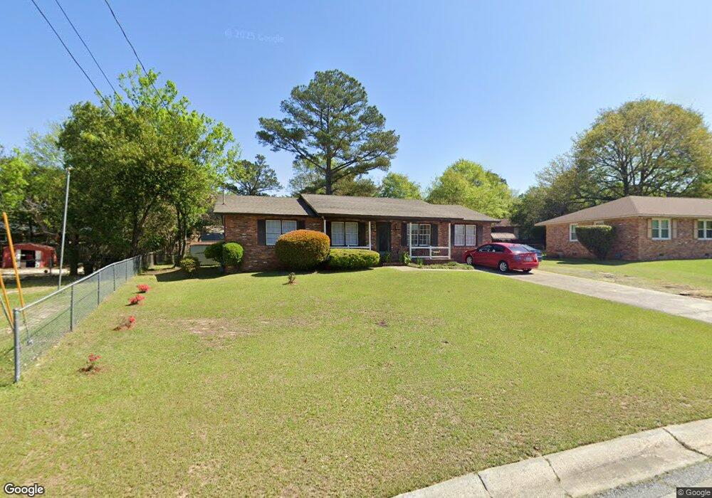
1561 Westbury Dr Macon, GA 31206
Estimated Value: $111,380 - $127,000
3
Beds
2
Baths
1,506
Sq Ft
$79/Sq Ft
Est. Value
About This Home
This home is located at 1561 Westbury Dr, Macon, GA 31206 and is currently estimated at $118,345, approximately $78 per square foot. 1561 Westbury Dr is a home located in Bibb County with nearby schools including Hartley Elementary School, Southwest High School, and Cirrus Charter Academy.
Ownership History
Date
Name
Owned For
Owner Type
Purchase Details
Closed on
Mar 22, 2022
Sold by
Gail Carswell
Bought by
Blash George
Current Estimated Value
Home Financials for this Owner
Home Financials are based on the most recent Mortgage that was taken out on this home.
Original Mortgage
$78,551
Outstanding Balance
$73,460
Interest Rate
4.16%
Mortgage Type
New Conventional
Estimated Equity
$44,885
Purchase Details
Closed on
May 5, 2016
Sold by
Fagin Annie Made
Bought by
Carswell Gail
Purchase Details
Closed on
Dec 16, 1983
Sold by
Ralph Carpenter Stubbs 1413 and Ralph 52
Bought by
Fagin Annie M
Create a Home Valuation Report for This Property
The Home Valuation Report is an in-depth analysis detailing your home's value as well as a comparison with similar homes in the area
Home Values in the Area
Average Home Value in this Area
Purchase History
| Date | Buyer | Sale Price | Title Company |
|---|---|---|---|
| Blash George | $80,000 | None Listed On Document | |
| Carswell Gail | $62,240 | -- | |
| Fagin Annie M | $39,000 | -- |
Source: Public Records
Mortgage History
| Date | Status | Borrower | Loan Amount |
|---|---|---|---|
| Open | Blash George | $78,551 |
Source: Public Records
Tax History Compared to Growth
Tax History
| Year | Tax Paid | Tax Assessment Tax Assessment Total Assessment is a certain percentage of the fair market value that is determined by local assessors to be the total taxable value of land and additions on the property. | Land | Improvement |
|---|---|---|---|---|
| 2025 | $740 | $37,100 | $3,240 | $33,860 |
| 2024 | $764 | $37,100 | $3,240 | $33,860 |
| 2023 | $178 | $37,100 | $3,240 | $33,860 |
| 2022 | $862 | $24,896 | $5,011 | $19,885 |
| 2021 | $946 | $24,896 | $5,011 | $19,885 |
| 2020 | $967 | $24,896 | $5,011 | $19,885 |
| 2019 | $975 | $24,896 | $5,011 | $19,885 |
| 2018 | $1,672 | $24,896 | $5,011 | $19,885 |
| 2017 | $933 | $24,896 | $5,011 | $19,885 |
| 2016 | $619 | $24,896 | $5,011 | $19,885 |
| 2015 | $877 | $24,896 | $5,011 | $19,885 |
| 2014 | $1,116 | $25,898 | $6,014 | $19,885 |
Source: Public Records
Map
Nearby Homes
- 1504 Berkshire Dr
- 1740 Downing Cir
- 2350 Anthony Terrace
- 3254 Markwood Dr
- 2249 Lowe St
- 2420 Adams Ave
- 3158 Brownell Ave
- 2349 Mason St
- 1545 Anthony Rd
- 1066 Jessamine St
- 3339 Markwood Dr
- 1049 Anthony Rd
- 1045 Anthony Rd
- 3446 Tamplin Terrace
- 1062 Rose St
- 3005 Margaret Dr
- 3445 Travis Blvd
- 3480 Travis Blvd
- 815 Edwards Ave
- 1547 Westbury Dr
- 1573 Westbury Dr
- 1614 Winston Dr
- 0 Westbury Dr
- 1544 Greenwich Place
- 1622 Winston Dr
- 1536 Greenwich Place
- 1550 Greenwich Place
- 1587 Westbury Dr
- 1554 Westbury Dr
- 1588 Westbury Dr
- 1524 Greenwich Place
- 1630 Winston Dr
- 1536 Westbury Dr
- 1617 Westbury Dr
- 1539 Penfield Place
- 1512 Westbury Dr
- 1619 Winston Dr
- 1636 Winston Dr
- 1543 Greenwich Place