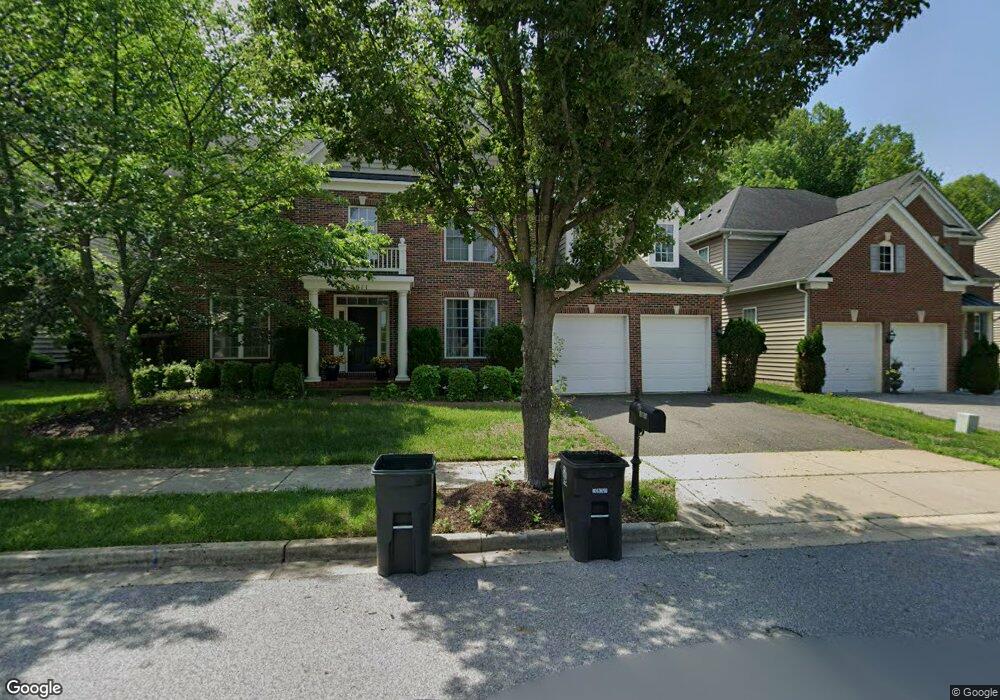
15611 Sir Edwards Dr Upper Marlboro, MD 20772
Estimated Value: $598,000 - $813,000
--
Bed
4
Baths
3,256
Sq Ft
$220/Sq Ft
Est. Value
About This Home
This home is located at 15611 Sir Edwards Dr, Upper Marlboro, MD 20772 and is currently estimated at $715,576, approximately $219 per square foot. 15611 Sir Edwards Dr is a home located in Prince George's County with nearby schools including Patuxent Elementary School, James Madison Middle School, and Dr. Henry A. Wise Jr. High School.
Ownership History
Date
Name
Owned For
Owner Type
Purchase Details
Closed on
Oct 27, 2008
Sold by
M I Homes Of D C Llc
Bought by
Davis Andre L and Davis Venita
Current Estimated Value
Home Financials for this Owner
Home Financials are based on the most recent Mortgage that was taken out on this home.
Original Mortgage
$529,921
Outstanding Balance
$352,386
Interest Rate
6.43%
Mortgage Type
FHA
Estimated Equity
$363,190
Purchase Details
Closed on
Sep 29, 2008
Sold by
M I Homes Of D C Llc
Bought by
Davis Andre L and Davis Venita
Home Financials for this Owner
Home Financials are based on the most recent Mortgage that was taken out on this home.
Original Mortgage
$529,921
Outstanding Balance
$352,386
Interest Rate
6.43%
Mortgage Type
FHA
Estimated Equity
$363,190
Create a Home Valuation Report for This Property
The Home Valuation Report is an in-depth analysis detailing your home's value as well as a comparison with similar homes in the area
Home Values in the Area
Average Home Value in this Area
Purchase History
| Date | Buyer | Sale Price | Title Company |
|---|---|---|---|
| Davis Andre L | $531,490 | -- | |
| Davis Andre L | $531,490 | -- |
Source: Public Records
Mortgage History
| Date | Status | Borrower | Loan Amount |
|---|---|---|---|
| Open | Davis Andre L | $529,921 | |
| Closed | Davis Andre L | $529,921 |
Source: Public Records
Tax History Compared to Growth
Tax History
| Year | Tax Paid | Tax Assessment Tax Assessment Total Assessment is a certain percentage of the fair market value that is determined by local assessors to be the total taxable value of land and additions on the property. | Land | Improvement |
|---|---|---|---|---|
| 2025 | $8,538 | $596,300 | $185,400 | $410,900 |
| 2024 | $8,538 | $563,633 | $0 | $0 |
| 2023 | $8,065 | $530,967 | $0 | $0 |
| 2022 | $7,593 | $498,300 | $155,400 | $342,900 |
| 2021 | $7,478 | $490,333 | $0 | $0 |
| 2020 | $7,363 | $482,367 | $0 | $0 |
| 2019 | $7,248 | $474,400 | $100,200 | $374,200 |
| 2018 | $6,936 | $452,800 | $0 | $0 |
| 2017 | $6,624 | $431,200 | $0 | $0 |
| 2016 | -- | $409,600 | $0 | $0 |
| 2015 | $6,034 | $409,533 | $0 | $0 |
| 2014 | $6,034 | $409,467 | $0 | $0 |
Source: Public Records
Map
Nearby Homes
- 15411 Governors Park Ln
- 15407 Governors Park Ln
- 15318 Governors Park Ln
- 15700 Grand St
- 15312 Sir Edwards Dr
- 15701 Norus St
- 3823 Effie Fox Way
- 3807 Pentland Hills Dr
- 4661 Crain Hwy
- 15200 Peerless Ave
- 16115 Brookmead Ct
- 3902 Presidential Golf Dr
- 16201 Brookmead Ct
- 3604 Halloway N
- 15109 Marlboro Pike
- 3907 Bishopmill Place
- 16504 Village Dr W
- 15308 Littleton Place
- 4000 Bishopmill Dr
- 3512 Eyre Dr S
- 15609 Sir Edwards Dr
- 15613 Sir Edwards Dr
- 15607 Sir Edwards Dr
- 15615 Sir Edwards Dr
- 4015 Wales Ln
- 4014 Wales Ln
- 15605 Sir Edwards Dr
- 15606 Sir Edwards Dr
- 15617 Sir Edwards Dr
- 4013 Wales Ln
- 4013 Crathie Ln
- 4012 Wales Ln
- 15604 Sir Edwards Dr
- 15603 Sir Edwards Dr
- 0 Crathie Ln Unit PG8049166
- 4011 Wales Ln
- 15619 Sir Edwards Dr
- 4011 Crathie Ln
- 4010 Wales Ln
- 15601 Sir Edwards Dr