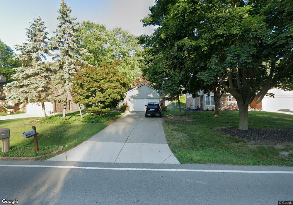
15615 Hubbard St Livonia, MI 48154
Estimated Value: $335,448 - $513,000
3
Beds
3
Baths
1,307
Sq Ft
$308/Sq Ft
Est. Value
About This Home
This home is located at 15615 Hubbard St, Livonia, MI 48154 and is currently estimated at $402,362, approximately $307 per square foot. 15615 Hubbard St is a home located in Wayne County with nearby schools including Buchanan Elementary School, Riley Upper Elementary School, and Holmes Middle School.
Ownership History
Date
Name
Owned For
Owner Type
Purchase Details
Closed on
Aug 14, 2009
Sold by
Green Curtis R and Krueger Keri A
Bought by
Kowalski Kevin J
Current Estimated Value
Purchase Details
Closed on
Jun 11, 2003
Sold by
Krueger Keri and Krueger Keri A
Bought by
Green Curtis R
Home Financials for this Owner
Home Financials are based on the most recent Mortgage that was taken out on this home.
Original Mortgage
$124,000
Interest Rate
5.51%
Mortgage Type
Purchase Money Mortgage
Create a Home Valuation Report for This Property
The Home Valuation Report is an in-depth analysis detailing your home's value as well as a comparison with similar homes in the area
Home Values in the Area
Average Home Value in this Area
Purchase History
| Date | Buyer | Sale Price | Title Company |
|---|---|---|---|
| Kowalski Kevin J | $180,000 | None Available | |
| Green Curtis R | -- | Philip R Seaver Title Compan |
Source: Public Records
Mortgage History
| Date | Status | Borrower | Loan Amount |
|---|---|---|---|
| Previous Owner | Green Curtis R | $124,000 |
Source: Public Records
Tax History Compared to Growth
Tax History
| Year | Tax Paid | Tax Assessment Tax Assessment Total Assessment is a certain percentage of the fair market value that is determined by local assessors to be the total taxable value of land and additions on the property. | Land | Improvement |
|---|---|---|---|---|
| 2025 | $2,253 | $157,700 | $0 | $0 |
| 2024 | $2,253 | $151,000 | $0 | $0 |
| 2023 | $2,149 | $138,000 | $0 | $0 |
| 2022 | $3,774 | $125,600 | $0 | $0 |
| 2021 | $3,666 | $120,800 | $0 | $0 |
| 2019 | $3,517 | $107,500 | $0 | $0 |
| 2018 | $1,817 | $100,100 | $0 | $0 |
| 2017 | $3,216 | $98,100 | $0 | $0 |
| 2016 | $3,111 | $98,100 | $0 | $0 |
| 2015 | $7,503 | $86,080 | $0 | $0 |
| 2012 | -- | $71,370 | $16,500 | $54,870 |
Source: Public Records
Map
Nearby Homes
- 32651 5 Mile Rd Unit 15
- 15075 Hubbard St Unit 5
- 15600 Auburndale St
- 15873 Shadyside Dr
- 14879 Fairfield St
- 15040 Berwick St
- 14677 Auburndale St
- 16365 Farmington Rd
- 16966 Fairfield St
- 31005 Roycroft St
- 16385 Farmington Rd
- 32136 Lyndon St
- 16832 Bell Creek Ln
- 15345 Bainbridge St
- 15709 Stamford St
- 32525 6 Mile Rd
- 14563 Melrose St
- 31069 Munger Dr
- 33040 Allen St
- 16537 Pollyanna St
- 15629 Hubbard St
- 15549 Hubbard St
- 15537 Hubbard St
- 15624 Fairfield St
- 15645 Hubbard St
- 15636 Fairfield St
- 15564 Fairfield St
- 15533 Hubbard St
- 15661 Hubbard St
- 15658 Fairfield St
- 15604 Hubbard St
- 15644 Hubbard St
- 15562 Hubbard St
- 15536 Fairfield St
- 15542 Hubbard St
- 15525 Hubbard St Unit Bldg-Unit
- 15525 Hubbard St
- 15511 Hubbard St
- 15625 Fairfield St
- 15609 Fairfield St