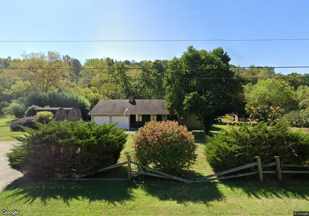
15616 State Route 550 Fleming, OH 45729
Estimated Value: $234,000 - $295,000
3
Beds
2
Baths
1,564
Sq Ft
$176/Sq Ft
Est. Value
About This Home
This home is located at 15616 State Route 550, Fleming, OH 45729 and is currently estimated at $274,821, approximately $175 per square foot. 15616 State Route 550 is a home located in Washington County with nearby schools including Warren High School.
Ownership History
Date
Name
Owned For
Owner Type
Purchase Details
Closed on
Jun 29, 2017
Sold by
Kindig Victoria and Estate Of Richard E Tuttle
Bought by
Brown Garrett L
Current Estimated Value
Home Financials for this Owner
Home Financials are based on the most recent Mortgage that was taken out on this home.
Original Mortgage
$157,102
Outstanding Balance
$132,211
Interest Rate
4.37%
Mortgage Type
FHA
Estimated Equity
$142,610
Purchase Details
Closed on
Apr 19, 1999
Bought by
Tuttle Richard E
Purchase Details
Closed on
Aug 19, 1995
Bought by
Tuttle Richard E and Tuttle Rober
Create a Home Valuation Report for This Property
The Home Valuation Report is an in-depth analysis detailing your home's value as well as a comparison with similar homes in the area
Home Values in the Area
Average Home Value in this Area
Purchase History
| Date | Buyer | Sale Price | Title Company |
|---|---|---|---|
| Brown Garrett L | $160,000 | Title First Agency Inc | |
| Tuttle Richard E | -- | -- | |
| Tuttle Richard E | $85,000 | -- |
Source: Public Records
Mortgage History
| Date | Status | Borrower | Loan Amount |
|---|---|---|---|
| Open | Brown Garrett L | $157,102 |
Source: Public Records
Tax History Compared to Growth
Tax History
| Year | Tax Paid | Tax Assessment Tax Assessment Total Assessment is a certain percentage of the fair market value that is determined by local assessors to be the total taxable value of land and additions on the property. | Land | Improvement |
|---|---|---|---|---|
| 2024 | $2,495 | $65,960 | $10,470 | $55,490 |
| 2023 | $2,495 | $65,960 | $10,470 | $55,490 |
| 2022 | $2,488 | $65,960 | $10,470 | $55,490 |
| 2021 | $2,012 | $50,960 | $7,270 | $43,690 |
| 2020 | $2,004 | $50,960 | $7,270 | $43,690 |
| 2019 | $1,982 | $50,960 | $7,270 | $43,690 |
| 2018 | $1,847 | $46,040 | $6,320 | $39,720 |
| 2017 | $1,836 | $46,040 | $6,320 | $39,720 |
| 2016 | $2,343 | $46,040 | $6,320 | $39,720 |
| 2015 | $1,496 | $41,710 | $6,070 | $35,640 |
| 2014 | $2,147 | $41,710 | $6,070 | $35,640 |
| 2013 | $747 | $41,710 | $6,070 | $35,640 |
Source: Public Records
Map
Nearby Homes
- 254 Riggenbach Hill Rd
- 65 High Point Dr
- 0 Fisher Ridge Rd Tract 6
- 0 Fisher Ridge Rd Tract 7
- 0 Fisher Ridge Rd Tract 8
- 0 Fisher Ridge Rd Tract 5
- 0 Fisher Ridge Rd Tract 4
- 0 Fisher Ridge Rd Tract 2
- 0 Fisher Ridge Rd Tract 1
- 0 Fisher Ridge Rd
- 203 57th St
- 302 57th St
- 411 58th St
- 1998 Reese Rd
- 407 56th St
- 5607 Grand Central Ave
- 5505 6th Ave
- 53 Central Dr
- 604 51st St
- 405 47th Place
- 15616 Ohio 550
- 15724 State Route 550
- 15616 Oh 550
- 15619 State Route 550
- 15585 State Route 550
- 15752 State Route 550
- 15768 Ohio 550
- 15780 Oh 550
- 15780 Ohio 550
- 15780 State Route 550
- 15834 Ohio 550
- 15958 State Route 550
- 15998 State Route 550
- 15936 State Route 550
- 15533 State Route 550
- 15850 Oh 550
- 15850 Ohio 550
- 15850 State Route 550
- 98 Salster Rd
- 15498 State Route 550