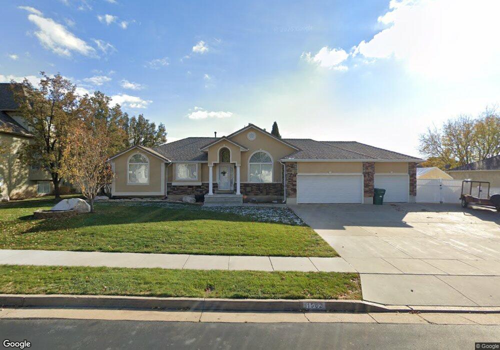
1562 E 525 N Layton, UT 84040
Estimated Value: $599,698 - $656,000
3
Beds
2
Baths
3,140
Sq Ft
$198/Sq Ft
Est. Value
About This Home
This home is located at 1562 E 525 N, Layton, UT 84040 and is currently estimated at $622,425, approximately $198 per square foot. 1562 E 525 N is a home located in Davis County with nearby schools including King Elementary School, Central Davis Junior High School, and Layton High School.
Ownership History
Date
Name
Owned For
Owner Type
Purchase Details
Closed on
May 24, 2000
Sold by
Stewart Gary and Stewart Carol
Bought by
Norton William J and Norton Debra
Current Estimated Value
Home Financials for this Owner
Home Financials are based on the most recent Mortgage that was taken out on this home.
Original Mortgage
$171,400
Outstanding Balance
$58,957
Interest Rate
8.08%
Estimated Equity
$563,468
Purchase Details
Closed on
Feb 23, 2000
Sold by
Summit Construction Inc
Bought by
Stewart Gary and Stewart Carol
Purchase Details
Closed on
Jul 31, 1998
Sold by
Kirk Darrell G and Kirk Linda
Bought by
Summit Construction Inc
Home Financials for this Owner
Home Financials are based on the most recent Mortgage that was taken out on this home.
Original Mortgage
$180,000
Interest Rate
6.9%
Create a Home Valuation Report for This Property
The Home Valuation Report is an in-depth analysis detailing your home's value as well as a comparison with similar homes in the area
Home Values in the Area
Average Home Value in this Area
Purchase History
| Date | Buyer | Sale Price | Title Company |
|---|---|---|---|
| Norton William J | -- | First American Title Co | |
| Stewart Gary | -- | First American Title Ins Co | |
| Summit Construction Inc | -- | First American Title Co |
Source: Public Records
Mortgage History
| Date | Status | Borrower | Loan Amount |
|---|---|---|---|
| Open | Norton William J | $171,400 | |
| Previous Owner | Summit Construction Inc | $180,000 | |
| Closed | Norton William J | $22,100 |
Source: Public Records
Tax History Compared to Growth
Tax History
| Year | Tax Paid | Tax Assessment Tax Assessment Total Assessment is a certain percentage of the fair market value that is determined by local assessors to be the total taxable value of land and additions on the property. | Land | Improvement |
|---|---|---|---|---|
| 2025 | $3,313 | $315,700 | $126,524 | $189,176 |
| 2024 | $3,156 | $303,601 | $150,002 | $153,599 |
| 2023 | $3,021 | $514,000 | $201,486 | $312,514 |
| 2022 | $3,145 | $293,150 | $108,144 | $185,006 |
| 2021 | $3,019 | $420,000 | $164,692 | $255,308 |
| 2020 | $2,786 | $371,000 | $133,778 | $237,222 |
| 2019 | $2,877 | $379,000 | $119,412 | $259,588 |
| 2018 | $2,650 | $350,000 | $93,287 | $256,713 |
| 2016 | $2,343 | $162,030 | $49,032 | $112,998 |
| 2015 | $2,309 | $151,635 | $49,032 | $102,603 |
| 2014 | $2,364 | $159,144 | $49,032 | $110,112 |
| 2013 | -- | $136,084 | $35,698 | $100,386 |
Source: Public Records
Map
Nearby Homes
- 1503 E 530 N
- 308 N 1800 E
- 1515 E Gentile St
- 479 N 1375 E
- 2877 E Gentile St Unit 2
- 580 N Allanwood Place
- 1247 E 300 N
- 1148 N 1875 E Unit 2
- 1204 N 1875 E Unit 5
- 508 N Adamswood Rd
- 1884 Nalder St
- 556 N Fairfield Rd Unit A2
- 556 N Fairfield Rd Unit D1
- 556 N Fairfield Rd Unit D2
- 556 N Fairfield Rd Unit A3
- 556 N Fairfield Rd Unit D3
- 556 N Fairfield Rd Unit D4
- 556 N Fairfield Rd Unit A1
- 556 N Fairfield Rd Unit A4
- 861 E 575 N
- 1534 E 525 N
- 1588 E 525 N
- 1573 E Ridge Rd Unit 42
- 1573 E Ridge Rd
- 1551 E Ridge Rd Unit 43
- 1573 E 525 N
- 1597 E Ridge Rd Unit 41
- 1597 E Ridge Rd
- 1525 E Ridge Rd Unit 44
- 1547 E 525 N
- 1518 E 525 N
- 517 N 1625 E
- 547 N 1625 E
- 1532 Ridge Rd
- 1523 E 525 N
- 1530 Ridge Rd
- 1621 E Ridge Rd Unit 40
- 1621 E Ridge Rd
- 1495 E Ridge Rd Unit 45
- 1495 E Ridge Rd