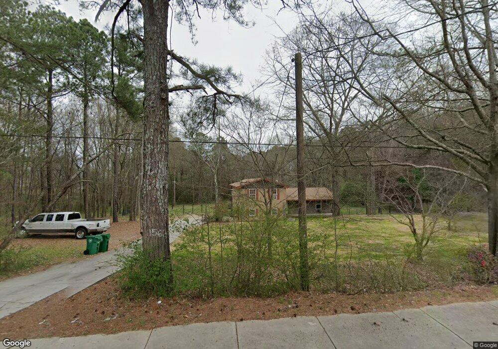
1562 Stephenson Rd Lithonia, GA 30058
Estimated Value: $297,794 - $367,000
3
Beds
3
Baths
1,776
Sq Ft
$179/Sq Ft
Est. Value
About This Home
This home is located at 1562 Stephenson Rd, Lithonia, GA 30058 and is currently estimated at $317,449, approximately $178 per square foot. 1562 Stephenson Rd is a home located in DeKalb County with nearby schools including Rock Chapel Elementary School, Stephenson Middle School, and Stephenson High School.
Ownership History
Date
Name
Owned For
Owner Type
Purchase Details
Closed on
Oct 13, 2016
Sold by
Nolen
Bought by
Kennebrew Lashunda
Current Estimated Value
Purchase Details
Closed on
Jan 22, 2015
Sold by
Rice H Grant
Bought by
Kennebrew Norman Laron
Purchase Details
Closed on
Jan 18, 1994
Sold by
Gibby Larry P Joy
Bought by
Rice Kevin G
Home Financials for this Owner
Home Financials are based on the most recent Mortgage that was taken out on this home.
Original Mortgage
$74,800
Interest Rate
7.1%
Create a Home Valuation Report for This Property
The Home Valuation Report is an in-depth analysis detailing your home's value as well as a comparison with similar homes in the area
Home Values in the Area
Average Home Value in this Area
Purchase History
| Date | Buyer | Sale Price | Title Company |
|---|---|---|---|
| Kennebrew Lashunda | -- | -- | |
| Kennebrew Norman Laron | $2,000 | -- | |
| Rice H Grant | -- | -- | |
| Rice Kevin G | $93,500 | -- |
Source: Public Records
Mortgage History
| Date | Status | Borrower | Loan Amount |
|---|---|---|---|
| Previous Owner | Rice Kevin G | $74,800 |
Source: Public Records
Tax History Compared to Growth
Tax History
| Year | Tax Paid | Tax Assessment Tax Assessment Total Assessment is a certain percentage of the fair market value that is determined by local assessors to be the total taxable value of land and additions on the property. | Land | Improvement |
|---|---|---|---|---|
| 2025 | $3,278 | $119,880 | $20,240 | $99,640 |
| 2024 | $3,322 | $118,680 | $20,240 | $98,440 |
| 2023 | $3,322 | $121,640 | $20,240 | $101,400 |
| 2022 | $2,937 | $104,800 | $20,240 | $84,560 |
| 2021 | $2,379 | $80,640 | $9,520 | $71,120 |
| 2020 | $2,075 | $67,280 | $9,520 | $57,760 |
| 2019 | $2,641 | $53,040 | $9,520 | $43,520 |
| 2018 | $1,867 | $39,840 | $9,520 | $30,320 |
| 2017 | $2,041 | $38,080 | $9,520 | $28,560 |
| 2016 | $1,568 | $28,400 | $9,520 | $18,880 |
| 2014 | $1,393 | $23,840 | $9,520 | $14,320 |
Source: Public Records
Map
Nearby Homes
- 1788 Stephenson Rd
- Presley Plan at Kingsley Creek
- Travis Plan at Kingsley Creek
- Apollo Plan at Kingsley Creek
- Atlas Plan at Kingsley Creek
- 1005 Kingsley Way
- 1005 Kingsley Way Unit LOT 7
- 971 Asborough Ct
- 1011 Kingsley Way Unit LOT 8
- 1011 Kingsley Way
- 1017 Kingsley Way Unit LOT 9
- 1017 Kingsley Way
- 1023 Kingsley Way
- 1023 Kingsley Way Unit LOT 10
- 1029 Kingsley Way
- 1029 Kingsley Way Unit LOT 11
- 1639 Stephenson Rd
- 1035 Kingsley Way
- 1035 Kingsley Way Unit LOT 12
- 7211 Wheeler Trail
- 947 Old Greystone Dr Unit I
- 944 Old Greystone Dr Unit 1
- 955 Old Greystone Dr
- 950 Old Greystone Dr
- 7291 Asbury Dr
- 7279 Asbury Dr
- 1545 Stephenson Rd
- 959 Old Greystone Dr
- 954 Old Greystone Dr
- 1589 Stephenson Rd
- 7361 Asbury Dr
- 7271 Asbury Dr
- 960 Old Greystone Dr
- 965 Old Greystone Dr
- 1535 Stephenson Rd
- 966 Old Greystone Dr
- 7256 Iverson Trail
- 7252 Iverson Trail Unit 1
- 971 Old Greystone Dr
- 7255 Asbury Dr