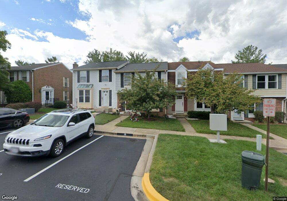
15622 Mews Ct Laurel, MD 20707
Estimated Value: $310,000 - $357,000
--
Bed
2
Baths
1,360
Sq Ft
$246/Sq Ft
Est. Value
About This Home
This home is located at 15622 Mews Ct, Laurel, MD 20707 and is currently estimated at $334,936, approximately $246 per square foot. 15622 Mews Ct is a home located in Prince George's County with nearby schools including Scotchtown Hills Elementary School, Laurel High School, and Chesapeake Math and IT Elementary Public Charter.
Ownership History
Date
Name
Owned For
Owner Type
Purchase Details
Closed on
Apr 1, 2016
Bought by
Young Peggy and Young Kevin
Current Estimated Value
Home Financials for this Owner
Home Financials are based on the most recent Mortgage that was taken out on this home.
Original Mortgage
$194,666
Outstanding Balance
$154,384
Interest Rate
3.71%
Estimated Equity
$180,552
Purchase Details
Closed on
Jun 12, 2003
Sold by
Ho Derek Sung and Ho Yin
Bought by
Young Kevin W and Young Peggy A
Purchase Details
Closed on
Dec 2, 1994
Sold by
Land Vincent J
Bought by
Ho Derek S
Home Financials for this Owner
Home Financials are based on the most recent Mortgage that was taken out on this home.
Original Mortgage
$109,200
Interest Rate
8.81%
Purchase Details
Closed on
Jun 13, 1988
Sold by
Prochaska Rozelin
Bought by
Land Dolores A and Land Vincent J
Create a Home Valuation Report for This Property
The Home Valuation Report is an in-depth analysis detailing your home's value as well as a comparison with similar homes in the area
Home Values in the Area
Average Home Value in this Area
Purchase History
| Date | Buyer | Sale Price | Title Company |
|---|---|---|---|
| Young Peggy | -- | -- | |
| Young Kevin W | $138,000 | -- | |
| Ho Derek S | $109,500 | -- | |
| Land Dolores A | $96,000 | -- |
Source: Public Records
Mortgage History
| Date | Status | Borrower | Loan Amount |
|---|---|---|---|
| Open | Ho Derek S | $194,666 | |
| Closed | Ho Derek S | -- | |
| Previous Owner | Ho Derek S | $109,200 |
Source: Public Records
Tax History Compared to Growth
Tax History
| Year | Tax Paid | Tax Assessment Tax Assessment Total Assessment is a certain percentage of the fair market value that is determined by local assessors to be the total taxable value of land and additions on the property. | Land | Improvement |
|---|---|---|---|---|
| 2025 | $4,252 | $265,000 | $90,000 | $175,000 |
| 2024 | $4,252 | $259,833 | $0 | $0 |
| 2023 | $4,174 | $254,667 | $0 | $0 |
| 2022 | $2,774 | $249,500 | $75,000 | $174,500 |
| 2021 | $3,740 | $236,767 | $0 | $0 |
| 2020 | $7,437 | $224,033 | $0 | $0 |
| 2019 | $3,026 | $211,300 | $75,000 | $136,300 |
| 2018 | $3,458 | $208,100 | $0 | $0 |
| 2017 | $3,387 | $204,900 | $0 | $0 |
| 2016 | -- | $201,700 | $0 | $0 |
| 2015 | $2,795 | $194,667 | $0 | $0 |
| 2014 | $2,795 | $187,633 | $0 | $0 |
Source: Public Records
Map
Nearby Homes
- 15443 Arbory Way
- 1210 Westview Terrace
- 1106 Snowden Place
- 7619 Woodbine Dr
- 1002 West Ct
- 7709 Brooklyn Bridge Rd
- 15603 Dorset Rd Unit 101
- 7419 Berryleaf Dr
- 7616 Woodbine Dr
- 7323 Split Rail Ln
- 1103 Montgomery St
- 7681 E Arbory Ct
- 7651 E Arbory Ct
- 211 Patuxent Rd
- 7631 S Arbory Ln
- 7403 Berryleaf Dr
- 1003 Ward St
- 15708 Dorset Rd Unit 203
- 15708 Dorset Rd Unit 304
- 200 1/2 11th St
- 15624 Mews Ct
- 15620 Mews Ct
- 15626 Mews Ct
- 15618 Mews Ct
- 15628 Mews Ct
- 15616 Mews Ct
- 15630 Mews Ct
- 15614 Mews Ct
- 15632 Mews Ct
- 0 Mews Ct Unit 1006869410
- 0 Mews Ct Unit PG7694215
- 15612 Mews Ct
- 15610 Mews Ct
- 15606 Mews Ct
- 15608 Mews Ct
- 15604 Mews Ct
- 15631 Mews Ct
- 7808 Sandy Spring Rd
- 15602 Mews Ct
- 15634 Mews Ct