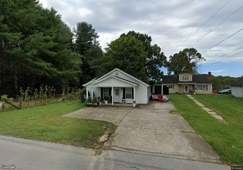
1563 E Highway 312 Corbin, KY 40701
Estimated Value: $77,000 - $184,000
2
Beds
1
Bath
1,120
Sq Ft
$98/Sq Ft
Est. Value
About This Home
This home is located at 1563 E Highway 312, Corbin, KY 40701 and is currently estimated at $110,115, approximately $98 per square foot. 1563 E Highway 312 is a home located in Laurel County with nearby schools including Heart To Heart Christian School.
Ownership History
Date
Name
Owned For
Owner Type
Purchase Details
Closed on
Mar 21, 2025
Sold by
Bree Properties Llc
Bought by
Thomas Byron Joe and Bain Michelle
Current Estimated Value
Home Financials for this Owner
Home Financials are based on the most recent Mortgage that was taken out on this home.
Original Mortgage
$127,272
Outstanding Balance
$126,513
Interest Rate
6.89%
Mortgage Type
New Conventional
Estimated Equity
-$16,398
Purchase Details
Closed on
Jun 11, 2024
Sold by
Bree Properties Llc
Bought by
Windjammer Properties Llc
Purchase Details
Closed on
Oct 14, 2011
Sold by
Hill Melvin and Hill Barbara
Bought by
Bree Properties Llc
Create a Home Valuation Report for This Property
The Home Valuation Report is an in-depth analysis detailing your home's value as well as a comparison with similar homes in the area
Home Values in the Area
Average Home Value in this Area
Purchase History
| Date | Buyer | Sale Price | Title Company |
|---|---|---|---|
| Thomas Byron Joe | $125,000 | Kentucky Mountain Land Title | |
| Thomas Byron Joe | $125,000 | Kentucky Mountain Land Title | |
| Windjammer Properties Llc | $700,000 | Kentucky Mountain Land Title | |
| Bree Properties Llc | $34,100 | -- |
Source: Public Records
Mortgage History
| Date | Status | Borrower | Loan Amount |
|---|---|---|---|
| Open | Thomas Byron Joe | $127,272 | |
| Closed | Thomas Byron Joe | $127,272 |
Source: Public Records
Tax History Compared to Growth
Tax History
| Year | Tax Paid | Tax Assessment Tax Assessment Total Assessment is a certain percentage of the fair market value that is determined by local assessors to be the total taxable value of land and additions on the property. | Land | Improvement |
|---|---|---|---|---|
| 2025 | $700 | $90,000 | $0 | $0 |
| 2024 | $263 | $34,100 | $0 | $0 |
| 2023 | $270 | $34,100 | $0 | $0 |
| 2022 | $271 | $34,100 | $0 | $0 |
| 2021 | $281 | $34,100 | $0 | $0 |
| 2020 | $283 | $34,100 | $0 | $0 |
| 2019 | $284 | $34,100 | $0 | $0 |
| 2018 | $284 | $34,100 | $0 | $0 |
| 2017 | $284 | $34,100 | $0 | $0 |
| 2015 | $283 | $34,100 | $4,100 | $30,000 |
| 2012 | $273 | $34,100 | $4,100 | $30,000 |
Source: Public Records
Map
Nearby Homes
- 72/71 Blossom Ridge Dr
- 210 Blossom Ridge Dr
- 162 Verbena Dr
- 46 Brandon Dr
- 100 Bellwood Ln
- 969 E Highway 312
- 585 Cotton Rd
- 154 Bryan Dr
- 24 Beehive Ln
- 136 Martin Rd
- 780 Level Green Rd
- 688 Rooks Branch Rd
- 504 Earl Howard Rd
- 72 Vine St
- 63 Hollywood Dr
- 64 Hollywood Dr
- 66 Hollywood Dr
- 79 Hollywood Dr
- 35 Malibu Dr
- 75 Malibu Dr
- 1551 Kentucky 312
- 1557 E Highway 312
- 1545 E Highway 312
- 1557 Kentucky 312
- 5 Blossom Ridge Rd
- 53 Smokey Ln
- 1 Smokey Ln
- 2 Smokey Ln
- 2365 E Highway 312
- 21 Blossom Ridge Dr
- 21 Blossom Ridge Rd
- 198 Smokey Ln
- 33 Blossom Ridge Dr
- 4 Smokey Ln
- 5 Smokey Ln
- 55 Blossom Ridge Dr
- 55 Blossom Ridge Dr
- 34 Blossom Ridge Dr
- 34 Blossom Ridge Dr
- 67 Blossom Ridge Dr