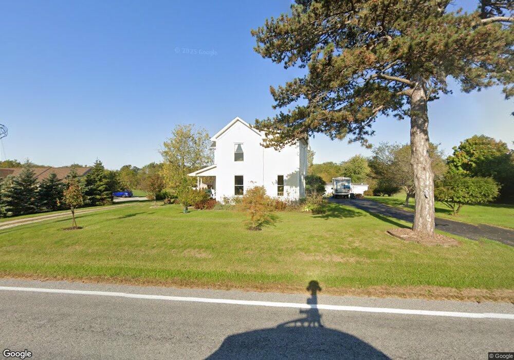
15639 State Route 67 Wapakoneta, OH 45895
Estimated Value: $244,000 - $369,000
4
Beds
1
Bath
2,064
Sq Ft
$141/Sq Ft
Est. Value
About This Home
This home is located at 15639 State Route 67, Wapakoneta, OH 45895 and is currently estimated at $291,980, approximately $141 per square foot. 15639 State Route 67 is a home located in Auglaize County with nearby schools including Wapakoneta Elementary School, Wapakoneta High School, and Wapakoneta Middle School.
Ownership History
Date
Name
Owned For
Owner Type
Purchase Details
Closed on
Apr 6, 2011
Sold by
Oakley John B and Oakley Christina P
Bought by
Oakley John B and Oakley Chistina P
Current Estimated Value
Purchase Details
Closed on
Dec 19, 2003
Bought by
Oakley John B
Purchase Details
Closed on
Sep 5, 2002
Sold by
Koch Rowena R
Bought by
Dalt Enterprises Llc
Create a Home Valuation Report for This Property
The Home Valuation Report is an in-depth analysis detailing your home's value as well as a comparison with similar homes in the area
Home Values in the Area
Average Home Value in this Area
Purchase History
| Date | Buyer | Sale Price | Title Company |
|---|---|---|---|
| Oakley John B | -- | Attorney | |
| Oakley John B | $119,000 | -- | |
| Dalt Enterprises Llc | $194,600 | -- |
Source: Public Records
Tax History Compared to Growth
Tax History
| Year | Tax Paid | Tax Assessment Tax Assessment Total Assessment is a certain percentage of the fair market value that is determined by local assessors to be the total taxable value of land and additions on the property. | Land | Improvement |
|---|---|---|---|---|
| 2024 | $3,110 | $62,510 | $13,160 | $49,350 |
| 2023 | $2,139 | $62,510 | $13,160 | $49,350 |
| 2022 | $1,676 | $44,800 | $10,970 | $33,830 |
| 2021 | $1,657 | $44,800 | $10,970 | $33,830 |
| 2020 | $1,659 | $44,801 | $10,973 | $33,828 |
| 2019 | $1,415 | $36,722 | $8,995 | $27,727 |
| 2018 | $1,420 | $36,722 | $8,995 | $27,727 |
| 2017 | $1,411 | $36,722 | $8,995 | $27,727 |
| 2016 | $1,458 | $38,200 | $8,565 | $29,635 |
| 2015 | $1,457 | $38,200 | $8,565 | $29,635 |
| 2014 | $1,450 | $38,200 | $8,565 | $29,635 |
| 2013 | $1,438 | $36,880 | $8,565 | $28,315 |
Source: Public Records
Map
Nearby Homes
- 15633 State Route 67
- 15642 State Route 67
- 15653 State Route 67
- 15725 State Route 67
- 15771 State Route 67
- 15608 Blackhoof Creek Rd
- 15590 Blackhoof Creek Rd
- 15668 Blackhoof Creek Rd
- 15769 Blackhoof Creek Rd
- 15789 State Route 67
- 15821 State Route 67
- 15468 State Route 67
- 15766 Blackhoof Creek Rd
- 15468 Ohio 67
- 15835 State Route 67
- 15835 Ohio 67
- 15863 State Route 67
- 15560 Blackhoof Creek Rd