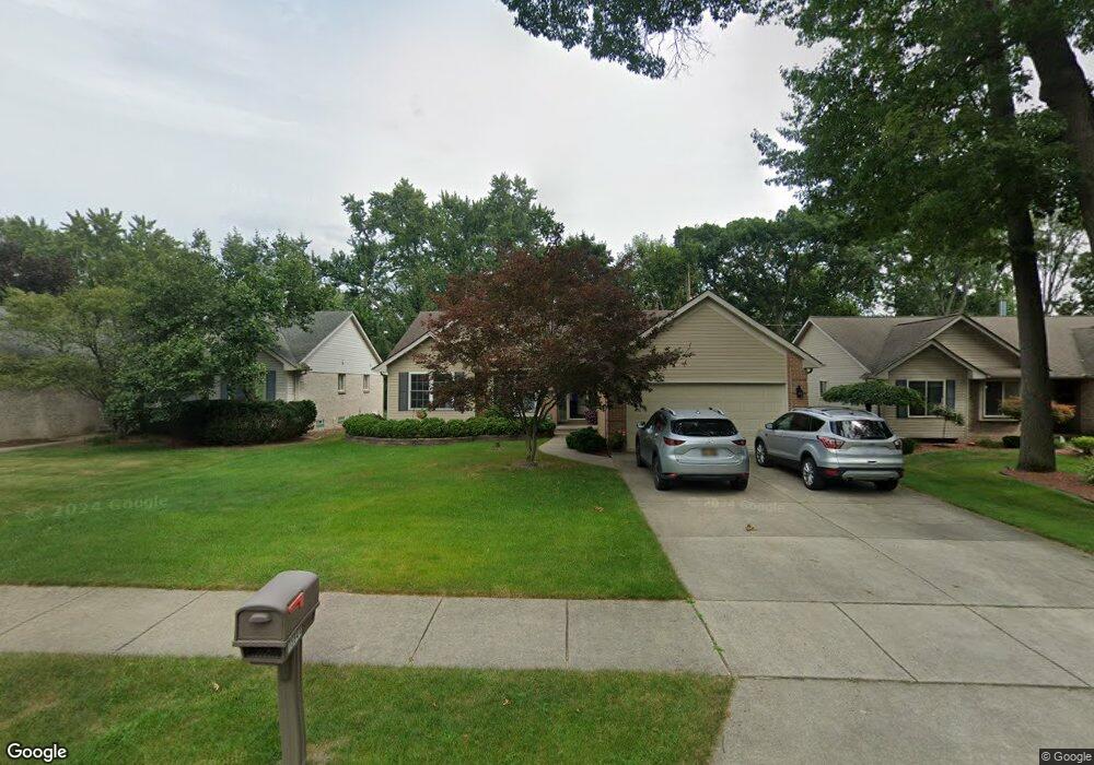
15644 Mayfield St Livonia, MI 48154
Estimated Value: $386,000 - $448,000
3
Beds
3
Baths
1,839
Sq Ft
$222/Sq Ft
Est. Value
About This Home
This home is located at 15644 Mayfield St, Livonia, MI 48154 and is currently estimated at $407,737, approximately $221 per square foot. 15644 Mayfield St is a home located in Wayne County with nearby schools including Buchanan Elementary School, Riley Upper Elementary School, and Holmes Middle School.
Ownership History
Date
Name
Owned For
Owner Type
Purchase Details
Closed on
Nov 17, 2023
Sold by
Hill Family Trust
Bought by
Grone Christopher and Grone Marielle
Current Estimated Value
Home Financials for this Owner
Home Financials are based on the most recent Mortgage that was taken out on this home.
Original Mortgage
$155,000
Outstanding Balance
$152,332
Interest Rate
7.57%
Mortgage Type
New Conventional
Estimated Equity
$255,405
Purchase Details
Closed on
Jul 6, 2020
Sold by
Hill Robert D and Hill Angela A
Bought by
Hill Robert D and Hill Angela A
Purchase Details
Closed on
Aug 25, 2004
Sold by
Weaver Sandra and Weaver Sandra L
Bought by
Hill Robert D
Purchase Details
Closed on
Nov 11, 2003
Sold by
Anchor Homes Llc
Bought by
Weaver Sandra
Create a Home Valuation Report for This Property
The Home Valuation Report is an in-depth analysis detailing your home's value as well as a comparison with similar homes in the area
Home Values in the Area
Average Home Value in this Area
Purchase History
| Date | Buyer | Sale Price | Title Company |
|---|---|---|---|
| Grone Christopher | $360,000 | Title One | |
| Grone Christopher | $360,000 | Title One | |
| Hill Robert D | -- | None Available | |
| Hill Robert D | $305,000 | Golden Title | |
| Weaver Sandra | $312,150 | First American Title Ins Co |
Source: Public Records
Mortgage History
| Date | Status | Borrower | Loan Amount |
|---|---|---|---|
| Open | Grone Christopher | $155,000 | |
| Closed | Grone Christopher | $155,000 |
Source: Public Records
Tax History Compared to Growth
Tax History
| Year | Tax Paid | Tax Assessment Tax Assessment Total Assessment is a certain percentage of the fair market value that is determined by local assessors to be the total taxable value of land and additions on the property. | Land | Improvement |
|---|---|---|---|---|
| 2025 | $2,749 | $188,100 | $0 | $0 |
| 2024 | $2,749 | $181,400 | $0 | $0 |
| 2023 | $2,622 | $165,600 | $0 | $0 |
| 2022 | $4,604 | $150,700 | $0 | $0 |
| 2021 | $4,473 | $144,700 | $0 | $0 |
| 2019 | $4,291 | $129,500 | $0 | $0 |
| 2018 | $2,217 | $127,900 | $0 | $0 |
| 2017 | $3,924 | $121,300 | $0 | $0 |
| 2016 | $4,111 | $121,300 | $0 | $0 |
| 2015 | $9,907 | $113,650 | $0 | $0 |
| 2012 | -- | $94,180 | $22,050 | $72,130 |
Source: Public Records
Map
Nearby Homes
- 15873 Shadyside Dr
- 32651 5 Mile Rd Unit 15
- 15075 Hubbard St Unit 5
- 16365 Farmington Rd
- 14879 Fairfield St
- 16385 Farmington Rd
- 15600 Auburndale St
- 16966 Fairfield St
- 16832 Bell Creek Ln
- 15709 Stamford St
- 15040 Berwick St
- 16537 Pollyanna St
- 32525 6 Mile Rd
- 16880 Farmington Rd Unit 42
- 16962 Farmington Rd Unit 20
- 32920 6 Mile Rd
- 14677 Auburndale St
- 32136 Lyndon St
- 33040 Allen St
- 31005 Roycroft St
- 15648 Mayfield St
- 15600 Mayfield St
- 15651 Brookfield St
- 15643 Brookfield St
- 32807 Rayburn St
- 15580 Mayfield St
- 15637 Brookfield St
- 32756 Rayburn St
- 15621 Mayfield St
- 15625 Brookfield St
- 32726 Rayburn St
- 32825 Rayburn St
- 32712 Rayburn St
- 15605 Mayfield St
- 15544 Mayfield St
- 32740 Rayburn St
- 15545 Brookfield St
- 15553 Brookfield St
- 32678 Rayburn St
- 15642 Loveland St