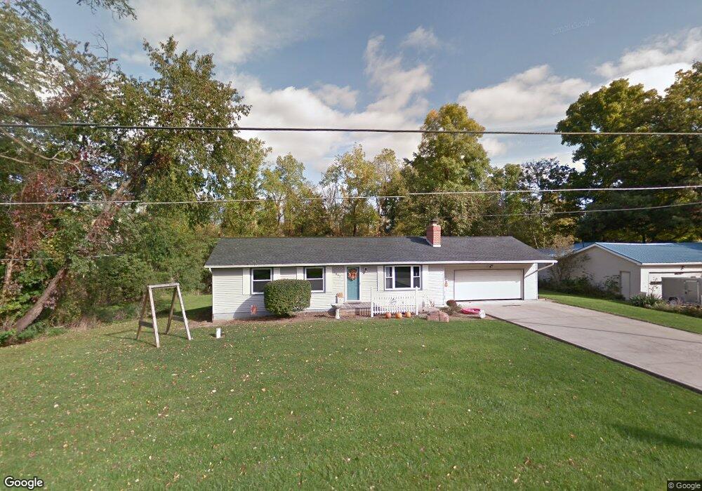
1565 Chew Rd Mansfield, OH 44903
Estimated Value: $188,000 - $209,000
3
Beds
2
Baths
1,144
Sq Ft
$173/Sq Ft
Est. Value
About This Home
This home is located at 1565 Chew Rd, Mansfield, OH 44903 and is currently estimated at $198,477, approximately $173 per square foot. 1565 Chew Rd is a home located in Richland County with nearby schools including Temple-Christian School.
Ownership History
Date
Name
Owned For
Owner Type
Purchase Details
Closed on
Sep 21, 1995
Sold by
Eichler Danny N
Bought by
Smith Scott A and Smith Kristine R
Current Estimated Value
Home Financials for this Owner
Home Financials are based on the most recent Mortgage that was taken out on this home.
Original Mortgage
$72,650
Interest Rate
7.78%
Mortgage Type
New Conventional
Create a Home Valuation Report for This Property
The Home Valuation Report is an in-depth analysis detailing your home's value as well as a comparison with similar homes in the area
Home Values in the Area
Average Home Value in this Area
Purchase History
| Date | Buyer | Sale Price | Title Company |
|---|---|---|---|
| Smith Scott A | $76,500 | -- |
Source: Public Records
Mortgage History
| Date | Status | Borrower | Loan Amount |
|---|---|---|---|
| Closed | Smith Scott A | $72,650 |
Source: Public Records
Tax History Compared to Growth
Tax History
| Year | Tax Paid | Tax Assessment Tax Assessment Total Assessment is a certain percentage of the fair market value that is determined by local assessors to be the total taxable value of land and additions on the property. | Land | Improvement |
|---|---|---|---|---|
| 2024 | $2,017 | $41,590 | $7,230 | $34,360 |
| 2023 | $2,017 | $41,590 | $7,230 | $34,360 |
| 2022 | $1,721 | $31,540 | $6,460 | $25,080 |
| 2021 | $1,721 | $31,540 | $6,460 | $25,080 |
| 2020 | $1,734 | $31,540 | $6,460 | $25,080 |
| 2019 | $1,654 | $26,740 | $5,480 | $21,260 |
| 2018 | $1,546 | $26,740 | $5,480 | $21,260 |
| 2017 | $1,524 | $26,740 | $5,480 | $21,260 |
| 2016 | $1,534 | $26,190 | $5,200 | $20,990 |
| 2015 | $1,534 | $26,190 | $5,200 | $20,990 |
| 2014 | $1,458 | $26,190 | $5,200 | $20,990 |
| 2012 | $725 | $27,570 | $5,480 | $22,090 |
Source: Public Records
Map
Nearby Homes
- 0 State Route 39 & I-71 Northeast Quadrant
- 0 State Route 39 & I-71 Southeast Quadrant
- 929 Antionette Dr
- 1875 Mansfield Lucas Rd
- 1679 Pulver Rd
- 2061 Washington North Rd
- 0 Woodville Rd Unit Lot 14952, 14953
- 0 Woodville Rd Unit Lot 14954, 14955
- 0 Woodville Rd Unit Lot 14956, 14957,
- 794 Mansfield Washington Rd
- 36 Ridge Rd S
- 1135 E Hanley Rd
- 0 Mcelroy Rd
- 716 Mansfield Washington Rd
- 174 W Main St
- 76 Ford Rd N
- 0 Peterson Rd
- 155 Ford Rd N Unit Lot 30
- 155 Ford Rd N
- 369 Davidson St