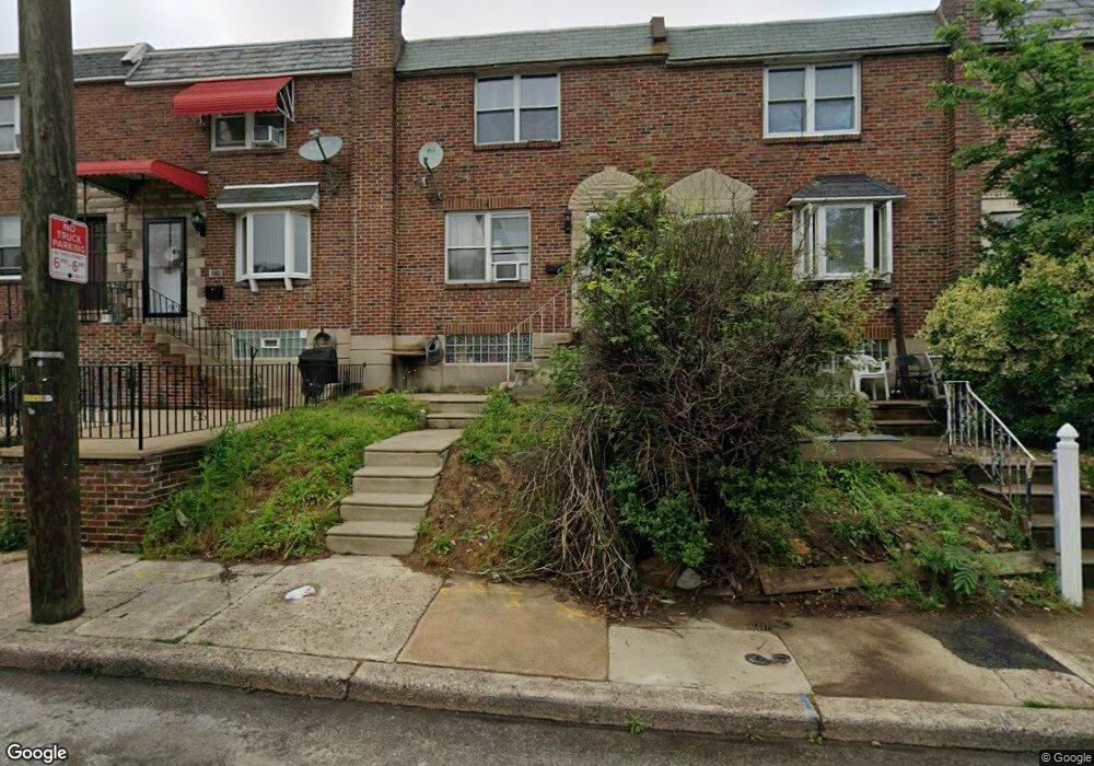
1565 Stevens St Philadelphia, PA 19149
Oxford Circle NeighborhoodEstimated Value: $171,000 - $204,000
3
Beds
1
Bath
1,126
Sq Ft
$173/Sq Ft
Est. Value
About This Home
This home is located at 1565 Stevens St, Philadelphia, PA 19149 and is currently estimated at $194,871, approximately $173 per square foot. 1565 Stevens St is a home located in Philadelphia County with nearby schools including Gilbert Spruance School, Northeast High School, and The Philadelphia Charter School for the Arts & Sciences.
Ownership History
Date
Name
Owned For
Owner Type
Purchase Details
Closed on
Mar 15, 2006
Sold by
Law Richard K
Bought by
Li Heng
Current Estimated Value
Home Financials for this Owner
Home Financials are based on the most recent Mortgage that was taken out on this home.
Original Mortgage
$58,500
Outstanding Balance
$33,070
Interest Rate
6.27%
Mortgage Type
Purchase Money Mortgage
Estimated Equity
$161,801
Create a Home Valuation Report for This Property
The Home Valuation Report is an in-depth analysis detailing your home's value as well as a comparison with similar homes in the area
Home Values in the Area
Average Home Value in this Area
Purchase History
| Date | Buyer | Sale Price | Title Company |
|---|---|---|---|
| Li Heng | $90,000 | Fidelity Natl Title Ins Co |
Source: Public Records
Mortgage History
| Date | Status | Borrower | Loan Amount |
|---|---|---|---|
| Open | Li Heng | $58,500 |
Source: Public Records
Tax History Compared to Growth
Tax History
| Year | Tax Paid | Tax Assessment Tax Assessment Total Assessment is a certain percentage of the fair market value that is determined by local assessors to be the total taxable value of land and additions on the property. | Land | Improvement |
|---|---|---|---|---|
| 2026 | $2,079 | $185,800 | $37,160 | $148,640 |
| 2025 | $2,079 | $185,800 | $37,160 | $148,640 |
| 2024 | $2,079 | $185,800 | $37,160 | $148,640 |
| 2023 | $2,079 | $148,500 | $29,700 | $118,800 |
| 2022 | $2,079 | $148,500 | $29,700 | $118,800 |
| 2021 | $1,485 | $0 | $0 | $0 |
| 2020 | $1,485 | $0 | $0 | $0 |
| 2019 | $1,425 | $0 | $0 | $0 |
| 2018 | $0 | $0 | $0 | $0 |
| 2017 | $1,503 | $0 | $0 | $0 |
| 2016 | $1,503 | $0 | $0 | $0 |
| 2015 | $1,439 | $0 | $0 | $0 |
| 2014 | -- | $107,400 | $15,357 | $92,043 |
| 2012 | -- | $14,208 | $1,362 | $12,846 |
Source: Public Records
Map
Nearby Homes
- 1551 Lardner St
- 1548 Lardner St
- 2001R Mckinley St
- 1531 Stevens St
- 1507 Benner St
- 6005 Horrocks St
- 1453 Mckinley St
- 1439 Higbee St
- 1440 Robbins Ave
- 1438 Higbee St
- 1417 Stevens St
- 2003 Devereaux Ave
- 7040 E Roosevelt Blvd
- 7536 E Roosevelt Blvd
- 6840 E Roosevelt Blvd
- 7600 E Roosevelt Blvd Unit 206
- 7600 E Roosevelt Blvd Unit 212
- 7600 E Roosevelt Blvd Unit 909
- 7600 E Roosevelt Blvd Unit 705
- 7600 E Roosevelt Blvd Unit 701
- 1563 Stevens St
- 1567 Stevens St
- 1561 Stevens St
- 1559 Stevens St
- 1569 Stevens St
- 1557 Stevens St
- 1566 Devereaux Ave
- 1564 Devereaux Ave
- 1568 Devereaux Ave
- 1562 Devereaux Ave
- 1570 Devereaux Ave
- 1560 Devereaux Ave
- 1555 Stevens St
- 1572 Devereaux Ave
- 1560 Stevens St
- 1574 Devereaux Ave
- 1553 Stevens St
- 1558 Stevens St
- 1558 Devereaux Ave
- 1556 Devereaux Ave