Estimated Value: $418,459 - $572,000
3
Beds
2
Baths
2,648
Sq Ft
$185/Sq Ft
Est. Value
About This Home
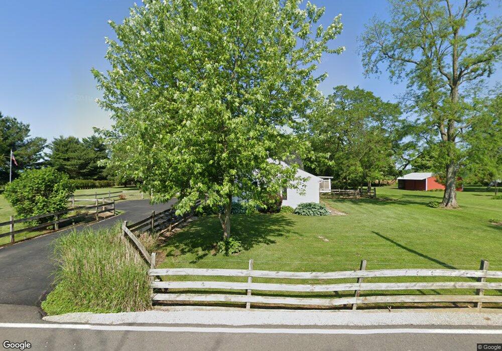
This home is located at 1565 Union Rd, Xenia, OH 45385 and is currently estimated at $489,615, approximately $184 per square foot. 1565 Union Rd is a home located in Greene County with nearby schools including Xenia High School and Legacy Christian Academy.
Ownership History
Date
Name
Owned For
Owner Type
Purchase Details
Closed on
Nov 14, 2016
Sold by
Reynolds Jeffrey T
Bought by
Reynolds Jeffrey T and Reynolds Carolyn S
Current Estimated Value
Purchase Details
Closed on
Dec 16, 2009
Sold by
Reynolds Jeffrey T and Reynolds Carolyn S
Bought by
Reynolds Jeffrey T
Home Financials for this Owner
Home Financials are based on the most recent Mortgage that was taken out on this home.
Original Mortgage
$155,500
Outstanding Balance
$101,738
Interest Rate
4.96%
Mortgage Type
New Conventional
Estimated Equity
$387,877
Purchase Details
Closed on
Jul 29, 2003
Sold by
Reynolds Jeffrey T and Reynolds Carolyn S
Bought by
Reynolds Jeffrey T and Reynolds Carolyn S
Purchase Details
Closed on
Aug 28, 1998
Sold by
Bardoorian Kim Steven and Bardoorian Karen Lee
Bought by
Reynolds Jeffrey T
Home Financials for this Owner
Home Financials are based on the most recent Mortgage that was taken out on this home.
Original Mortgage
$132,000
Interest Rate
7.03%
Create a Home Valuation Report for This Property
The Home Valuation Report is an in-depth analysis detailing your home's value as well as a comparison with similar homes in the area
Home Values in the Area
Average Home Value in this Area
Purchase History
| Date | Buyer | Sale Price | Title Company |
|---|---|---|---|
| Reynolds Jeffrey T | -- | None Available | |
| Reynolds Jeffrey T | -- | Attorney | |
| Reynolds Jeffrey T | -- | -- | |
| Reynolds Jeffrey T | $165,000 | -- |
Source: Public Records
Mortgage History
| Date | Status | Borrower | Loan Amount |
|---|---|---|---|
| Open | Reynolds Jeffrey T | $155,500 | |
| Closed | Reynolds Jeffrey T | $132,000 |
Source: Public Records
Tax History Compared to Growth
Tax History
| Year | Tax Paid | Tax Assessment Tax Assessment Total Assessment is a certain percentage of the fair market value that is determined by local assessors to be the total taxable value of land and additions on the property. | Land | Improvement |
|---|---|---|---|---|
| 2024 | $4,147 | $97,010 | $24,990 | $72,020 |
| 2023 | $4,147 | $97,010 | $24,990 | $72,020 |
| 2022 | $3,607 | $77,540 | $21,730 | $55,810 |
| 2021 | $3,653 | $77,540 | $21,730 | $55,810 |
| 2020 | $3,507 | $77,540 | $21,730 | $55,810 |
| 2019 | $2,878 | $61,720 | $19,260 | $42,460 |
| 2018 | $2,887 | $61,720 | $19,260 | $42,460 |
| 2017 | $2,809 | $61,720 | $19,260 | $42,460 |
| 2016 | $2,724 | $57,870 | $18,740 | $39,130 |
| 2015 | $2,731 | $57,870 | $18,740 | $39,130 |
| 2014 | $2,620 | $57,870 | $18,740 | $39,130 |
Source: Public Records
Map
Nearby Homes
- 1736 Winchester Rd
- 966 U S 68
- 0 U S 68
- 733 State Route 380
- 920 Wright Cycle Blvd
- 926 Wright Cycle Blvd
- 2102 High Wheel Dr
- 104 Ledbetter Rd
- 260 Pocahontas St
- 55 Lake St
- 523 Newport Rd
- 979 Mcdowell St
- 46 Lake St
- 847 S Detroit St
- 633 Xenia Ave
- 1348 Berkshire Dr
- 148 Home Ave
- 293 S Miami Ave
- 222 Washington St
- 1272 Bellbrook Ave