Estimated Value: $186,000 - $233,000
3
Beds
2
Baths
1,448
Sq Ft
$143/Sq Ft
Est. Value
About This Home
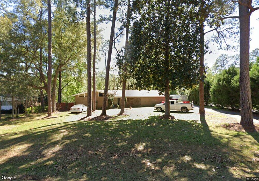
This home is located at 1566 Lullwater Cir SE, Cairo, GA 39828 and is currently estimated at $207,672, approximately $143 per square foot. 1566 Lullwater Cir SE is a home located in Grady County with nearby schools including Cairo High School.
Ownership History
Date
Name
Owned For
Owner Type
Purchase Details
Closed on
May 14, 2009
Sold by
Porter Joseph R
Bought by
Weaver Diana Hallmark
Current Estimated Value
Home Financials for this Owner
Home Financials are based on the most recent Mortgage that was taken out on this home.
Original Mortgage
$104,000
Outstanding Balance
$65,568
Interest Rate
4.81%
Mortgage Type
New Conventional
Estimated Equity
$142,104
Purchase Details
Closed on
Jul 23, 2001
Sold by
Porter J R
Bought by
Porter Joseph R
Purchase Details
Closed on
Aug 31, 1970
Sold by
Porter J R
Bought by
Porter J R
Create a Home Valuation Report for This Property
The Home Valuation Report is an in-depth analysis detailing your home's value as well as a comparison with similar homes in the area
Home Values in the Area
Average Home Value in this Area
Purchase History
| Date | Buyer | Sale Price | Title Company |
|---|---|---|---|
| Weaver Diana Hallmark | $130,000 | -- | |
| Porter Joseph R | $82,000 | -- | |
| Porter J R | -- | -- |
Source: Public Records
Mortgage History
| Date | Status | Borrower | Loan Amount |
|---|---|---|---|
| Open | Weaver Diana Hallmark | $104,000 |
Source: Public Records
Tax History Compared to Growth
Tax History
| Year | Tax Paid | Tax Assessment Tax Assessment Total Assessment is a certain percentage of the fair market value that is determined by local assessors to be the total taxable value of land and additions on the property. | Land | Improvement |
|---|---|---|---|---|
| 2024 | $2,607 | $67,630 | $8,000 | $59,630 |
| 2023 | $1,474 | $41,488 | $5,920 | $35,568 |
| 2022 | $1,536 | $41,488 | $5,920 | $35,568 |
| 2021 | $1,540 | $41,488 | $5,920 | $35,568 |
| 2020 | $1,544 | $41,488 | $5,920 | $35,568 |
| 2019 | $1,544 | $41,488 | $5,920 | $35,568 |
| 2018 | $1,468 | $41,488 | $5,920 | $35,568 |
| 2017 | $1,413 | $41,488 | $5,920 | $35,568 |
| 2016 | $1,234 | $35,654 | $5,920 | $29,734 |
| 2015 | $1,222 | $35,654 | $5,920 | $29,734 |
| 2014 | $1,222 | $35,654 | $5,920 | $29,734 |
| 2013 | -- | $32,713 | $5,920 | $26,793 |
Source: Public Records
Map
Nearby Homes
- 130 17th Ave SE
- 198 Oakdale Rd SE
- 75 14th Ave SE
- 1406 Platt Ave
- 1310 Stone Ave
- 1193 S Broad St
- 270 Muggridge Ln
- 109 Oriac Ave SW
- 530 6th St
- 117 Pine Cir SW
- 1870 Oakdale Rd SE
- 112 Pine Cir SW
- 720 1st St SW
- 7501 111 S
- 602 4th St SE
- 27 6th Ave SW
- 530 6th Ave SE
- 460 2nd St SW
- 481 4th St SE
- 471 4th St SE
- 1570 Lullwater Cir SE
- 1556 Lullwater Cir SE
- 1519 Lullwater Cir SE
- 1575 Lullwater Cir SE
- 1590 Lullwater Cir SE
- 1595 Lullwater Cir SE
- 1546 Lullwater Cir SE
- 1537 Lullwater Cir SE
- 1596 Lullwater Cir SE
- 1578 Lakewood Dr SE
- 1581 Lullwater Cir SE
- 1580 Lullwater Cir SE
- 1536 Lullwater Cir SE
- 1583 Lakewood Dr SE
- 145 Oakdale Rd SE
- 1525 Lullwater Cir SE
- 159 Oakdale Rd SE
- 91 Southwood Ln
- 0 SE Lakewood Lot #24 Dr Unit 20132801
- 1526 Lullwater Cir SE