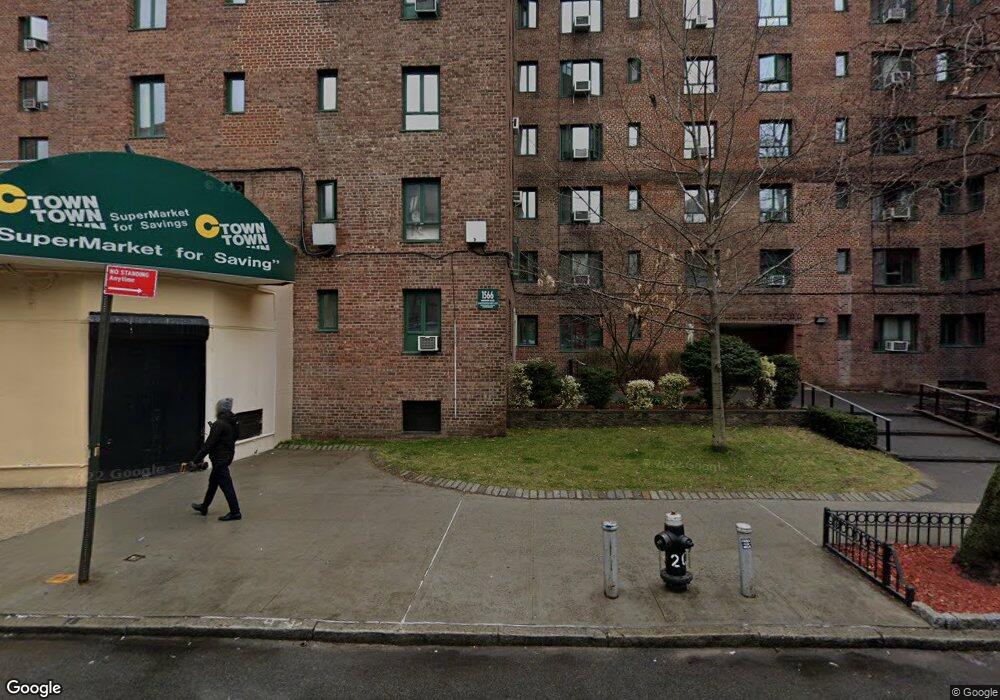
1566 Unionport Rd Unit 5E Bronx, NY 10462
Parkchester NeighborhoodEstimated Value: $187,986 - $252,000
--
Bed
--
Bath
654
Sq Ft
$344/Sq Ft
Est. Value
About This Home
This home is located at 1566 Unionport Rd Unit 5E, Bronx, NY 10462 and is currently estimated at $224,747, approximately $343 per square foot. 1566 Unionport Rd Unit 5E is a home located in Bronx County with nearby schools including P.S. 106 - Parkchester, M.S. 127 - The Castle Hill Middle School, and Bronx Charter School For Excellence 2.
Ownership History
Date
Name
Owned For
Owner Type
Purchase Details
Closed on
May 2, 2014
Sold by
Castro Luis
Bought by
Tamba Mossa
Current Estimated Value
Home Financials for this Owner
Home Financials are based on the most recent Mortgage that was taken out on this home.
Original Mortgage
$68,800
Outstanding Balance
$52,610
Interest Rate
4.42%
Mortgage Type
New Conventional
Estimated Equity
$172,137
Create a Home Valuation Report for This Property
The Home Valuation Report is an in-depth analysis detailing your home's value as well as a comparison with similar homes in the area
Home Values in the Area
Average Home Value in this Area
Purchase History
| Date | Buyer | Sale Price | Title Company |
|---|---|---|---|
| Tamba Mossa | $86,000 | -- |
Source: Public Records
Mortgage History
| Date | Status | Borrower | Loan Amount |
|---|---|---|---|
| Open | Tamba Mossa | $68,800 |
Source: Public Records
Tax History Compared to Growth
Tax History
| Year | Tax Paid | Tax Assessment Tax Assessment Total Assessment is a certain percentage of the fair market value that is determined by local assessors to be the total taxable value of land and additions on the property. | Land | Improvement |
|---|---|---|---|---|
| 2025 | $1,363 | $24,955 | $6,739 | $18,216 |
| 2024 | $1,363 | $24,821 | $6,517 | $18,304 |
| 2023 | $1,325 | $24,237 | $6,213 | $18,024 |
| 2022 | $1,215 | $23,568 | $6,658 | $16,910 |
| 2021 | $1,091 | $22,838 | $5,928 | $16,910 |
| 2020 | $84 | $24,503 | $5,928 | $18,575 |
| 2019 | $883 | $24,096 | $5,521 | $18,575 |
| 2018 | $793 | $22,127 | $3,552 | $18,575 |
| 2017 | $751 | $20,817 | $2,242 | $18,575 |
| 2016 | $737 | $20,037 | $3,046 | $16,991 |
| 2015 | -- | $19,134 | $3,046 | $16,088 |
| 2014 | -- | $19,291 | $3,046 | $16,245 |
Source: Public Records
Map
Nearby Homes
- 1501 Metropolitan Ave Unit 6C
- 11 Metropolitan Oval Unit 6E
- 11 Metropolitan Oval Unit 5F
- 1505 Archer Rd Unit 6B
- 1938 E Tremont Ave Unit 5C
- 89 Metropolitan Oval Unit 7B
- 1936 E Tremont Ave Unit 5H
- 1504 Metropolitan Ave Unit ME
- 1491 West Ave Unit 6H
- 1563 Metropolitan Ave Unit ME
- 22 Metropolitan Oval Unit 7C
- 1543 Leland Ave
- 1560 Metropolitan Ave Unit ME
- 18 Metropolitan Oval Unit 8A
- 18 Metropolitan Oval Unit 3C
- 34 Metropolitan Oval Unit 8C
- 34 Metropolitan Oval Unit 1H
- 1595 Metropolitan Ave Unit 7D
- 20 Metropolitan Oval Unit 11A
- 1470 East Ave Unit 5G
- 1566 Unionport Rd Unit MD
- 1566 Unionport Rd Unit 7H
- 1566 Unionport Rd Unit 7G
- 1566 Unionport Rd Unit 7F
- 1566 Unionport Rd Unit 7E
- 1566 Unionport Rd Unit 7D
- 1566 Unionport Rd Unit 7C
- 1566 Unionport Rd Unit 7B
- 1566 Unionport Rd Unit 7A
- 1566 Unionport Rd Unit 6H
- 1566 Unionport Rd Unit 6G
- 1566 Unionport Rd Unit 6F
- 1566 Unionport Rd Unit 6E
- 1566 Unionport Rd Unit 6D
- 1566 Unionport Rd Unit 6C
- 1566 Unionport Rd Unit 6B
- 1566 Unionport Rd Unit 6A
- 1566 Unionport Rd Unit 5H
- 1566 Unionport Rd Unit 5G
- 1566 Unionport Rd Unit 5F